Mouth of the Okavango River. A water world surrounded by desert and the Okavango River crossing it. What does Popa Falls mean?
During the trip, having gotten used to the drying up of seasonal rivers in Namibia, it is a little strange to come across long deep rivers, and even those that flow continuously all year round. How many rivers flow through the Caprivi land? Oh, this is an interesting and confusing question. It happens that the Zambezi region is called the place of four rivers, and sometimes there are all five or only three. I remember how this fact embarrassed me at first. Calm down, friends, now we’ll figure it all out!
Holding a geography textbook in hands
The area of the former Caprivi strip is crossed by a trio of mighty rivers:
Company of rivers on the map
This is what the main ones look like water arteries on the map. It can be seen that only a small part of them passes through the orange plot of land that is now of our interest. long way from the source to the mouth.

Pay special attention to the Okavango Delta on the map and how Kwando curves around the protruding finger of Namibia.
Surprises of the water world
No, friends, I haven't forgotten about two more big rivers- Linyanti and Chobe. The point is that they seem to exist, and they seem to not exist.
Do you see on the map how sharply the Kwando River bends, changing its direction by almost 90 degrees? There is a vast area of Kwando swamps. From the moment of leaving them, the river will continue to exist between the reed banks under the name Linyanti.
And it will flow under this name until the seasonal Lake Liambezi in the northeast, after which it will already be designated as the Chobe River, which it will remain until the moment it flows into the Zambezi near Kazungula...

You can see for yourself how saturated the Caprivi region is with water. The abundance of moisture favors the appearance of mosquitoes, and they are carriers of malaria. Because of this, special precautions must be taken when visiting these places.
And now - surprise! You will be surprised, but despite the fact that this region of the country is surrounded by abundant and permanent rivers, it seriously suffers from a lack of clean water. drinking water. Most people in this part of the country are forced to drink water obtained from wells, which is often saline and unsuitable for consumption. There are also no watering places for animals in this territory, so the animals huddle close to the rivers.
Amazing Okavango River
What is especially remarkable about it is that it is an exception to the rule. Everyone knows that rivers, as a rule, flow into the sea. The Okavango does not flow anywhere, but spreads over 20 thousand square kilometers across open areas, flooding the savannah, forming floodplains at the borders of coastal forest and woodland, canals, islands, impenetrable reed thickets and unsteady swamps overgrown with thick papyrus.
The Okavango Delta is one of the wildest places on Earth: this is Africa a hundred thousand years ago. On the map, she looks like a downward hand with fingers spread, a narrow section of her wrist is called the Panhandle - the least explored area of the Okavango system.
Delta is an ecologically clean area wildlife, which has recently received status, is considered one of the largest and most important wetland areas in the world. The kingdom of fish, birds and animals.
A few more words about the Okavango and other rivers
Some interesting details about them:
- The Zambezi, the fourth longest river on the African continent, defines part of Namibia's state border with neighboring Zambia in the northeast.
It is on the Zambezi that “ natural miracle» world-class - Victoria Falls. The story about him is in one of the following articles.

- Okavango – largest river southwest Africa.
Its name varies from region to region: from its source on the high plateau and throughout in Angola, it is known as the Cubango, in its lower course in Botswana it is called the Okavango, and the section of the channel crossing Namibia is known by two names - both as the Okavango, and like Kavango.

- Another river flows from Angola through the Caprivi to the south into Botswana. This is the Kwando, and like the Okavango, its course begins to split into numerous branches, forming a 1,500 square kilometer wetland known as the Linyanti Swamp.
Wonderful water lilies bloom in magical waters Kwando River, about 100 species of fish live in them. There is a colorful chorus of birds chirping here, with more species than you can imagine.
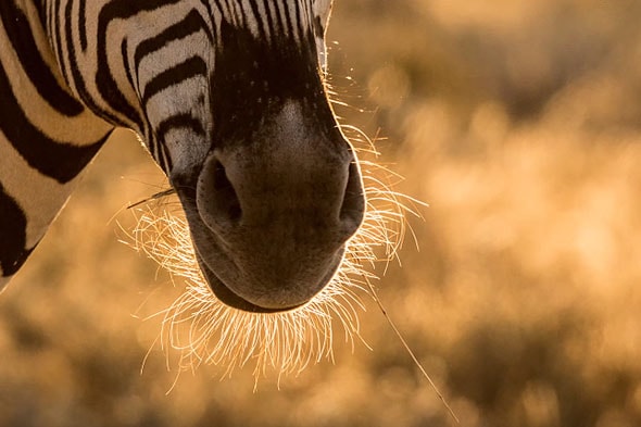
Hippos splashing in the waves and basking in the sun, as huge as submarines off the coast. There are many animals - wrinkled giants elephants, buffaloes, kudu, shy sitatunga antelopes, red lychees, majestic sable antelopes, impalas and zebras. There are no less of the latter than there are single guys, so that once you notice the minke whales, you no longer attach any importance to them.
- Several other small rivers run along the Caprivi in the area of the Mamili National Park, but they look so pale in comparison with the giants that it’s not worth talking about them.

In the morning light along the eternal Okavango River
The night passed beautifully - with the roar of the waterfall, the grumbling of the hippopotamus and the sound of frogs in the distance. By the way, the reed frog, of which there are millions in the Okavango, easily eats 500 mosquitoes per night. The hordes of squeaks are also reduced by birds that readily feed on them. The birds living here have adapted to life in an area saturated with an abundance of water, and, for the most part, prefer reed thickets that cover the muddy banks of the river and its channels.
Grasshoppers jump in the thicket of stems and leaves, water striders glide along the water surface, and the backs of swimming beetles turn green. There is also a sandy patch with a pier where a square, double-decker ship, reminiscent of a painted cake box, awaits us.

We had breakfast and were in a good mood looking forward to the pleasure of the river cruise. We are the only camp guests on the boat. This vessel is purely a tourist vehicle; the natives have been sailing on mokoro boats for generations.

Mokoro - nimble and unstable boats, hollowed out from solid tree trunks, sit deep in the water. Local residents - African gondoliers, standing, deftly control them with long poles. It must be great to glide so quietly with the flow among the delicate lilies and reeds and, dipping your fingers into warm water, look at tiny, fingernail-sized frogs, big-eyed dragonflies that frolic and swoop over the boat, jumping grasshoppers and many wonderful birds.

But it’s scary. What if the flimsy ark turns over?
About the terrible
And this threatens not only swimming in the waters and a bunch of swallowed microbes. The real danger is:
- water buffalos that roam the banks,
- crocodiles with teeth as long as a finger, whiling away their days, basking on the gently sloping bank, and, at the same time, vigilantly observing everything that happens around,
- sleepy hippos who love to have fun diving under such boats.
Oh, how deceptive is the sleepy appearance of the hippopotamus basking in the waters of the Okavango River! How mistaken is anyone who believes him to be a peaceful vegetarian, a lazy and slow two-ton hulk! It turns out they are the most dangerous animals on the Okavango. A hippopotamus underwater can reach speeds of up to 40 km per hour, and can chase a motorboat without falling behind. So much for the slow ones...
During the period when they have small hippos, suspicious mothers often, for inexplicable reasons, become furious and rush at everything that is nearby - people, animals, and one movement of the mouth of the beast with curved teeth similar to tusks can break the mokoro in half. Incidents happen. And even with human victims... In one of the European museums of natural history, a tooth is exhibited - or is it a tusk? – hippopotamus, the length of the exhibit is as much as 64 cm.
Our dark-skinned guide speaks good English. Not even five minutes had passed after our shuttle set off along the great, almost Russian, Okavango River, when he and Sanya were chatting, sitting on the bow of the ship, and, at the same time, furiously scanning the water surface with binoculars in search of hippos.

About crocodiles that survived dinosaurs
Friends, how do you feel about crocodiles? How would you feel when a reptile like this walked on short, scaly legs just a few meters away from you? Perhaps you would admire a beautiful ancient creature that could be over 100 years old? But much more often the crocodiles encountered a different human reaction as soon as they turned their attention to people. It was often a good dose of lead from a high powered rifle.
There is no such thing as a crocodile “problem” on the shores of the Okavango. Here they say that it is just such an animal. Sometimes dangerous for human life, but also in need of protection. Here, conservationists and authorities can be proud of the efforts being made to control and manage the crocodile situation, as well as the deliberate changes in the perception of wildlife and these reptiles among the Caprivian populace. The latter are persuaded with kind words and despicable metal to make a choice in favor of preserving prehistoric predators.
This is before local residents, angry at the harassment of one of the dinosaurs’ contemporaries, it didn’t cost anything to deal with the crocodile, and then arrange a luxurious feast in the village - the Caprivians have always simply adored crocodile meat... And even now restaurants serve dishes from it. Look, this is the crocodile kebab they offered us. Doesn't it look delicious? Sanechka ate it and said: “An awesome reptile, if you will.” Like a chicken!
By the way, crocodiles themselves have the amazing ability to slow down the functions of their body, so hard times can do without food at all for a period of time - it’s simply incredible! – more than two years and survive after that. Well, when they eat, it doesn’t matter to them who they eat – wildebeest, kudu, fish or humans.
Keeping my promise
Yes, we once, friends, were going to discuss the difference between a hippopotamus and a hippopotamus. So, if there are still those among us who have endured and have not recognized this until now, then I inform you that there is and never was any difference between them, these are just two names for one animal.
A gentle current carries us forward, I look at the propeller, it is seething, foaming, a shadow flashes nearby... Then the guide shouts: “Hippo!” The propellers are muffled, we peer into the water. Far ahead, a head appears with a loud snort. We came to him, and he left us and safely went to the bottom.

Through binoculars we had a good look at these giants with pinkish cheeks and suitcase-sized mouths, but the muzzled hippopotamuses did not let us get within range for a good portrait photograph.
Birds, a couple of crocodiles sleeping on the shore... Another crowd of hippos! They're yawning! Or showing off their strong teeth? Ah - ah! And these ones waited until Sanya focused on them and immediately dived... Another, equally vile, Caudla...

Dark Secrets of the River
Water has been given the mysterious power to be the juice of life on Earth... For the people living on its shores, the Okavango is very important. The river is a source of drinking water, it provides food, and it is used as a transport route. Here is a bunch of women on the shore, washing their large families...
Human history is full of legendary creatures. Who hasn’t heard about the Loch Ness monster, or about the Yeti living high in the mountains? In Rus' there was a legend about... But few know that in the dark depths of the Okavango there is a monster - the guardian of the river, with horns like a kudu, a giant voracious snake Dikongoro.
Once again, friends, now from a different angle, take a look at the photo of the horned antelope at the beginning of the article. Well, is it impressive? And if you add horns... The legend does not give firm guidelines, and here everyone constructs their own nightmare, based on their own taste and imagination. Apparently, I did a good job, since I wondered who those strange sounds on the river at night belonged to...
Meeting with a monster is dangerous, but you, friends, are in luck: because I will tell you how to act correctly in such an emergency situation. So, if at some point your mokoro suddenly stops moving, and suspicious ripples begin to spread in front of it, causing your boat to rotate, hurry up - there’s not a second to lose!
The water is about to foam and a huge black head of a snake with an open mouth will rise from it to swallow its prey. Don't freeze in horror - now is the time to act. Grab your fishing knife, quickly make a cut on your wrist and drop a few drops of blood into the water. All! And then the awe-inspiring Dikongoro will not harm you...

What does Popa Falls mean?
I am writing about this for the sake of two, out of the many categories of people existing in the world. Firstly, for curious people and, secondly, for those who have a rich imagination. Perhaps, mostly for the sake of the latter. So that when they hear this suspicious-sounding word in the name, they are not embarrassed, involuntarily seeing behind it, due to its peculiarity, a living image of the object itself or a process associated with it. The rest of the people can safely skip a couple of paragraphs.
So what does the name mean? Popa Falls? Well, if everything is clear with the second word - it means waterfall, then what about Popa, which causes a laugh? To be honest, this word has remained a linguistic mystery. Having sifted through a lot of sources, only one found the statement that “Popa” is translated as “right here.” True, the author did not indicate from which language it was translated this way.
And thousands of others who have written something about Popa Falls are generally silent about the meaning of the name, as if they were bound by the mutual guarantee of some kind of international conspiracy. In general, it’s beneficial for someone that we don’t know this...

A waterfall that is not a waterfall at all
The word “waterfall” in the name of Popa Falls conjures up powerful and raging masses of water falling from somewhere from a great height, so it is not surprising that many are disappointed by what they see. Especially compared to the not so distant Victoria Falls.
Before the Okavango River enters Botswana and spreads into swamps across the delta, its level drops by 4 meters. Along the entire 1.2 kilometer width of the river there is a series of rapids called Popa Falls. They arose as a consequence of an ancient geological fault, and are now considered a local landmark. The water in the riffles is noisy, you can hear it even in the camp houses, and we slept so sweetly under this noise...
But if you look without prejudice, then this is a very beautiful sight, especially for the semi-desert landscapes of Namibia with ephemeral rivers, when a wide water flow, divided into many channels, cascades along quartzite ledges and beats against sharp underwater rocks.

And the trees and reeds growing around, together with the yellow sand and pebbles, form a mosaic of beautiful landscapes, to which is added wonderfully fresh air.
The rapids look especially impressive during the dry season when the river level is low. And if at the same time you still happen to pass in the upper reaches good rain... It is a curious phenomenon when, at the height of the dry season, the river swells from many millions of cubic meters of water flowing from the upper reaches into the Kalahari Desert. But from February to April the level of the Okavango is high, and we just happened to be at a time when the rapids were almost completely flooded.
Interesting article? Subscribe to blog updates and get more more information By RSS Email
This amazing river flows in an amazing place and ends in an amazing way. Surprising with its number and diversity and animal world its shores.
_Foto_HandmadePicture_-_Depositphotos.jpg)
_Foto_HandmadePicture_-_Depositphotos.jpg)
_Foto_HandmadePicture_-_Depositphotos.jpg)
No less surprising is the unique language of the people living in its basin.
The Okavango is the only permanent river in a vast and unusual area called the Kalahari, located between the Zambezi, Limpopo and Orange rivers in South Africa.

_in_Botswana_Africa_Foto_imagex_-_Depositphotos.jpg)
_in_Botswana_Africa_Foto_imagex_-_Depositphotos.jpg)
_in_Botswana_Africa_Foto_imagex_-_Depositphotos.jpg)
_in_Botswana_Africa_Foto_imagex_-_Depositphotos.jpg)


It is customary to write “Kalahari Desert” on maps. But this is not a desert at all.
In summer it rains heavily here, and in terms of annual precipitation (from a thousand millimeters in the north to two hundred and fifty in the south), these places cannot be compared, for example, with the Sahara or the deserts of Arabia.
Scientists have not been able to agree on what the Kalahari is. Some call it “desert savannah”, others use the term “green semi-desert”, others believe that in relation to such places it is more appropriate to talk about steppe park landscapes.
One way or another, there is water in the Kalahari. There are temporary rivers (during the rainy season), and lakes (most of which, however, dry up in winter). There are trees, shrubs, and herbs here, and large quantities.
Umbrella acacias and tree-like spurges grow in the Kalahari forty to fifty meters from each other, as befits savanna trees.
Bushes and grass (sometimes up to a meter high) also do not cover the ground with a continuous carpet; Islands of sand are always visible between the green patches of vegetation. But this vegetation is quite enough for thousands of herds of antelope, buffalo and zebra for food, especially since the Okavango, this South African Nile, provides them with water all year round.


Beginning in the savannas of southern Angola, this river quickly rushes south through gorges and rapids, along steep slopes with waterfalls. And only in the Kalahari does it calm down, as if forgetting about its violent temper.
In the endless sea of sandy plain, it spreads through labyrinths of branches, lagoons, lakes, forming a completely unusual river delta at the confluence... into nowhere.
It is called "an island of water in a sea of sand."


Sixteen square kilometers of thickets of papyrus, bushes and algae provide shelter to many birds and animals all year round.
And during the flood, in May-June, the half-dried branches of the delta turn into stormy foaming streams, one of which reaches the “blue heart of the Kalahari” - the beautiful and inhabited freshwater Lake Ngami, opened to science by the great Livingston.
The remnants of the Okavango waters wander for another three hundred kilometers and disappear into the huge lake-swamp Makarikari.

The lake is a giant settling tank for soda brine.
In the dry season, from an airplane it resembles a lunar landscape: a solid white blanket with rare dark spots of water stretches all the way to the horizon.

The winding stripes of shallows surrounded by a motionless sultry haze are clearly visible.
The Okavango Delta contains all (or almost all) species of African fauna. Hippos coexist with crocodiles on green islands.
Herds of graceful antelopes rush by. Looking around carefully, a timid water goat gallops by - sensing danger, it plunges into the water up to its nostrils.
Graceful giraffes and gloomy buffalos and wildebeest come to drink.


Slowly, with a sense of self-esteem, elephants and rhinoceroses walk towards the water, and shaggy and serious warthogs dart busily through the thickets.
Not far away, zebras, eland antelopes and ostriches graze in a friendly company - together it is easier for them to detect predators, since the birds' vision complements the sensitive hearing of striped horses and the delicate sense of smell of antelopes.
And, of course, around this abundance of game there are leopards, cheetahs and royal lions with their constant retinue of hyenas and jackals, and gloomy vultures slowly circle in the air, looking out for prey.
The abundance of fauna in the Okavango Delta is amazing. In addition to the animals already mentioned, there are about four hundred species of birds and up to seventy species of fish.
A vegetable world The delta has more than a thousand trees and shrubs.


And a traveler going to this unique oasis on a local pirogue - mokoro, will be able, during such a unique water safari, to see and capture on film water antelopes and hyena dogs, which have almost disappeared in other parts of Africa, admire herds of elephants, zebras and blue wildebeests, or catch a fishing rod of a hefty bream, or even a tiger fish.
And from the shores and islands, flocks of pelicans and storks, flamingos and marabou will look at the floating pirogue...
When the heat gives way to coolness and an impenetrable tropical night thickens over the Kalahari, the inhabitants of these places - Tswana shepherds and Bushmen hunters - find their way along the stars, so bright in these latitudes.
Their main reference point is the southern tropical constellation Capricorn. They turn to him with requests, and they thank him for a successful hunt.
Bushmen are a mysterious people. In appearance they do not resemble most of the inhabitants South Africa. Yellow skin and narrowed eyes bring them closer to peoples Mongoloid race. How and why they ended up in the depths of the “Dark Continent”, science does not yet know.
The language of the Bushmen puzzled (and still puzzles!) even linguistic experts. A European cannot not only pronounce half of its sounds, but even write them down. The compilers of dictionaries did not have icons to indicate such sounds, and they simply wrote down: “clicking sound”, “smacking sound”, “kissing sound” and so on.
The Bushmen are nomadic hunters, and the Kalahari, which in the 19th century was considered one of the richest regions in Africa, gave them the opportunity to feed their families with tasty game, as well as the edible roots and juicy fruits of wild melon.
But the appearance of white people with firearms quickly led to a reduction in the number of wild animals, and moreover, more and more watering places began to be captured by the neighboring tribes of Tswana pastoralists, pushing the Bushmen into the driest areas.
However, this intelligent people of born hunters and trackers managed to adapt to new conditions and now roam further south, closer to the basin of the Orange River and its tributaries that dry up in winter.
The ability to find places in dry riverbeds where there may be water under the sand helps them out, allowing them to survive until the rainy season, and the ability to eat everything that moves on the grass or sand, from larvae to locusts, allows them to survive in the event of an unsuccessful hunt.
This amazing tribe evokes involuntary sympathy with its intelligence, musicality, humor and kindness, which, by the way, was demonstrated by the recently released talented film “The gods must have gone crazy...”.
The Okavango crosses from northwest to southeast almost half of the vast southern African country of Botswana, which lies entirely in the Kalahari.
Until recently, this poor pastoral state did not shine with economic success.
But since the 1960s of the 20th century, when several large diamond deposits were discovered in the depths of Botswana, the situation has changed.
Now the country can afford to drill water wells in the dry park forests of the Kalahari, build civilized villages for the Bushmen and Tswana, and, finally, take up the protection of wildlife.
National parks and reserves now occupy almost a fifth of Botswana. They are found in the north, in the Zambezi basin, and in the southwest - on the tributaries of the Orange River.
But the three largest reserves cover the Central Kalahari, Okavango Delta and Lake Makarikari.

_in_Botswana_Africa_Foto_imagex_-_Depositphotos.jpg)
_in_Botswana_Africa_Foto_YuryBirukov_-_Depositphotos.jpg)
5 facts about the Okavango Delta
1. The Okavango River flowed into large lake in South Africa - Makgadikgadi Lake. Then, as a result of tectonic activity earth's crust, the natural course of the river was blocked, which led to a change in the direction of the flow towards the Kalahari Desert. Thus, a unique natural formation was formed - a river flowing into the desert.
2. Most of Botswana's territory is located in the so-called Kalahari Lowland, which is the largest semi-desert in Africa, and the Okavango Delta is the largest oasis.
3. The second largest animal migration (after the Great Migration in Kenya) occurs in Botswana. More than 30,000 zebras migrate through the Okavango Delta between December and March each year.
4. The period from December to March (the so-called “green season”) is the breeding time not only for the mammals that inhabit this area, but also for the birds that fly here for the winter from Europe, including Russia.
5. Travel by land is only possible to a small section of the Moremi Nature Reserve from the “capital of the Okavango Delta”, Maun. In other cases, there is only one option - only by light aircraft.
The flight from Shinde to Moremi takes 25 minutes.
1 The entire flight passes over the territory of the Okavango Delta, so you can get an idea about the landscapes.
These are mainly papyrus-covered floodplains, cut by delta branches and channels. 
2 Sometimes you come across quite large pieces of sushi... 
3 Or very small islands per tree. As a rule, termite mounds form the basis of such small islands. 
4 Larger islands are formed by the alluvium of bottom soil as a result of blocking a channel or delta branch. 
5
6 The water in the delta is relatively clean and transparent. On a clear sunny day, all the underwater life is perfectly visible from the boat. 
7 Thickets of papyrus and sedge are dotted with “paths” that are trampled by elephants and other large animals. Subsequently, such paths have every chance of becoming another channel of the delta. 
8
9 Some canals expand and strengthen over time, turning into full-fledged rivers. 
10
11 Date palms are common and dominate the outer contours of the islands. 
12
13
14
15 Under some trees you can even see animals from the air. 
16 There are a lot of dead trees. 
17 We are landing... 
18 The entrance to the reserve is located next to the airstrip. Here you will definitely be recorded in a ledger, including your citizenship and religion for statistics.
By the way, as I wrote above, Moremi is the only place in the Okavango Delta that can be reached by land from Maun. That's why you can find self-drivers here. Arriving here in your own or rented car ( four-wheel drive required), you can stay in one of the camps or on the territory of the equipped campsite, pitching your own tent. 
19 Immediately after entering the reserve, as usual, the transfer turns into a safari. 
20 The road from the runway to the Okuti camp takes about 15 minutes, while mostly bee-eating birds are encountered. The lack of fear of the local fauna is immediately noticeable; they let you in quite close. 
21
22 Okuti Camp is one of three camps in the public part of the Moremi Nature Reserve. Okuti is owned by Ker & Downey, the other two: Camp Moremi and Camp Xakanaka (pronounced Kakanaka) are owned by Desert & Delta.
Despite the fact that Okuti is not a lodge, but a camp, looking at the rooms, it’s a stretch to call them tents. Well, perhaps because of the tarpaulin that acts as an external covering. 
23 Inside, the rooms also do not look like tents. Quite so good number five-star hotel with a veranda balcony, all amenities, including two showers: one in the room and the second in the open air.
This is luxury in the middle of nowhere. 
I would like to focus a little on general rules, inherent to all camps in the Okavango Delta, regardless of the level of luxury.
1. No mobile connection. Forget about mobile operators, roaming and others tariff plans. For emergencies, the administration of any camp has a satellite telephone connection
2. No wi-fi. Neither in the rooms nor in the general area of the camp. At best in common area The camp will have one laptop connected to satellite Internet. The speed of such Internet will make you remember with a kind word the forgotten dial-up.
3. Don’t get your hopes up, there are no TVs in the rooms either. The best late night TV program in Africa is starry sky accompanied by a glass of sheri and the singing of cicadas. If you're lucky, you can get to full moon or the milky way, fireflies in the background.
3. Accommodation in all camps according to the Fully Inclusive system - everything is included: meals, drinks (except for premium brands), safari, laundry, etc.
4. All rooms must have
- mosquito repellent spray for indoors
- mosquito repellent spray for skin
- flashlight
- horn - a mechanical device that makes a loud sound. Used in case of a threat to your safety. After you initiate the loud noise, it is recommended to turn on the lights/shine a flashlight through the windows.
5. The last subparagraph of paragraph 4 hints that cases are different. If you hear a loud, drawn-out sound, but you are not in danger, then refrain from any illumination in your room. This will help the camp administration to determine from the glowing windows which of the guests requires validol help.
6. It goes without saying that in the dark, moving around the camp without the escort of rangers is strictly not recommended.
A similar safety briefing occurs every time you check in.
24 I listened to the instructions, laid out my things, decided to take a walk... There was this monkey sitting next to the entrance to the room, pretending that he was waiting for the tram; he didn’t care about me at all. 
Sooner or later organizational matters are over, the formalities have been completed and it’s time to get down to business, that is, to the safari, especially since a pair of bushbucks are sarcastically grazing at the entrance to the camp. 
25
26 The Moremi Nature Reserve is known for the high probability of meeting felines during a safari: lions, leopards, cheetahs. We left with this mood.
As I already wrote, December is the breeding period for artiodactyls. These antelopes of tenderness are found at every step 
27 Kids learn to take care of themselves... 
28 Animals are absolutely not afraid and do not mind portrait photography. 
29 Every zebra, even a recently born one, gets a buffalo starling :) 
30 Tsetsebe antelope - a relative of the East African topi 
31 Woodland kingfisher 
32 Red-billed Hornbill 
33 At some point, the photo fraternity sitting in the jeep almost simultaneously came to the conclusion that the birds in Moremi are so relaxed that there is not enough dynamics. The ranger suggested turning on the engine; a sharp sound would frighten the bird and it would fly away.
It worked one, two, three :) 
34 Well, what would the Okavango be without lychee antelopes! 
35 Moremi's landscapes are as fascinating as its wildlife. Moremi features all types of landscapes native to the Okavango Delta. This is the savannah. 
36
37 And water meadows 
38 And wooded area 
39
40 Rollers in the delta serve as sparrows, at least in terms of numbers. 
41 Male lychee antelope. Sometimes they jump very picturesquely, and sometimes they run like this, half-bent, with their necks stretched forward. 
42 Traditionally, the evening safari ends with a sundowner. 
43 On the way back to the camp, we come across another touching scene involving impalas right next to the road. 
44 Morning. The already familiar awakening from the traditional “Knock, knock.” Your coffee is ready" and drinking coffee in the company of a rainbow starling. 
45 The morning safari begins with an encounter with a male kudu antelope crossing the road right in front of the jeep. 
46 Another bee-eater, a swallowtailed bee-eater. 
47
48 Coppertailed cuckoo 
49 Water goats (waterbok). 
50 Ground Hornbill. 
51 Stopped by a lone giraffe accompanied by oxpeckers
Seasonal rivers drying up in Africa or in deserts on other continents will not surprise anyone, but this is a special case. In all respects, the Okavango is not an oued, but a normal river that does not even think of drying up during the dry season. It quickly rushes along a narrow rapids channel with the savannah-covered banks of the Angolan plateau of Bie down in a south-easterly direction; Before the border with Botswana, it overcomes the waterfalls that form a cascade of Popa waterfalls, blocking its entire width, which in this place is 1.2 km. Only on the plateau does the river acquire a flat character.
As the slope decreases, the Okavango slows down and spreads out, spreading through a labyrinth of branches, lagoons and lakes that form the world's largest inland delta. The Okavango has a solid annual flow at the mouth; about 10 thousand km 3 of water flows into the delta annually, but... The river’s path usually ends at this gigantic delta. The Okavango does not flow into a lake, nor into another river, nor into the sea, nor into the ocean. “Where does all this water go? It’s just some kind of mysticism!” - exclaimed one of its researchers in the 19th century. In fact, where?
During high water, the southern branch of the delta feeds the freshwater Lake Ngami, the northern branch periodically, once every few years, reaches the Kwando River, a tributary - and then the Okavango briefly finds a way out into Indian Ocean. And the Botletle sleeve occasionally feeds salt Lake Tskau on the southern edge of the swamps, formed during the rainy season on the salt marshes of the Makgadikgadi drainage basin. But this is no more than 5% of all water entering the delta.
The Okavango was once part of a large river system of the ancient Lake Makgadikgadi, which supposedly had an area of 80 thousand km 2 and a depth of 30 m, but gradually dried up about 10 thousand years ago.
The residual reservoirs of the Okavango Delta are almost all that remains of the huge lake. Now in its basin during the dry season there are huge lifeless salt marshes with a cracked salt crust (very large reserves of potash), and during the rainy season two large salt lakes are formed in the depressions and life is in full swing there: animals come, birds fly in, in some places the shores seem pink from thousands of flamingos. Rarely, once every 10-15 years, these lake-swamps are connected to the Okavango Swamp through one of the branches of the Botletle delta during the rainy season.
Recent studies have shown that of the total mass of water that annually enters the shallow, flat marshy Okavango delta, about 60% is absorbed by plants (thickets of papyrus and shrubs, algae, water lilies, lilies, etc.) and 36% evaporates from the water surface. Approximately 2% goes into the ground, and another 2% feeds Lake Ngami in high-water years. But this is not enough for the “blue heart” of the northern edge of the Kalahari Desert, and Ngami gradually dries up, gradually decreasing in size and turning from a fresh lake into a soda brine sump, with stripes of shallows and white shores.
And the Okavango Delta, which occupies an area of about 15 thousand km 2, and after the summer rains during the flood, all 22 thousand km 2, is not going to dry out and provides shelter for many birds and animals. In the northeastern part of the delta it is organized large nature reserve Moremi Wildlife (Botswana).
In the upper reaches, the Okavango River (Cubango) flows from the Bie plateau onto the plain - fast, narrow and rapids. Then it acquires a flat character and flows calmly, but before the border with Botswana its channel along the entire width of 1.2 km is crossed by waterfalls (in the dry season they protrude above the water), forming Popa Falls. After them, the river’s edge drops by 4 m. In the lower reaches, the river gradually slows down as it approaches the northern edge of the Kalahari Desert.
The shallow, swampy and flat (elevation differences of less than 2 m) river delta, also known as the Okavango Swamp, forms an oasis with richest variety flora and fauna. This is where the path of the water flow usually ends.
On a map of northwestern Botswana, the inner Okavango delta, with its central swampy area and branches, resembles the shape of an open palm extended towards the Kalahari.
The Okavango is the only permanent river of the vast Kalahari Plain, located between the Zambezi Rivers, and in South Africa. On maps it is usually designated as the “Kalahari Desert”. But these places are not like the Sahara or the deserts of Arabia; Compared to them, it is not even quite a desert. In summer, the Kalahari experiences heavy rainfall, ranging from 250 mm in the south to 1000 mm in the north of precipitation per year. In addition to one permanent river, there are also temporary rivers and lakes (most of which, however, dry up in winter). Trees, shrubs and herbs grow in the Kalahari, and in large quantities. Therefore, scientists cannot agree on what is more correct to call it: “desert savanna”, “green semi-desert” or, perhaps, “steppe park landscape”. Sometimes on maps its central sandy region is distinguished as the “Kalahari Desert”, and its outskirts as the “Kalahari Basin”. And the vast green wetlands of the shallow, flat Okavango Delta amid the sands of the northwestern sector of the Kalahari Desert are called the world's largest oasis. In terms of its importance for southwest Africa, the Okavango is no less important than the Nile for the northeast. The life of all inhabitants of the surrounding area directly depends on their waters.
The Okavango swamps are teeming with all kinds of wildlife all year round. Here, in this giant green oasis, overgrown with reeds, bushes, water lilies and algae, elephants, giraffes and antelopes, lions, leopards and hyenas and many others come from afar to drink. This is heaven for waterfowl, hippos and all kinds of insects...
Archaeological finds confirm that people have continuously lived in the lower reaches of the Okavango for 30 thousand years, but there have always been few of them: perhaps precisely because of insects that carry malaria, sleeping sickness and other tropical ailments. Nowadays, the banks of the river are mainly inhabited by Bantu peoples, including those who gave the river its name, the Kavango. Also living here are the indigenous peoples of hunters and gatherers - the Bushmen ( common name), who inhabited South Africa long before the Bantu migration. The Tsodilo Hills, west of the Okavango Delta, are a sacred place for the Bushmen and their ancestors, with many legends associated with this place and the firm belief that the ancient gods still live in caves painted by their ancestors with thousands of Stone Age rock paintings.
The Okavango in its upper, middle and lower reaches is divided between Angola, Namibia and Botswana. Moreover, they are dividing in the literal sense, seriously conflicting over water and river resources that are precious in arid areas (these territories suffer from drought). Although there is practically no economic activity directly along the banks of the river (due to which, by the way, the water in the river is very clean), Angola and Namibia are trying to save the situation of existing farms: the first - through the construction of a dam, the second - through the already built water diversion canal and the planned pipeline construction. Botswana is home to a delta famous for its rich wildlife, huge contribution Ecotourism in the Moremi Nature Reserve and the organization of safari bring into the state treasury, so the local government does not intend to lose such an important source of income due to the threat of water shortage and, as a result, impoverishment of flora and fauna. So now controversial issues A special commission decides on water consumption between neighboring countries.

general information
A river flowing inland and flowing into the Kalahari Desert.Location: southwest Africa, flowing from the Bie plateau in Angola to the southeast, ending in a vast marshy delta on the northern edge of the Kalahari Desert.
Feeding method: mainly rain.
Basin: an area of internal drainage that does not empty into any ocean.
Source height: 1780 m above sea level (Bie plateau).
Estuary: Okavango swamps (700-1000 m above sea level), formerly Lake Makgadikgadi (dry).
Other names: Cubango (in Angola).
Largest influx: Quito (left).
Flows through the territory: the upper course in Angola, 400 km to the south serves as a natural border between Angola and Namibia, then flows through the territory of Botswana.
Numbers
Length: 1600 km - 4th longest in South Africa.Width: narrow in the upper reaches, up to 20 km closer to the delta.
Pool area: 721,258 km 2 .
Delta area: about 15,000 km2 (up to 22,000 km2 during the rainy season) - the largest inland delta in the world.
Average water consumption: 475 m 3 /s.
Water flow at the mouth by season: 100-200 m 3 /s in the dry season (November), about 1000 m 3 /s in the rainy season (March and April).
Annual flow: about 10,000 km3.
Solid runoff: about 2 million tons per year of solid sediments (sand, etc.) and another 2 million tons per year of dissolved salts settling in the delta during the evaporation of moisture.
Water level: drops by 4 m after Popa Falls (before the border with Botswana).
Climate and weather
The Okavango Delta is a kind of oasis with a special microclimate, very different from the surrounding tropical arid climate.Hot and wet season rains: December - March (humidity 50-80%, up to 40°C during the day, warm nights).
The most comfortable period: March - early June (about 30°C during the day, cool nights).
Dry and cold season: June - August (warm during the day, night temperatures can drop to 0°C).
Dry and hot season: September - November.
Average annual precipitation: 450 mm.Economy
The banks of the river are sparsely populated; There is virtually no agricultural or industrial activity along the Okavango, so the water is very clean.Agriculture: subsistence farming, hunting and gathering; livestock farming in dry areas on the outskirts of the delta.
Fishery.
Service sector: tourism (safari and ecotourism).
Attractions
■ Natural: gorges and rapids in the upper reaches, Popa waterfalls (to the border of Botswana), Okavango delta (swamp) overgrown with reeds and water lilies; Lake Ngami with acacia, baobabs and palm trees along the banks, ancient dry lake Makgadikgadi.■ National Park Moremi(with an area of 3900 km 2, located in the north-eastern part of the Okavango River Delta): the park does not have any fences, animals move freely throughout the reserve and beyond; many come here from afar to drink water during the dry season, such as elephants from the neighboring Chobe Nature Reserve. Among the animals in Moremi Park you can find zebras, elephants, giraffes, buffalos, baboons, hippos, crocodiles, many different antelopes (impala, kudu, bushbuck, springbok, waterbuck, puku and wildebeest); Predators here include lions, leopards, cheetahs, hyenas and jackals. More than 400 species of birds (hoopoes, herons, ibises, etc.).
■ Makgadikgadi National Park(4900 km 2, located in the basin of the same name, an ancient lake that dried up about 10,000 years ago. During the rainy season, low-lying areas are filled with water and turn into a swamp, people come here wild animals and thousands and thousands of birds flock (especially many pink flamingos).
■ Cultural-historical: The Tsodilo Hills, sacred to the Bushmen, west of the Okavango Delta - thousands of Stone Age rock paintings have been discovered in the caves there.
Curious facts
■ Most of salt islands in the Okavango Delta formed on the site of termite mounds.■ The surface of the delta is almost flat, the height difference is only about 2 m, and the current there is extremely slow: river water it takes approximately seven months to travel from the top of the delta to its southern edge.
■ To protect the river delta from poaching and industrial livestock farming, the Botswana government decided to develop tourism. But only 4,000 people a year can get permission to visit these protected places, and it costs very, very much.
■ Botswana is a leader in diamond mining, but this does not save the majority of the population from hunger. Following an emergency in the late 1970s due to drought and foot-and-mouth disease among livestock, it was decided to expand grazing resources by fencing off the outlying areas of the Okavango Delta to allow livestock to graze dry areas of the swamp.
Okavango River
(Angola - Botswana)
This amazing river flows in an amazing place and ends in an amazing way. The fauna of its shores also surprises with its abundance and diversity. No less surprising is the unique language of the people living in its basin.
The Okavango is the only permanent river in a vast and unusual area called the Kalahari, located between the Zambezi, Limpopo and Orange rivers in South Africa. It is customary to write “Kalahari Desert” on maps. But this is not a desert at all. In summer it rains heavily here, and in terms of annual precipitation (from a thousand millimeters in the north to two hundred and fifty in the south), these places cannot be compared, for example, with the Sahara or the deserts of Arabia.
Scientists have not been able to agree on what the Kalahari is. Some call it “desert savannah”, others use the term “green semi-desert”, others believe that in relation to such places it is more appropriate to talk about steppe park landscapes.
One way or another, there is water in the Kalahari. There are temporary rivers (during the rainy season), and lakes (most of which, however, dry up in winter). There are trees, shrubs, and herbs here, and in large quantities. Umbrella acacias and tree-like spurges grow in the Kalahari forty to fifty meters from each other, as befits savanna trees. Bushes and grass (sometimes up to a meter high) also do not cover the ground with a continuous carpet; Islands of sand are always visible between the green patches of vegetation. But this vegetation is quite enough for thousands of herds of antelope, buffalo and zebra for food, especially since the Okavango, this South African Nile, provides them with water all year round.
Beginning in the savannas of southern Angola, this river quickly rushes south through gorges and rapids, along steep slopes with waterfalls. And only in the Kalahari does it calm down, as if forgetting about its violent temper. In the endless sea of sandy plain, it spreads through labyrinths of branches, lagoons, lakes, forming a completely unusual river delta at the confluence... into nowhere. It is called "an island of water in a sea of sand."
Sixteen square kilometers of thickets of papyrus, bushes and algae provide shelter to many birds and animals all year round. And during the flood, in May-June, the half-dried branches of the delta turn into stormy foaming streams, one of which reaches the “blue heart of the Kalahari” - the beautiful and inhabited freshwater Lake Ngami, opened to science by the great Livingston. The remnants of the Okavango waters wander for another three hundred kilometers and disappear into the huge lake-swamp Makarikari. The lake is a giant settling tank for soda brine. In the dry season, from an airplane it resembles a lunar landscape: a solid white blanket with rare dark spots of water stretches all the way to the horizon. The winding stripes of shallows surrounded by a motionless sultry haze are clearly visible.
The Okavango Delta contains all (or almost all) species of African fauna. Hippos coexist with crocodiles on green islands. Herds of graceful antelopes rush by. Looking around carefully, a timid water goat gallops by - sensing danger, it plunges into the water up to its nostrils. Graceful giraffes and gloomy buffalos and wildebeest come to drink. Slowly, with a sense of self-esteem, elephants and rhinoceroses walk towards the water, and shaggy and serious warthogs dart busily through the thickets. Not far away, zebras, eland antelopes and ostriches graze in a friendly company - together it is easier for them to detect predators, since the birds' vision complements the sensitive hearing of striped horses and the delicate sense of smell of antelopes.
And, of course, around this abundance of game there are leopards, cheetahs and royal lions with their constant retinue of hyenas and jackals, and gloomy vultures slowly circle in the air, looking out for prey.
The abundance of fauna in the Okavango Delta is amazing. In addition to the animals already mentioned, there are about four hundred species of birds and up to seventy species of fish. And the flora of the delta numbers more than a thousand trees and shrubs. And a traveler going to this unique oasis on a local pirogue - mokoro, will be able, during such a unique water safari, to see and capture on film water antelopes and hyena dogs, which have almost disappeared in other parts of Africa, admire herds of elephants, zebras and blue wildebeests, or catch a fishing rod of a hefty bream, or even a tiger fish. And from the shores and islands, flocks of pelicans and storks, flamingos and marabou will look at the floating pirogue...
When the heat gives way to coolness and an impenetrable tropical night thickens over the Kalahari, the inhabitants of these places - Tswana shepherds and Bushmen hunters - find their way along the stars, so bright in these latitudes. Their main reference point is the southern tropical constellation Capricorn. They turn to him with requests, and they thank him for a successful hunt.
Bushmen are a mysterious people. In appearance they do not resemble the majority of South Africans. Yellow skin and narrowed eyes bring them closer to the peoples of the Mongoloid race. How and why they ended up in the depths of the “Dark Continent”, science does not yet know. The language of the Bushmen puzzled (and still puzzles!) even linguistic experts. A European cannot not only pronounce half of its sounds, but even write them down. The compilers of dictionaries did not have icons to indicate such sounds, and they simply wrote down: “clicking sound”, “smacking sound”, “kissing sound” and so on.
The Bushmen are nomadic hunters, and the Kalahari, which in the 19th century was considered one of the richest regions in Africa, gave them the opportunity to feed their families with tasty game, as well as the edible roots and juicy fruits of wild melon. But the appearance of white people with firearms quickly led to a reduction in the number of wild animals, and moreover, more and more watering places began to be captured by the neighboring tribes of Tswana cattle breeders, pushing the Bushmen into the driest areas. However, this intelligent people of born hunters and trackers managed to adapt to new conditions and now roam further south, closer to the basin of the Orange River and its tributaries that dry up in winter. The ability to find places in dry riverbeds where there may be water under the sand helps them out, allowing them to survive until the rainy season, and the ability to eat everything that moves on the grass or sand, from larvae to locusts, allows them to survive in the event of an unsuccessful hunt.
This amazing tribe evokes involuntary sympathy with its intelligence, musicality, humor and kindness, which, by the way, was demonstrated by the recently released talented film “The gods must have gone crazy...”.
The Okavango crosses from northwest to southeast almost half of the vast southern African country of Botswana, which lies entirely in the Kalahari. Until recently, this poor pastoral state did not shine with economic success. But since the 1960s of the 20th century, when several large diamond deposits were discovered in the depths of Botswana, the situation has changed. Now the country can afford to drill water wells in the dry park forests of the Kalahari, build civilized villages for the Bushmen and Tswana, and, finally, take up the protection of wildlife.
National parks and reserves now occupy almost a fifth of Botswana. They are found in the north, in the Zambezi basin, and in the southwest - on the tributaries of the Orange River. But the three largest reserves cover the Central Kalahari, Okavango Delta and Lake Makarikari. So the wild animals of the Okavango basin are finally guaranteed a quiet life, their herds are multiplying, and the population of the Kalahari is growing. And the Bushmen, roaming its expanses, again see each other off in the morning with the usual parting words: “Good hunting!”
From the book Great Soviet Encyclopedia (YaYa) by the author TSB From the book Great Soviet Encyclopedia (KR) by the author TSB From the book Great Soviet Encyclopedia (LA) by the author TSBLahn (river in Germany) Lahn (Lahn), river in Germany, right tributary of the Rhine. Length 245 km, basin area 5.9 thousand km2. It flows mainly within the Rhine Slate Mountains in a winding valley. The average water flow at the mouth is 57 m3/sec, winter-spring floods. At 148 km from the mouth (to the city of Giessen)
From the book Great Soviet Encyclopedia (MA) by the author TSBMa (river) Ma, Song Ma, a river in northern Vietnam and Laos. The length is about 400 km. It originates on the slopes of the Shamshao ridge and flows into Bakbo Bay, forming a delta. High water in July - August; in the lower reaches it is navigable. The Delta is densely populated. On M. - Thanh Hoa city
From the book Great Soviet Encyclopedia (MU) by the author TSBMur (river) Mur, Mura (Mur, Mura), a river in Austria and Yugoslavia, in the lower reaches of the Mura there is a section of the border between Yugoslavia and Hungary; left tributary of the Drava (Danube basin). The length is 434 km, the basin area is about 15 thousand km2. In the upper reaches it flows in a narrow valley, below the city of Graz - along the plain.
From the book Great Soviet Encyclopedia (OB) by the author TSBOb (river) Ob, one of the largest rivers in the USSR and globe; the third most water-bearing river (after the Yenisei and Lena) Soviet Union. Formed by the merger of pp. Biya and Katun in Altai, crossing from the south to the north of the territory Western Siberia and flows into the Ob Bay of the Kara Sea. Length
From the book Great Soviet Encyclopedia (OK) by the author TSB From the book Great Soviet Encyclopedia (PO) by the author TSBPo (river) Po (Po), the largest river in Italy. The length is 652 km, the basin area is about 75 thousand km2. It originates in the Cottian Alps, flows primarily along the Padan plain from west to east, flows into the Adriatic Sea, forming a swampy delta with an area of about 1,500 km2 (which grows in
From the book Great Soviet Encyclopedia (RE) by the author TSBRezh (river) Rezh, river in Sverdlovsk region RSFSR, right component of the river. Nitsa (Obi basin). Length 219 km, basin area 4400 km2. Formed by the merger of pp. Ayat and Bolshoy Sap, originating on the eastern slope of the Middle Urals. The food is predominantly snowy. Average consumption
From the book Great Soviet Encyclopedia (SI) by the author TSBSim (river) Sim, a river in the Bashkir ASSR and Chelyabinsk region RSFSR, right tributary of the river. Belaya (Kama basin). Length 239 km, basin area 11.7 thousand km2. Originates from the western slopes Southern Urals; in the upper reaches it flows in a narrow valley, in the lower reaches it flows in a wide, often swampy floodplain.
From the book Great Soviet Encyclopedia (TA) by the author TSBTaz (river) Taz, a river in the Yamalo-Nenets National District of the Tyumen Region of the RSFSR, partially on the border with Krasnoyarsk Territory. Length 1401 km, basin area 150 thousand km 2. It originates on the Sibirskie Uvaly, flows into the Tazovskaya Bay of the Kara Sea in several branches. Flowing
From the book Great Soviet Encyclopedia (UF) by the author TSB From the book Great Soviet Encyclopedia (CHI) by the author TSBChir (river) Chir, river in Rostov region RSFSR (lower reaches in the Volgograd region), right tributary of the Don. Length 317 km, basin area 9580 km2. It originates on the Donskaya ridge and flows into the Tsimlyanskoye Reservoir. The food is predominantly snowy. Flood at the end of March -
From the book Great Soviet Encyclopedia (EN) by the author TSB From the book Great Soviet Encyclopedia (YL) by the author TSB From the book Inhabitants of Reservoirs author Lasukov Roman YurievichRiver A river is a watercourse of significant size, flowing in a natural channel and collecting water from the surface and underground flow of its drainage basin. The river begins at the source and is further divided into three sections: the upper reaches, the middle reaches and the lower reaches,