Territory of the Balkans. Balkan Peninsula holiday map
If you are going to get acquainted with new countries, take a close look at the map of the Balkan Peninsula. These lands can offer travelers unexpected but pleasant surprises, there is history, art, a fusion of the most diverse cultures create amazing itineraries for family vacations, active pastimes and even for exotic travels.
Unique and bustling urban centers, historical places from different eras, museums full of various artifacts, original architecture, busy embankments and pedestrian streets full of restaurants and cafes...
And the Balkan Peninsula and its map are famous for their unique natural landscapes, which create ample opportunities for outdoor activities, including mountain lakes, in winter - skiing from the mountains, in summer - historical tourism, introducing the ruins of ancient civilizations. Add the fact that the Balkan countries themselves are quite compact, but at the same time they have a very developed transport infrastructure, and the prices for holidays here are quite low, which makes them undoubtedly very interesting for a budget traveler. In addition, a significant part of the population in the Balkans are Slavic peoples, close to us in spirit, religion, and character ...
Map of the countries of the Balkan Peninsula
The countries on the map of the Balkan Peninsula, whose territory is partially or completely within the Balkans, include: Albania, Croatia, Bosnia and Herzegovina, Greece, Macedonia, Montenegro, Serbia, Slovenia, Romania, Turkey.
The European Union includes Greece, Slovenia, Bulgaria, Croatia and Romania, so you need a Schengen visa to visit these countries. Other countries listed above offer visa-free entry into their territory.
Balkan Peninsula visa map
For the most part, the countries of the Balkan Peninsula practice visa-free entry. For example, the Republic of Macedonia in once more in unilaterally extended the possibility of free entry for our compatriots. The visa-free regime, which has been virtually uninterrupted in this country since March 15, 2012, has now been extended once again for citizens of the Russian Federation and Ukraine - until March 15, 2020.

You can also visit Albania, Bosnia and Herzegovina without visas. Until recently, Croatia also had a visa-free regime, but having joined the European Union, it introduced Schengen visas (see the post "Visa to Croatia"). Montenegro today is also a visa-free country (see "Montenegro summer").
You can stay continuously on the territory of the visa-free Balkan countries for 30-90 days within a six-month period.
Holiday season in the Balkans
The best time for a holiday in the Balkans is May-September, and for those who love skiing - January-February.

Macedonia and Serbia do not have access to the sea, but rest on mountain lakes these countries, their balneological resorts can be a great addition to excursion tours across the Balkans.
In the north and northwest, the Balkan Peninsula, which is part of Southern Europe, borders on such states as Austria, Hungary and Italy.
Climate and weather
The north of the Balkan Peninsula and its central regions (Serbia, Slovenia, partly Croatia, Bosnia and Herzegovina) have a temperate continental climate, which is characterized by cold, snowy winters and roast dry summer. Here in July average temperature is about 22 -25C; in January the air temperature fluctuates between -1C in the plains and -5C in the Balkan mountains.
Balkans video
The climate in the south and west (Greece, Turkey, Montenegro, Albania, Macedonia) is typical subtropical Mediterranean, which is characterized by hot summers and cool winters. In July, the average air temperature is 26C, and in January + 10C.
The climate in the northeast (part of Romania, Serbia, Bulgaria) is characterized by warm summer and cool winters. In July, the average air temperature here is 22C, and in January + 5C.
Macedonia is famous for hot and dry weather in summer, as well as humid and cold winter, which is typical for continental climate. In the south of this country, the climate is reminiscent of the Mediterranean - mild and warm. In July itself warm month summer, the average air temperature is +22C. In January, slight frosts await you with a temperature of -3C.
He knows a lot about train travel, because traveling around Italy by train is our everything))) This, by the way, is far from our best and most interesting video! Go to YouTube channel Aviamaniya and, so to speak, get acquainted with the assortment. And don't forget to subscribe and hit the bell!
Montenegro on the world map: what about the products?
In Montenegro, in many shops and supermarkets, you will hardly find goods from local manufacturers. Most of assortment - imported names. There are many Serbian, Croatian and Italian products here. By the way, due to low prices compared to most European countries Here you can buy quality items at low prices.
Aviamania plans to check the assortment and prices on store shelves and tell you what for what and where)
Montenegro on the world map: the smallest and largest country

The inhabitants of the country selflessly love her. This is not surprising, even V. Vysotsky in his poem regretted that he lives once. Many people dream of being born in Montenegro and enjoying its beauty. The Montenegrins themselves joke about the area of the country in a very funny way.
They say that there are so many mountains in Montenegro and they are so high that if they are “smoothed out”, then the area of the country will exceed the area of Russia.
A beautiful story, but you understand ....
Montenegro on the world map:
The name Montenegro or Black Mountain is fully justified. It is nature that is the hallmark of Montenegro and attracts tourists from all over the world. Those who come here leave in a small hospitable country piece of your heart.
Aviamania wants to convey to the maximum through its videos everything that the amazing country of Montenegro will open for us!
See you on the pages of the site and the YouTube channel!
One of bright features of this region lies in the fact that it is incredibly contrasting. It is difficult for many residents of Russia, which occupies a vast territory, to understand how so many states managed to fit on one peninsula at once. And it is even more difficult to understand how they, so different, manage to get along with each other. After all, what countries just do not lie on the Balkan Peninsula: Christian and Muslim, with beach and ski resorts very different and at the same time very similar.
Albania
The republic is located in the western part. Among the countries that are on the Balkan Peninsula, this is one of the smallest in terms of population. Less than about 2.8 million people live here. The capital is Tirana. One of the less popular places among tourists, however, in last years The service here has grown rapidly.
Bulgaria

The state, located in the eastern part of the peninsula, occupies 22% of its area, has a population of more than 7 million people. The capital is Sofia. Long years visa-free entry was opened for Russians in this country. Now, as for most other states, you can enter here from Russia with a Schengen visa. The country is popular as a beach resort.
Bosnia and Herzegovina

A tiny country in the western part of the peninsula with a population of approximately 3.5 million people. The capital is Sarajevo. Great option for sightseeing holiday in a temperate climate.
Greece

One of the most popular tourist destinations in the region. This country is also one of the most densely populated among the Balkans - more than 10 million people. The capital is Athens.
Italy

One of the fashion capitals of the world is also included in the list of countries located on the Balkan Peninsula. The population is more than 60 million people. The capital is Rome. Not only shopping lovers, but also fans of beach or ski holidays come here from all over the world.
Macedonia

The republic has a population of just over 2 million people. The capital is Skolie. This state has no access to the sea. But it boasts mighty mountains, beautiful lakes and ancient cities with amazing architecture.
Romania

According to the work of Bram Stoker and folklore, this country is the birthplace of Count Dracula. It's also a great option for budget travelers. European holiday. This state is quite crowded in comparison with its neighbors on the peninsula. The population is just under 20 million people. The capital is Bucharest.
Serbia
 A small state with a population of just over 7 million people and the capital in the city of Belgrade. It is located in the central part of the peninsula. There is a truly rich program for a tourist with any requests - mountains, lakes, ancient architecture. Except there is no sea.
Slovenia

Another tiny country with a population of just over 2 million people and a capital with a touching name is Ljubljana. It is located in the pre-alpine part of the peninsula. Ski holidays here it is well developed and much cheaper than in other countries with access to the Alps.
Turkey

This is probably the most popular holiday destination for Russian tourists. The population of the country is about 80 million people. The main part of the territory of the state falls on the Anatolian Peninsula and the Armenian Highlands, and the Balkan Peninsula got a smaller one. However, this country can also be considered Balkan.
Croatia

Nature

coast
Minerals
Balkan Peninsula. origin of name
The modern name of the Balkan Peninsula comes from the name of the mountains of the same name, which in turn date back to the tour. Balkan "big, high Mountain chain, overgrown with forests", chag. Balkan"mountain range". In antiquity, the Balkan Mountains were called other Greek. Αἶμος , lat. Haemus.
History reference
In the 19th century the struggle of the Balkan peoples for the establishment of independence flared up; c - as a result of the Balkan wars, the borders of Turkey on the territory of the peninsula moved to modern borders. On the territory of the Balkans, the First World War began, the direct casus belli of which was the assassination of the Austrian heir Franz Ferdinand in Sarajevo.
In the 1990s, the region was agitated by conflicts in the republics of the former Yugoslavia, which ended with the breakup of the country into Serbia, Croatia, Montenegro, Bosnia and Herzegovina, Slovenia, Macedonia, and, partially recognized, Kosovo.
see also
Write a review on the article "Balkan Peninsula"
Notes
Literature
- // Military encyclopedia: [in 18 volumes] / ed. V. F. Novitsky [i dr.]. - St. Petersburg. ; [M .] : Typ. t-va I. V. Sytin, 1911-1915.
- Murzaev E. M. Dictionary of popular geographical terms. 1st ed. - M., Thought, 1984.
- Murzaev E. M. Turkic geographical names. - M., Vost. lit., 1996.
Links
|
|||||||||||||||||
 Europe
 polar regions
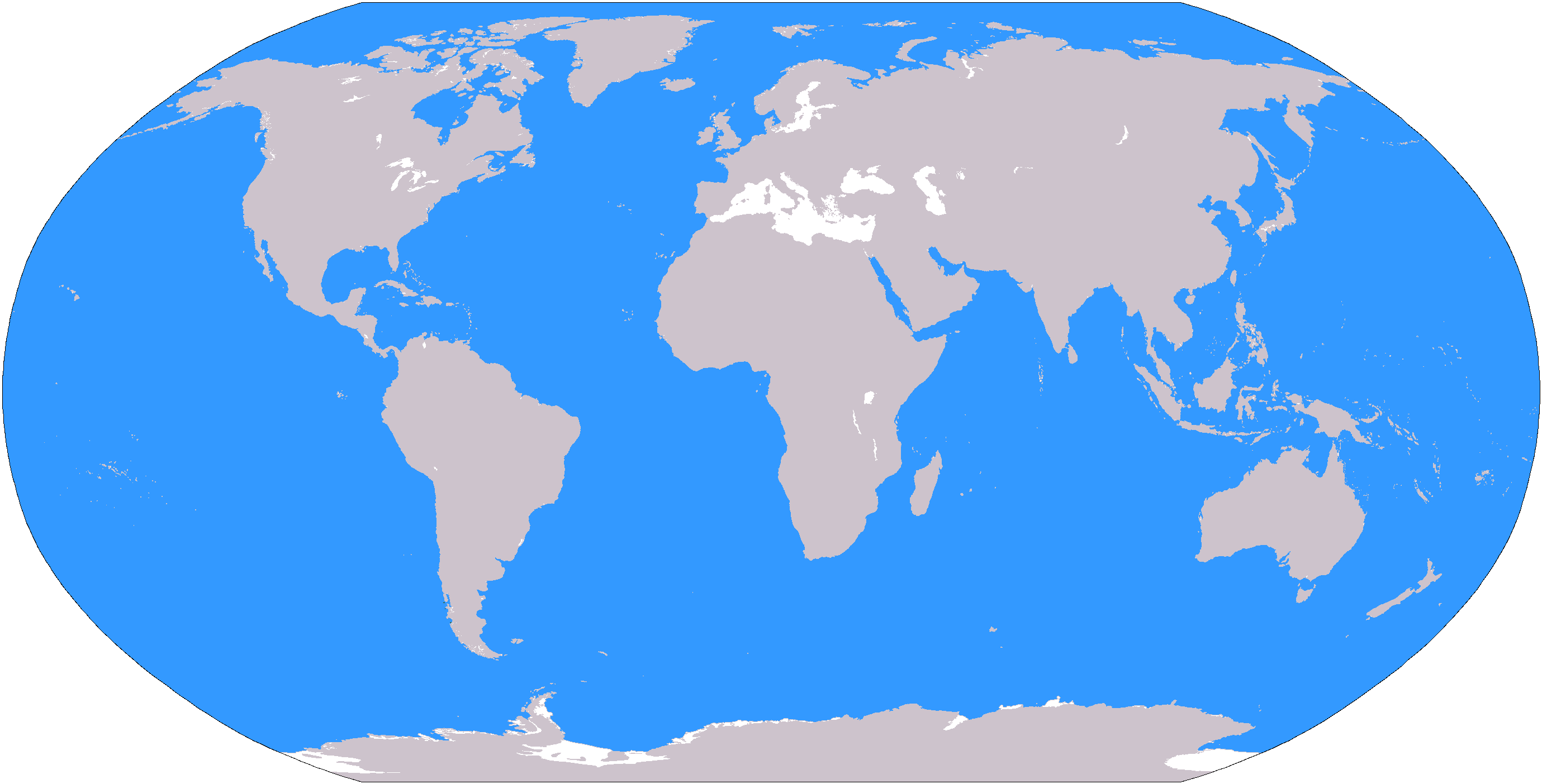 oceans
An excerpt characterizing the Balkan Peninsula
- What should I ask? General Armfeld offered an excellent position with an open rear. Or attack von diesem italienischen Herrn, sehr schon! [this Italian gentleman, very good! (German)] Or retreat. Auch gut. [Also good (German)] Why ask me? - he said. “After all, you yourself know everything better than me. - But when Volkonsky, frowning, said that he was asking his opinion on behalf of the sovereign, then Pfuel stood up and, suddenly animated, began to say:- They spoiled everything, confused everyone, everyone wanted to know better than me, and now they came to me: how to fix it? Nothing to fix. Everything must be done exactly according to the reasons I have set forth,” he said, tapping his bony fingers on the table. – What is the difficulty? Nonsense, Kinder spiel. [children's toys (German)] - He went up to the map and began to speak quickly, poking a dry finger on the map and proving that no chance could change the expediency of the Dris camp, that everything was foreseen and that if the enemy really goes around, then the enemy must inevitably be destroyed.
Pauluchi, who did not know German, began to ask him in French. Wolzogen came to the aid of his principal, who did not speak French well, and began to translate his words, barely keeping up with Pfuel, who quickly proved that everything, everything, not only what happened, but everything that could happen, everything was foreseen. in his plan, and that if now there were difficulties, then all the fault was only in the fact that everything was not executed exactly. He constantly laughed ironically, proved, and, finally, contemptuously gave up proving, as a mathematician quits to verify different ways once proven correctness of the task. Wolzogen replaced him, continuing to expound his thoughts in French and occasionally saying to Pfuel: "Nicht wahr, Exellenz?" [Isn't that right, Your Excellency? (German)] Pfuel, as in a battle a heated man beats his own, angrily shouted at Wolzogen:
– Nun ja, was soll denn da noch expliziert werden? [Well, yes, what else is there to interpret? (German)] - Pauluchi and Michaud attacked Wolzogen in French in two voices. Armfeld addressed Pfuel in German. Tol explained in Russian to Prince Volkonsky. Prince Andrew silently listened and watched.
Of all these persons, the embittered, resolute and stupidly self-confident Pful was the most arousing interest in Prince Andrei. He, one of all the people present here, obviously did not want anything for himself, did not harbor enmity towards anyone, but wanted only one thing - to put into action the plan drawn up according to the theory that he had deduced over the years of work. He was ridiculous, was unpleasant with his irony, but at the same time he inspired involuntary respect with his boundless devotion to the idea. In addition, in all the speeches of all the speakers, with the exception of Pfuel, there was one common feature, which was not at the military council in 1805 - it was now, although hidden, but panic fear before the genius of Napoleon, the fear that was expressed in every objection. Everything was supposed to be possible for Napoleon, they were waiting for him from all sides, and with his terrible name they destroyed one another's assumptions. One Pful, it seemed, considered him, Napoleon, the same barbarian as all the opponents of his theory. But, in addition to a sense of respect, Pful inspired Prince Andrei with a sense of pity. From the tone with which the courtiers treated him, from what Pauluchi allowed himself to say to the emperor, but most importantly from the somewhat desperate expression of Pfuel himself, it was clear that others knew and he himself felt that his fall was near. And, despite his self-confidence and German grumpy irony, he was pitiful with his smoothed hair on the temples and tassels sticking out at the back of his head. Apparently, although he concealed this under the guise of irritation and contempt, he was in despair because the only opportunity now to verify by vast experience and prove to the whole world the correctness of his theory eluded him.
The debate went on for a long time, and the longer it went on, the more disputes flared up, reaching shouts and personalities, and the less it was possible to draw any general conclusion from everything that was said. Prince Andrei, listening to this multilingual dialect and these assumptions, plans and denials and cries, was only surprised at what they all said. Those who had long and often come to him during his military activities, thoughts that there is not and cannot be any military science and therefore there can be no so-called military genius, now received for him a perfect evidence of the truth. “What kind of theory and science could there be in a matter in which the conditions and circumstances are unknown and cannot be determined, in which the strength of the leaders of the war can be even less determined? No one could and cannot know what the position of our and the enemy army will be in a day, and no one can know what the strength of this or that detachment is. Sometimes, when there is no coward in front who will shout: “We are cut off! - and he will run, and there is a cheerful, courageous person in front who will shout: “Hurrah! - a detachment of five thousand is worth thirty thousand, as at Shepgraben, and sometimes fifty thousand run before eight, as at Austerlitz. What kind of science can there be in such a matter, in which, as in any practical matter, nothing can be determined and everything depends on innumerable conditions, the significance of which is determined in one minute, about which no one knows when it will come. Armfeld says that our army is cut off, and Pauluchi says that we have placed French army between two fires; Michaud says that the worthlessness of the Drissa camp lies in the fact that the river is behind, and Pfuel says that this is his strength. Tol proposes one plan, Armfeld proposes another; and everyone is good, and everyone is bad, and the benefits of any situation can be obvious only at the moment when the event takes place. And why does everyone say: a military genius? Is a genius the person who manages to order the delivery of crackers in time and go to the right, to the left? Just because military people are clothed with brilliance and power, and masses of scoundrels flatter power, giving it the unusual qualities of a genius, they are called geniuses. Against, the best generals people I knew were stupid or distracted people. The best Bagration, - Napoleon himself admitted this. And Bonaparte himself! I remember his self-satisfied and limited face on the field of Austerlitz. Not only does a good commander not need a genius and any special qualities, but, on the contrary, he needs the absence of the best, highest, human qualities - love, poetry, tenderness, philosophical inquisitive doubt. He must be limited, firmly convinced that what he does is very important (otherwise he will lack patience), and then only he will be a brave commander. God forbid, if he is a man, he will love someone, take pity, think about what is fair and what is not. It is clear that from time immemorial the theory of geniuses has been forged for them, because they are the authorities. The merit in the success of military affairs does not depend on them, but on the person who shouts in the ranks: they are gone, or shouts: hurrah! And only in these ranks can you serve with confidence that you are useful!“
So thought Prince Andrei, listening to the talk, and woke up only when Pauluchi called him and everyone was already dispersing.
The next day, at the review, the sovereign asked Prince Andrei where he wanted to serve, and Prince Andrei lost himself forever in the court world, not asking to stay with the person of the sovereign, but asking for permission to serve in the army.
Before the opening of the campaign, Rostov received a letter from his parents, in which, briefly informing him of Natasha's illness and the break with Prince Andrei (this break was explained to him by Natasha's refusal), they again asked him to retire and come home. Nikolai, having received this letter, did not try to ask for a vacation or resignation, but wrote to his parents that he was very sorry about Natasha's illness and break with her fiancé and that he would do everything possible to fulfill their desire. He wrote to Sonya separately.
“Adored friend of my soul,” he wrote. “Nothing but honor could keep me from returning to the village. But now, before the opening of the campaign, I would consider myself dishonorable not only before all my comrades, but also before myself, if I preferred my happiness to my duty and love for the fatherland. But this is the last parting. Believe that immediately after the war, if I am alive and loved by you, I will drop everything and fly to you to press you forever to my fiery chest.
Indeed, only the opening of the campaign delayed Rostov and prevented him from coming - as he promised - and marrying Sonya. Otradnensky autumn with hunting and winter with Christmas time and with Sonya's love opened up to him the prospect of quiet aristocratic joys and tranquility, which he had not known before and which now beckoned him to them. “A glorious wife, children, a good flock of hounds, dashing ten - twelve packs of greyhounds, household, neighbors, election service! he thought. But now there was a campaign, and it was necessary to remain in the regiment. And since this was necessary, Nikolai Rostov, by his nature, was also pleased with the life he led in the regiment, and managed to make this life pleasant for himself.
Arriving from vacation, joyfully greeted by his comrades, Nikolai sent for repairs and brought excellent horses from Little Russia, which pleased him and earned him praise from his superiors. In his absence, he was promoted to captain, and when the regiment was put on martial law with an increased kit, he again received his former squadron.
A campaign began, the regiment was moved to Poland, a double salary was issued, new officers arrived, new people, horses; and, most importantly, that excitedly cheerful mood that accompanies the outbreak of war has spread; and Rostov, aware of his advantageous position in the regiment, gave himself up entirely to the pleasures and interests military service, although he knew that sooner or later he would have to leave them.
The troops retreated from Vilna for various complex state, political and tactical reasons. Each step of retreat was accompanied difficult game interests, inferences and passions in the headquarters. For the hussars of the Pavlograd regiment, this whole retreat, at the best time of summer, with sufficient food, was the simplest and most fun thing to do. They could lose heart, worry and intrigue in the main apartment, but in the deep army they did not ask themselves where, why they were going. If they regretted that they were retreating, it was only because they had to leave the habitable apartment, from the pretty lady. If it occurred to anyone that things were bad, then, as a good military man should, the one to whom it occurred to him tried to be cheerful and not think about the general course of affairs, but think about his immediate business. At first they cheerfully stood near Vilna, making acquaintances with the Polish landowners and waiting and serving reviews of the sovereign and other high commanders. Then the order came to retreat to the Sventsians and destroy the provisions that could not be taken away. The Sventsians were remembered by the hussars only because it was a drunken camp, as the whole army called the camp near Sventsians, and because in Sventsians there were many complaints against the troops because they, taking advantage of the order to take away provisions, took away horses among the provisions, and carriages, and carpets from the Polish pans. Rostov remembered Sventsyany because on the first day of entering this place he changed the sergeant-major and could not cope with all the people of the squadron who got drunk, who, without his knowledge, took away five barrels of old beer. From Sventsyan they retreated further and further to Drissa, and again retreated from Drissa, already approaching the Russian borders.
The Balkan Peninsula (Balkans, in German Balkanhalbinsel) is actually “between mediterranean sea and the Black Sea", the distance from end to end of the Balkan Peninsula is about 1400 kilometers. A wonderful map of the Balkan Peninsula, relief and states is on Wikipedia.
See what the "Balkan Peninsula" is in other dictionaries:
In the mountainous expanses of the Balkan Peninsula, everything, of course, is European ... In the general cultural sense, the Balkans are all of the above without taking into account Turkey and Italy: the first is usually attributed to Asia, the second to Southern Europe. From a tourist point of view, the Balkans is an ideally balanced region in terms of types of recreation.
The name is from the oronym used in the past Balkan mountains or the Balkans (from the Turks, balkan a chain of steep mountains); Now the mountains are called Stara Planina, but the name of the peninsula has been preserved. 505 thousand km2. Protrudes into the sea for 950 km. It is washed by the Mediterranean, Adriatic, Ionian, Marmara, Aegean and Black Seas. See these articles. Ivan Asen II, Jesse Russell. Slavic sword, F. Finzhgar.
Balkans as a space of problematic supranational identity
There is no geographical basis for the isolation of the Balkan Peninsula; The Balkans is an exclusively geopolitical category. During the years of the collapse of the Ottoman Empire in the geopolitical consciousness, the Balkan Peninsula was not yet clearly isolated as a geopolitical space. Until the Ottoman conquest, Southeast Europe was no "civilizational periphery": the foundations of European culture were laid right here, in the Balkans. This, in fact, is the area of concentration of a typical Balkan cultural landscape and a Balkan city. All three historical regions that make up today's Croatia - Croatia, Slavonia and Dalmatia - have strong ties to the civilizational traditions of Central and Western Europe. The definition of the Danube as the northern border of the Balkan Peninsula was supported by the majority of scientists. The modern Turkish state occupies only 3.2% of the territory of the Balkan Peninsula. 4.Geographic location of an ethnic or state territory people on the Balkan Peninsula does not automatically mean belonging to the Balkan cultural identity.
The Balkan Peninsula narrows to the south and breaks into indented capes and chains of islands. Cities such as Athens are full of reminders of the ancient Greek civilization, which greatly influenced the development of the whole world. Every year tourists come here from all over the world.
5. Politics Western states in the Balkans during the Eastern Crisis. 5. Bismarck's attitude to the national liberation struggle Slavic peoples. The purpose of the lesson is to analyze the causes and consequences of the Balkan wars of 1912-1913. The main sources are the texts of diplomatic documents. Be able to show on the map territorial changes in the Balkans (changes in the borders of Bulgaria, Greece, Serbia). It is necessary to have a good idea of the course of the Second Balkan War and the changes in borders after the defeat of Bulgaria, which predetermined its pro-German orientation in the future.
Relative to ethnic composition The Balkans are among the most diverse places on the continent. In addition to ethnic and linguistic relations, the Balkan region is also quite diverse in terms of religion. In the past, the Balkans was a land of numerous conflicts that stemmed from the great internal differences in the peninsula.
Unlike other Mediterranean countries, the Balkan country is less separated to the north from the mainland core of Europe. The border between the Balkan and Alpine countries is drawn along the average January isotherm +4 ... +5 0 C. At this temperature, evergreens are preserved. By genetic and geomorphological features, the mountains of the Balkan region are combined into two systems: the Dinaric west and the Thracian-Macedonian east. Peculiarities geographical location and the relief of the region determine the formation of three continental types of climate here: Mediterranean, sub-Mediterranean and temperate. The Mediterranean climate proper is typical only for a relatively narrow strip of the western and south coast Balkan Peninsula.
The Balkan Peninsula is still one of the poorest and most backward in economic terms parts in Europe. Integration processes are currently taking place in the Balkans.

The northern border of the peninsula is considered to be a conditional line drawn along the Danube, Sava and Kupa rivers, and from the source of the latter to the Kvarner Strait. Geographic position, culture, science, Islam, politics, earthly aspirations and ambitions tear the Balkans between East and West. Faith, and only Orthodox faith, elevates this peninsula above East and West.
It seemed that the Balkan Peninsula was returning to normal life. The power of Tamerlane scared Ottoman Empire. Already at the beginning of the twentieth century. the countries of the Balkan Peninsula decided to completely get rid of the influence of the Turks. In the 90s of the last century, Yugoslavia broke up into a number of states that exist until today(one of them - Kosovo - is partially recognized).
Geography of the area
The Balkan Peninsula has an exceptionally varied relief, although most of its area is occupied by mountains. Therefore, the Balkan Peninsula is one of the most seismic zones in Europe, along with the island of Iceland. The coast of Croatia and Greece is especially dissected. The most southern part The Balkans is occupied by the Peloponnese peninsulas.
The Dalmatian coast, which covers the western parts of the peninsula, is considered the most picturesque and greenest part of the Mediterranean. Greece however is considered a tourist paradise with its exceptionally beautiful white sandy beaches and crystal clear bays. Black Sea coast completely different.
Greece - located on the peninsula and nearby islands; Romania - located in the east, completely located on the peninsula.
On the outskirts is the Lower Danube and Middle Danube Plain. The southern territories are mostly occupied by Greece. Most of the plain is located in the basin of the Maritsa River. The northern and northwestern territories border on Montenegro and Serbia, the eastern territories border Macedonia, and the southern and southeastern territories border Greece. There are also several large lakes on the territory, which stretch along the border areas with Greece, Macedonia, Yugoslavia.
Relief. The surface is predominantly mountainous. To the west of the massif along the coast of the Adriatic Sea, the Dinaric fold-cover system (Dinarids) extends, which continues in Albania and Greece with an arcuately curved Ellinid system. The southern part of the peninsula is dominated by subtropical brown, mountain brown typical and carbonate soils; red-colored soils of terra rossa are common on the Adriatic coast.
Areas of karst development in the Dinaric Highlands in places with almost no vegetation cover.
More specifically, in the southeastern part of it. It is washed by the Mediterranean Sea from three sides (east, south and west). Accordingly, the seas in the east are the Aegean and Black, in the west, the Adriatic. The coastal line of this territory is very indistinct, the adjacent islands are widely scattered. In principle, the picture clearly shows which states are included in the Balkan Peninsula (all those that are not marked in light green). I will only note that it also includes a partially recognized state - Kosovo, which is located on the territory of Serbia.

Lower Danube lowland. Postojna, east of Trieste. Sofia basin. Along with this, there are areas that are primordially treeless.

On the territory of the Balkan Peninsula pass important highways connecting Western Europe with Southwest Asia (Asia Minor and the Middle East).