Geographical map of Africa. Political map of Africa. African Development and Economy
The mainland occupies 1/5 of the land mass globe and is inferior in size. Population - over 600 million people. There are currently more than 50 sovereign states, most of which were colonies until the mid-20th century.
European colonization began in this region in the 16th century. Ceuta and Melilla - rich cities in (in the territory of) the end points of the trans-Saharan trade route - were the first Spanish colonies. Next, mainly the West Coast of Africa was colonized. By the beginning of the 20th century. the “dark continent” had already been divided by the imperialist powers into dozens of colonies (see atlases of the New and Recent history 9,10,11 grades high school).
Almost all African states are classified according to typology into the group. The only exception on the continent is economically developed state - South Africa.
The success of the struggle of African states to strengthen political and economic independence depends to a very large extent on which political forces are in power.
In 1963, the Organization of African Unity (OAU) was created. Its goals are to promote the strengthening of the unity and cooperation of the states of the continent, to protect their sovereignty, and to fight against all forms of neo-colonialism.
Another influential organization is the League of Arab States (LAS), formed in 1945. It includes Arab countries North Africa and countries. The League advocates strengthening the economic and political cooperation Arab peoples.
Most African countries went from the era of wars of independence to the era of civil wars and interethnic conflicts. In many African countries over the years of independent development general rule became the privileged position of the ethnic group whose representatives were in power. Hence there are many interethnic conflicts in the countries of this region.
Lasted for about 20 years civil wars in Angola and Mozambique; For many years, war, devastation and famine have reigned in Somalia. For more than 10 years, the interethnic interfaith conflict in Sudan (between the Muslim North and adherents of Christianity and traditional beliefs in the south of the country) has not stopped. In 1993, there was a military coup in Burundi, and there is a civil war in Burundi and Rwanda. The conflict spread to neighboring states. Civil wars are also common in (the first of the countries of “black Africa”, which gained independence back in 1847).
Democracy is not taking root - for 23 of the 30-odd years after gaining independence, the country lived under a military regime. In June 1993, democratic elections were held and immediately after that another military coup took place, all democratic institutions of power were again dissolved and banned political organizations, rallies and meetings.
Examples of struggle for political power You can continue.
Nevertheless, there are practically no places left on the map of Africa where the problem of state independence has not been resolved. The exception is Western, which has still not acquired the status of an independent state, despite the 20-year struggle for liberation waged by the Polisario Front. In the near future, the UN intends to hold a referendum in the country - independence or joining Morocco?
Separately, the situation in the Republic of South Africa should be considered, where there is a transition from “democracy for the minority” to non-racial principles of local and central control: the elimination of apartheid and the creation of a united, democratic and non-racial South Africa. For the first time, non-racial presidential elections were held. Mandela is elected as the first black president of South Africa. Ex-president- Frederik de Klerk joined the coalition cabinet. South Africa was restored (after 20 years of absence) as a member of the UN.
In conclusion, we note that for many African countries The transition to political pluralism and multi-party system became a great challenge. Nevertheless, it is the stability of political processes in African countries that is the main condition for their further economic development.
Our resource is dedicated to tourism and travel, which is why maps of foreign cities and countries are so important for my readers. To avoid getting lost in a foreign city or country, visit our website! This article will provide you with map of africa, on which streets and houses are clearly visible. Simply put, here you will see an interactive map of Africa with cities directly from satellite in Russian!
Map of Africa from satellite

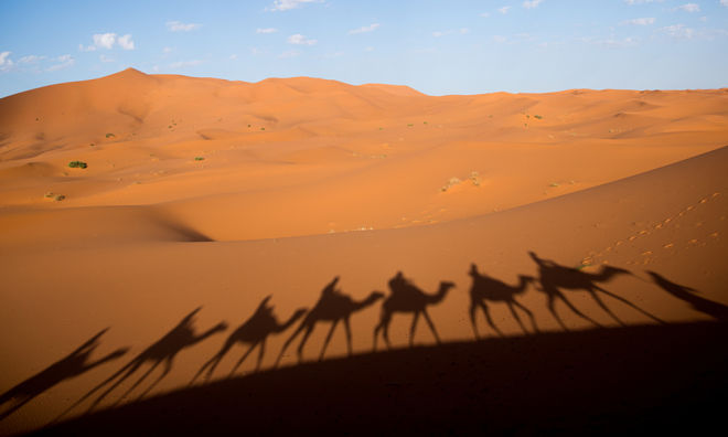
Everyone knows what Africa is, am I right? But anyway, I'll give you a little tour. Africa is located near the Mediterranean and Red Sea, a little to the south, in general. Africa is also washed by the Atlantic Ocean from the west, and the Indian Ocean from the east. We have all at least once seen a world map or a globe and should know that Africa is a fairly large continent. And so it is, in terms of area, it is the second continent in the world, after the giant Eurasia. There are as many as 55 states in Africa, of which 4 are not recognized and five are independent territories on islands. In both complexity, Africa is inhabited by about a billion people. Based on the generally accepted theory, Africa can be considered the progenitor of the human race, on this moment It was in Africa that the most ancient remains of early human ancestors were found.
Now let's talk about tourism in Africa. We all know that there is nothing better than exotic travel and Africa is just right for this purpose. Wonderful and unusual animals for our eyes, interesting and different people, a stunning and unusual climate - all this awaits you in Africa. If you have not yet decided which country you want to visit, then below I will give a list of African countries with a tourist analysis. Well, as always, according to tradition, with a bunch of maps, so that if you are already planning to go, you will not get lost in any case!
You can go to the end and leave a comment. Notifications are currently disabled.Africa map
Detailed map of Africa in Russian. Explore a map of Africa from a satellite. Zoom in on streets, houses and landmarks on a map of Africa.
Africa is part of the world located on both sides of the equator. In the northern part, in the Nile Valley and on the Mediterranean coast, lived tribes that created the first centers of human civilization (Egypt and Cartagena).
The Romans and ancient Greeks called central part Mediterranean coast of Libya (on the Libu tribe). Adjacent Libu was a warlike Berber tribe called the Afridas who fought ancient Rome several times.
In the 2nd century BC, the Romans defeated Carthage and established a landslide in the conquered territory called Africa. By the beginning of the Middle Ages, this name had spread along the entire Mediterranean coast, during European colonization and throughout the continent.
Africa has been a center of conquest and colonization for centuries.
There was a slave trade: the entire tribe disappeared from the land, large areas were abandoned. Over time, almost all of Africa was divided into colonies and spheres of influence between largest countries, such as France, Germany and England, which exported gold, ivory and other valuable goods from the country.
An important blow to the entire colonial system in the world, including in Africa, was after the defeat of Germany in World War II.
Almost all countries were forced to give up their colonies for independence and withdraw their military and administrative apparatus. Currently, Africa is a continent with approximately 50 independent countries.
The area of Africa is 30 million square kilometers. The African population is about a billion people. Hot climate in Africa - The African continent crosses the equator.
What else you can see:
- World maps
- Capital of the world
- Satellite map peace
- World map - political
- Geographic map of the world
- World map online
To enlarge or download the map, click on the image or the “Enlarge” link.
 Political map Africa in Russian
Card size: 2433x2333 px (pixels)
File size: 2.62 MB
Language: Russian
Image Format: jpg
Increase
 Map of Africa with countries and capitals
Card size: 1917x2033 px (pixels)
File size: 1.13 MB
Language: Russian
Image Format: jpg
Increase
 Physical map of Africa
Card size: 1550x2050 px (pixels)
File size: 1.44 MB
Language: Russian
Image Format: jpg
Increase
 Africa on the world map
Card size: 2018x1000 px (pixels)
File size: 415 KB
Language: Russian
Image Format: jpg
Increase
ALL MAPS

Africa map
Detailed map of Africa in Russian online.
Satellite map of Africa with cities and resorts, roads, streets and houses. The continent of Africa on the world map is the second largest continent, on its territory there are 55 countries, total population- about 960 million

Satellite map of Africa. Map of Africa from satellite.
Political map of Africa in Ukrainian:

Map of Africa in English:

Africa - Wikipedia
Population of Africa: 1,200,000,000 people
(2016)
Area of Africa: 30,370,000 sq. km.
Sights of Africa:
What to see in Africa: Victoria Falls, Congo River, Cape of Good Hope, Mount Kilimanjaro, Drakensberg Mountains, Serengeti, Sahara Desert, Namib Desert, Limpopo River, Table Mountain, Egyptian Pyramids.
A variety of ethnic groups live on the continent.
This is the Caucasian race in the states North Africa, Negroid - in central Africa, where many different African tribes live and Mongoloid race, whose representatives are the Bushmen living in South Africa . The population density in each country and region of Africa is different. The most densely populated area is the Mediterranean coast.
The most common languages are English, Arabic, African languages and French.
Nature Africa diverse. There are desert areas and rainforests, and steppes, and mountain ranges. The highest point is Mount Kilimanjaro, which is almost 6000 meters high. Africa has many rivers that are the largest in the world: Limpopo, Nile, Niger and others.
Because Africa is a huge continent, its territory is covered by many climatic zones– from northern temperate to southern temperate.
On average, the temperature on the mainland does not drop below +8 C. The highest temperatures in the world are also recorded in Africa. The record is + 54.8 C in one of the African settlements.
Africa- This is also the oldest continent on our planet.
It is often called the cradle of civilization. Many cultures and traditions have been preserved here in their original form, and the beauty of nature, in harmony with which Africans live, is amazing. On the mainland there is a huge amount national parks and nature reserves, which are protected areas. On the territory of these parks you can see the most rare representatives fauna in their natural living conditions: elephants, giraffes, lions, zebras and others.
2008 — 2018 © Maps-of-World.ru — detailed maps countries of the world in Russian with cities.
Africa is the second largest continent in the world, followed by Eurasia.
Interesting facts about African countries:
- Algeria is the most big country Africa. More than 80% of the territory is occupied by the Sahara Desert.
- Angola. The capital of Angola, Luanda, is considered the most expensive city to live in, but 50% of the country's population cannot read and write.
- Benin is a small country, famous for the town of Ouidah, which is considered a stronghold of the voodoo religion. Benin is one of the African countries that fully provides itself with all necessary food products.
- Botswana is one of the least explored countries in Africa. More than 70% of the territory is desert.
- Burkina Faso is a country with a very low standard of living. In the country it is rare to meet a person over 65 years old. The country is visited extremely rarely by tourists.
- Burundi is a country without hospitals. There are only about 200 doctors and nurses in the entire state, so the level of medical care is one of the lowest in the world.
- Gabon is one of the most stable and richest countries on the African continent. About 80% of the country's territory is occupied by tropical forests.
- The Gambia is the smallest country in Africa by area.
- Ghana is the first state in West Africa, which gained independence from the British people.
- Guinea is the leader in bauxite reserves. It is among the 10 poorest countries in the world.
- Guinea-Bissau. There is not a single power plant in the country. Electricity is supplied from city generators and is turned on only for 2-3 hours a day.
- Democratic Republic of the Congo. The main attraction of the republic is the Congo River, which is one of the deepest in the world.
- Djibouti is one of the driest countries in the world.
- Egypt is one of the cheapest and most popular resorts in the world. Famous for its developed infrastructure V tourist cities. But outside the tourist area, Egyptians live very poorly. It is in Egypt that one of the seven wonders of the world is located - the Pyramid of Cheops.
One of the wonders of the world is the Pyramid of Cheops. Egypt
- Zambia is the first African country to make banknotes from plastic rather than paper. The most visited place by tourists is the village of Mukuni artisans.
- Zimbabwe. One of the world's coffee exporters. The country is very high level unemployment in 2019 – about 80%.
- Cape Verde is a country of 18 islands. The state is engaged in the production and export of footwear.
- Cameroon. Half of the state's territory is occupied by forests, in which the most large goliath frogs in the world. The population lives below the poverty line, but despite this, the people of Cameroon are always hospitable and good-natured towards tourists.
- Kenya is the country with the largest international airport in East Africa. Kenya is different from other countries. There are no seasons in the country, there are only seasons: dry and rainy.
- Comoros Islands. A country where it is impossible to pay with a bank card. There are not even ATMs on the territory of the state.
- Congo is famous for the most dangerous dormant volcano in the world - Newiragongo.
- Cote d'Ivoire. More than 60 peoples live in the state. It is in this country that the largest church in the world is located.
- Lesotho is located in the highlands. There are two diamond mines in the country.
- Liberia. The country has not yet fully recovered from the war in 1980. The population lives below the poverty line. The only country in the world where there is not a single traffic light.
- Libya. 90% of the area is covered by desert. A state with a very limited number of animals and plants. The lack of flora and fauna is caused by the arid climate.
- Mauritius – tourist resort, which ranks second in terms of living standards on the African continent.
- Mauritania. All the rivers in this country dry up in the summer, except for one - Senegal. 100% of the Mauritanian population professes Islam.
- Madagascar is the fourth largest island in the world. The country is the world's first producer of vanilla.
- Malawi is the poorest republic in Africa. The country is famous for its orchids; more than 400 species grow on the territory of the state.
- Mali. The country ranks among the world's leading gold exporters.
- Morocco is a tourist country, visited by more than 10 million tourists every year. In the country, namely in Casablanca, there is the tallest religious building - the Hassan Mosque 2.
- Mozambique. About 25% of the country's population does not consider themselves followers of any faith, although they are not atheists. Meat is rare in Mozambique.
- Namibia. On its territory there is the largest in the world underground lake. Tourists are attracted to Namibia by the “skeleton coast” - a surf line strewn with whale skeletons.
“Skeleton Coast” is one of the most memorable places
- Niger. About 80% of the republic's area is occupied by the Sahara Desert. Niger is first in the world in terms of birth rate.
- Nigeria is the republic that ranks first in Africa in terms of population. The country is engaged in the production and export of oil and petroleum products.
- Rwanda is the country with the tallest inhabitants on the planet. Not in Rwanda railways and trams. The country is one of the few in Africa that does not experience a shortage of drinking water.
- Sao Tome and Principe are islands that are extinct volcanoes. The islands are popular with a local attraction - the Mouth of Hell (a place in the rocks from where a stream of sea water flows).
- Swaziland is a country with 2 capitals: Mbabane and Lobamba. The country is ruled by a king, but his power is partially limited by parliament. The republic ranks first in the world in terms of the number of HIV-infected people.
- Seychelles is one of the most expensive resorts in the world. The Seychelles includes 115 islands, of which only 33 are inhabited.
- Senegal. National symbol of this country - baobab. The famous Paris-Dakar rally is held annually in the capital of Senegal.
The Paris-Dakar Rally is a dream for many
- Somalia is one of the most armed countries in the world. For local residents carry with you constantly firearms considered the norm. Somalia is a country with anarchy.
- Sudan is a state where marriages with deceased people are legally permitted. Sudan is the world's largest importer of gum arabic.
- Sierra Leone. One of the poorest countries in the world. Half of the republic's population cannot read or write.
- Tanzania. A third of the country is occupied by nature reserves. The republic is characterized by a low level of education. According to statistics, only half of Tanzanian children attend school. The country has 2 capitals and the largest crater in the world - Ngorongoro.
- Togo is a country known for having the largest traditional market in the world, where you can buy absolutely everything. Togo is a country of contrasts, where monolithic elite high-rise buildings border on the mud huts of the poor.
- Tunisia is a popular tourist country, famous not only for its unique culture and nature, but also for its “Rose of the Sahara” landmark. This crystal is formed in the desert from salt and sand. Many tourists buy crystal as a souvenir to decorate aquariums and houses.
The amazing phenomenon “Rose of the Sahara”
- Uganda is the youngest republic in the world. Average age Ugandans are 15 years old. The country is home to one of the deepest lakes in the world - Albertina.
- The Central African Republic is a state with incredible reserves of uranium, gold, oil and diamonds. But despite this, the country is among the 30 poorest republics in the world.
- Chad. The country is named after Lake Chad, which is located on its territory. The country does not have a complete railway connection. This republic amazes with its dry and arid climate, Maximum temperature in the shade in summer it reaches 56 degrees Celsius.
- Equatorial Guinea is a country where the land is bright red due to the special composition of the soil. In Equatorial Guinea, gold mining is available to everyone.
- Eritrea is one of the poorest countries on the planet. Eritrea has no national language. This country became famous in the world thanks to the 30-year war for independence.
- Ethiopia is the most populous landlocked country on the planet. Ethiopia is an agricultural country where cereals, sugar cane, potatoes and cotton are grown.
- South Africa is the most diverse national republic African continent. South Africa is the most developed country Africa.
- South Sudan is one of the least developed republics in Africa. The country doesn't even have running water. South Sudan is famous for its constant civil wars and political upheavals.
The area of South Africa is 3.1 million square meters. km. The region is characterized by the development of the mining industry.
Table: Southern African countries
North Africa is washed Mediterranean Sea, Atlantic Ocean and Red Sea. Area - about 10,000,000 sq. km. Most of This part of the African continent is occupied by the Sahara Desert.
Table: North African countries
West Africa is washed by the Atlantic Ocean. Covers the Sahel and Sudan regions. This part continent is leader in the number of HIV infections and malaria.
Table: West African countries
| State | Square | Population of the state | Capital |
| Benin | 112 620 | 10 741 458 | Porto-Novo, Cotonou |
| Burkina Faso | 274,200 | 17 692 391 | Ouagadougou |
| Gambia | 10 380 | 1 878 999 | Banjul |
| Ghana | 238 540 | 25 199 609 | Accra |
| Guinea | 245 857 | 11 176 026 | Conakry |
| Guinea-Bissau | 36 120 | 1 647 000 | Bissau |
| Cape Verde | 4 033 | 523 568 | Praia |
| Ivory Coast | 322 460 | 23,740,424 | Yamoussoukro |
| Liberia | 111 370 | 4 294 000 | Monrovia |
| Mauritania | 1 030 700 | 3 359 185 | Nouakchott |
| Mali | 1 240 000 | 15 968 882 | Bamako |
| Niger | 1 267 000 | 23 470 530 | Niamey |
| Nigeria | 923 768 | 186 053 386 | Abuja |
| Senegal | 196 722 | 13 300 410 | Dakar |
| Sierra Leone | 71 740 | 5 363 669 | Freetown |
| Togo | 56 785 | 7 154 237 | Lome |
States Central Africa in 2019 have very good complex natural resources, therefore, countries are not only actively developing the industrial sector, but are also leading subjects foreign trade African continent.
Table: countries of Central Africa
| State | Square | Population of the state | Capital |
| Angola | 1 246 700 | 20 172 332 | Luanda |
| Gabon | 267 667 | 1 738 541 | Libreville |
| Cameroon | 475 440 | 20 549 221 | Yaounde |
| Democratic Republic of the Congo | 2 345 410 | 77 433 744 | Kinshasa |
| Congo | 342 000 | 4 233 063 | Brazzaville |
| Sao Tome and Principe | 1001 | 163 000 | Sao Tome |
| CAR | 622 984 | 5 057 000 | Bangui |
| Chad | 1 284 000 | 11 193 452 | N'Djamena |
| Equatorial Guinea | 28 051 | 740 743 | Malabo |
East Africa occupies the high part of the continent. It is in this part that the highest point in Africa is located - Kilimanjaro. Most of the territory is savannah. In East Africa the most a large number of national and protected parks. East Africa is characterized by frequent civil wars and armed conflicts.
Table: East African countries
| State | Square | Population of the state | Capital |
| Burundi | 27 830 | 11 099 298 | Bujumbura |
| Djibouti | 22 000 | 818 169 | Djibouti |
| Zambia | 752 614 | 14 222 233 | Lusaka |
| Zimbabwe | 390 757 | 14 229 541 | Harare |
| Kenya | 582 650 | 44 037 656 | Nairobi |
| Comoros (Comoros) | 2 170 | 806 153 | Moroni |
| Mauritius | 2040 | 1 295 789 | Port Louis |
| Madagascar | 587 041 | 24 235 390 | Antananarivo |
| Malawi | 118 480 | 16 777 547 | Lilongwe |
| Mozambique | 801 590 | 25 727 911 | Maputo |
| Rwanda | 26 338 | 12 012 589 | Kigali |
| Seychelles | 451 | 90 024 | Victoria |
| Somalia | 637 657 | 10 251 568 | Mogadishu |
| Tanzania | 945 090 | 48 261 942 | Dodoma |
| Uganda | 236 040 | 34 758 809 | Kampala |
| Eritrea | 117 600 | 6 086 495 | Asmara |
| 1 104 300 | 90 076 012 | Addis Ababa | |
| South Sudan | 619 745 | 12 340 000 | Juba |
On the territory of the African continent there are 55 countries that are bordered by:
- Mediterranean Sea.
- Red Sea.
- Indian Ocean.
- Atlantic Ocean.
The area of the African continent is 29.3 million square kilometers. If we take into account the islands near Africa, the area of this continent increases to 30.3 million square kilometers.
Table. Largest states in Africa:
List of the most major cities by population:
- Nigeria - 166,629,390 people. In 2017, it was the most populous country in Africa.
- Egypt - 82,530,000 people.
- Ethiopia - 82,101,999 people.
- Republic of the Congo. The population of this African country is 69,575,394 inhabitants.
- Republic of South Africa. There were 50,586,760 people living in South Africa in 2017.
- Tanzania. This African country has a population of 47,656,370 people.
- Kenya. This African country has a population of 42,749,420 people.
- Algeria. In this country tropical Africa Home to 36,485,830 people.
- Uganda - 35,620,980 people.
- Morocco - 32,668,000 people.
African Development and Economy
If you take the corresponding maps of Africa, the countries differ not only in their diversity weather conditions, but also in abundance land resources and minerals.
The African continent ranks 1st in the world in reserves of the following breeds:
- manganese;
- chromite;
- gold;
- platinoid;
- cobalt;
- phosphorite
The industry of African countries is very well developed. This is especially true in the mining industry. Thus, last year, 96% of the total volume of diamonds was mined on the African continent. The resources of African countries make it possible to extract large quantities of gold and cobalt ores. On average, about 76% of gold and 68% of cobalt ores of the total world volume are mined on the continent.
Chromites are mined in an amount of 67% of total number, and the share of manganese ore production is 57% of the total volume.
Africa contains and produces 35% of the world's total uranium ore and 24% of copper. The African continent exports 31% of the world's total phosphate rocks and 11% of oil and gas.
Despite the small volumes of oil and gas supplies, 6 African countries are members of OPEC, international organization oil exporting states.
If we take the most developing countries Africa in the field of mining, these will be:
South Africa is rapidly developing and rich in the mining industry. This country has deposits of all types of resources, except oil, gas and bauxite. According to statistics, it is in South Africa that about 40% of the continent’s total exports are produced.
South Africa is recognized not only on the African continent. This republic ranks first in the world in gold mining and second in diamond mining.
The manufacturing industry is in its infancy, but it is most developed in South Africa.
Industry Agriculture ranks second in the African economy. The agricultural sector is represented by tropical and subtropical agriculture. The main part of the products is exported. Thus, the African continent exports 60% of the total volume of cocoa beans. Africa also exports peanuts in the amount of 27% of the world's total, coffee - 22% and olives - 16% of the total.
Peanut cultivation is concentrated in Senegal, greatest number coffee is grown in Ethiopia, and the Republic of Ghana is popular for large volumes of growing and harvesting cocoa beans.
Livestock farming in the countries of the African continent is very poorly developed due to water shortages and the spread of a disease dangerous to livestock, spread by tsetse flies.
It is difficult to argue with the fact that Africa is an outstanding continent in all respects. It is the second largest continent in the world in terms of population and area. At the same time, the political map of Africa confirms that this territory makes up about 20% of the entire earth's landmass.
And nature is definitely unique, because any subregion will have its own unusual attractions, unlike anything else.
The Black Continent is oriented vertically - from north to south, and only hot climate zones are found here. There are coasts of two oceans - the Pacific and the Atlantic. African lands are washed by two famous seas- Red and Mediterranean.
The continent itself is divided into subregions by world scientists, usually distinguishing five with different geographical data:
- Northern;
- Central;
- West;
- Oriental;
- Southern.
In this part of the world there is a significant number of states and other entities, which are reflected by the political map of Africa in Russian. There are 62 of them in total, with 8 of them total number- dependent territories.
These countries can be classified according to various parameters; depending on the surrounding water bodies, the following countries have been recorded: 
- island (10);
- inland (15);
- with extensive sea and ocean coasts (37).
Many countries are loved by tourists, which is due to:
- natural conditions;
- historical heritage;
- unique wildlife.
Europeans are most likely to come to North Africa, since it is the closest region, and the local tourism industry has been working for many years, expanding and adapting to such visitors.
Many travelers strive to get there, and the local nature is perfectly combined with the civilization inherent in many resorts.
Among the African countries on the political map of Africa, the following are often chosen for vacation:
- Egypt (interested in heritage ancient civilization);
- Morocco (interesting Arab traditions and culture);
- South Africa (an incomparable safari that will be remembered forever);
- Zambia and Zimbabwe (amazing Victoria Falls and Lake Chad);
- Tanzania (with numerous national parks and Kilimanjaro);
- Kenya;
- Namibia;
- Zanzibar.
Political map of Africa in Russian
Even in the last century, the political map of Africa had a completely different look, different from the modern one. This is due to  widespread colonization of the continent European states which began in the 16th century.
The middle of the 20th century became a turning point in this process, when the country and its other parts quickly began to gain independence, tortured for centuries.
Formed in 1963, the Organization of African Unity promoted the restoration of indigenous power and defended sovereignty.
The League of Arab States, which appeared in 1945, also played a special role in history, especially for the countries of North Africa cooperating with the Middle East.
The then new political map of Africa in Russian reflected the difficult situation on the continent, because the suddenly established borders in the process of decolonization turned into numerous civil wars between peoples living nearby.
And yet, at the moment, many African countries are breathing not only freely, but also peacefully, although to this day the process of forming a map is not completed, since new states periodically appear that are not yet recognized by the world.
The North African region is the closest to Europe and the Middle East, so their influence is maximum here. These countries are of a significant size within the continent.
On the political map of Africa in Russian there are the following countries of North Africa:
- Egypt;
- Morocco;
- Sudan;
- Libya;
- Algeria;
- Tunisia;
- Mauritania;
- West Sahara.
Moreover, in Morocco there are two enclaves belonging to Spain:
- Melilla;
- Ceuta.
Sub-Saharan Africa is separated from the Eastern subregion by the Cameroon Mountains. Here are the states:
- Senegal;
- Cape Verde;
- Sierra Leone;
- Burkina Faso;
- Niger, Nigeria;
- Cote d'Ivoire;
- Mali;
- Liberia;
- Ghana;
- Togo;
- Guinea, Guinea-Bissau;
- Gambia;
- Benin.
The central part of the Dark Continent is amazingly rich in resources wildlife, it is located near the equator, so there is a significant amount rain forests and water. And the countries are as follows:
- Central African Republic;
- Republic of Congo, Democratic Republic Congo;
- Cameroon;
- Angola;
- Equatorial Guinea;
- Gabon.
Principe and Sao Tome are located on the coastal islands.
The history of the Eastern subregion is complex, which is associated with the incorrect creation of interstate borders by the colonialists. However modern processes developments are still moving inexorably forward in the states:

South Africa includes:
- Republic of South Africa;
- Zimbabwe;
- Botswana;
- Swaziland;
- Namibia;
- Lesotho;
- Mozambique.
There are also island states:
- Madagascar;
- Reunion;
- Mauritius;
- Comoros Islands;
- Seychelles.