El Niño has been replaced by La Niña: what does it mean. El Niño is the most powerful current in the world's oceans (based on materials from Hongjua) Peruvian in the year of El Niño formation
Author: S. Gerasimov
On April 18, 1998, the newspaper “World of News” published an article by N. Varfolomeeva “Moscow snowfall and the mystery of the El Niño phenomenon” which stated: “...We have not yet learned to be scared at the word El Niño... It is El Niño that is a threat to life on the planet ... The El Niño phenomenon has been practically unstudied, its nature is unclear, it cannot be predicted, which means it is, in the full sense of the word, a time bomb... If efforts are not immediately made to clarify the nature of this strange phenomenon, humanity cannot be sure of the future " Agree that all this looks quite ominous, it’s just scary. Unfortunately, everything that is described in the newspaper is not fiction, not a cheap sensation to increase the circulation of the publication. El Niño – the real unpredictable one natural phenomenon– a warm current so affectionately named.
"El Niño" means "baby" or "little boy" in Spanish. This tender name originated in Peru, where local fishermen have long encountered an incomprehensible mystery nature: in other years, the water in the ocean suddenly heats up and moves away from the shores. And this happens just before Christmas. That's why the Peruvians connected their miracle with the Christian mystery of Christmas: in Spanish, El Niño is the name for the Holy Child Christ. True, before it did not bring such troubles as it does now. Why does a phenomenon sometimes demonstrate its full force, and in other cases almost does not show itself? And what caused the Peruvian miracle, the consequences of which are very serious and sad?
For 20 years now, an entire scientific army has been exploring the space between Indonesia and South America. 13 meteorological vessels, replacing each other, are constantly in these waters. Many buoys are equipped with instruments to measure water temperature from the surface to a depth of 400 meters. Seven planes and five satellites are patrolling the sky over the ocean to get an overall picture of the state of the atmosphere, including understanding the mysterious natural phenomenon El Niño. This occasionally occurring warm current off the coast of Peru and Ecuador is associated with the occurrence of unfavorable weather disasters around the world. It is difficult to follow it - this is not the Gulf Stream, stubbornly moving along a set route for thousands of years. And El Niño occurs, like a jack-in-the-box, every three to seven years. From the outside it looks like this: from time to time in the Pacific Ocean - from the coast of Peru all the way to the islands of Oceania - a very warm giant current appears, with a total area equal to the area of the United States - about 100 million km2. It extends with a long, tapering sleeve. Over this vast space, as a result of increased evaporation, colossal energy is pumped into the atmosphere. The El Niño effect releases energy with a capacity of 450 million megawatts, which is equal to the total capacity of 300 thousand large nuclear power plants. As if one more - additional - Sun rises from Pacific Ocean, warming our planet! And then here, as if in a giant cauldron, between America and Asia, the signature climatic dishes of the year are cooked.
Naturally, the first to celebrate its “birth” are Peruvian fishermen. They are concerned about the disappearance of schools of sardines off the coast. The immediate reason for the departure of the fish lies, as it turns out, in the disappearance of food. Sardines, and not only them, feed on phytoplankton, component which are microscopic algae. And algae needs sunlight and nutrients, primarily nitrogen and phosphorus. They are found in ocean water, and their supply in the upper layer is constantly replenished vertical currents, going from the bottom to the surface. But when the El Niño current turns back, towards South America, its warm waters “lock” the exit of deep waters. Nutrients do not rise to the surface, algae reproduction stops. The fish leave these places - they do not have enough food. But sharks appear. They also react to “problems” in the ocean: bloodthirsty robbers are attracted by the water temperature - it rises by 5-9 ° C. It is precisely this sharp increase in the temperature of the surface layer of water in the eastern Pacific Ocean (in the tropical and central parts) that is the El phenomenon. Niño. What's happening to the ocean?
In normal years it is warm surface water oceans are transported and retained by easterly winds - trade winds - in the western zone of the tropical Pacific Ocean, where the so-called tropical warm pool (TTB) is formed. It should be noted that the depth of this warm layer of water reaches 100-200 meters. The formation of such a huge heat reservoir is the main necessary condition for the birth of El Niño. At the same time, as a result of the surge of water, the sea level off the coast of Indonesia is two feet higher than off the coast of South America. At the same time, the water surface temperature in the west in the tropical zone averages +29-30° C, and in the east +22-24° C. A slight cooling of the surface in the east is the result of the rise of deep cold waters to the ocean surface due to water suction trade winds. At the same time, the largest region of heat and stationary unstable equilibrium in the ocean-atmosphere system is formed above the TTB in the atmosphere (when all forces are balanced and the TTB is motionless).
For unknown reasons, once every three to seven years the trade winds suddenly weaken, the balance is upset and the warm waters of the western basin rush east, creating one of the strongest warm currents in the World Ocean. Over a vast area in the eastern Pacific Ocean, in the tropical and central equatorial parts, there is a sharp increase in the temperature of the surface layer of the ocean. This is the onset of El Niño. Its beginning was marked by a long onslaught of squalls western winds. They replace the usual weak trade winds over the warm western part of the Pacific Ocean and block the rise of cold deep waters to the surface, that is, the normal circulation of water in the World Ocean is disrupted. Unfortunately, such a scientific, dry explanation of the causes is nothing compared to the consequences.
But then a giant “baby” was born. His every “breath”, every “wave of his little hand” causes processes that are global in nature. El Niño is usually accompanied by environmental disasters: droughts, fires, heavy rains, causing flooding of vast areas of densely populated areas, which leads to the death of people and the destruction of livestock and crops in different regions of the Earth. El Niño also has a significant impact on the state of the global economy. According to American experts, in 1982-1983 the economic damage from his “pranks” in the USA amounted to 13 billion dollars and from one and a half to two thousand people died, and according to the estimates of the world’s leading insurance company Munich Re, the damage in 1997-1998 is estimated at already 34 billion dollars and 24 thousand human lives.
Drought and rain, hurricanes, tornadoes and snowfalls are the main satellites of El Niño. All this, as if on command, falls to the Earth in unison. During his “coming” in 1997-1998, fires turned rainforests Indonesia to ashes, and then raged across the vast expanses of Australia. They reached the outskirts of Melbourne. The ashes flew to New Zealand - 2000 kilometers away. Tornadoes swept through places where they had never been. Sunny California was attacked by “Nora” - a tornado (as a tornado is called in the USA) of unprecedented size - 142 kilometers in diameter. He rushed over Los Angeles, almost tearing the roofs off the Hollywood film studios. Two weeks later, another tornado, Pauline, struck Mexico. The famous resort of Acapulco was attacked by ten-meter ocean waves - buildings were destroyed, the streets were littered with debris, garbage and beach furniture. The floods did not spare South America either. Hundreds of thousands of Peruvian peasants fled from the onset of water that fell from the sky, their fields were lost, flooded with mud. Where streams used to gurgle, turbulent streams rushed through. The Chilean Atacama Desert, which has always been so unusually dry that NASA tested its Mars rover there, was hit by torrential rains. Catastrophic floods were also observed in Africa.
In other parts of the planet, climate turmoil has also brought misfortune. In New Guinea, one of the largest islands on the planet, mainly in its eastern part, the land is cracked by heat and drought. Tropical greenery dried up, wells were left without water, crops died. Half a thousand people died of hunger. There was a threat of a cholera epidemic.
Usually a “little boy” frolics for about 18 months, so the planet has time to change seasons several times. It makes itself felt not only in summer, but also in winter. And if at the turn of 1982-1983 in the village of Paradise (USA) 28 m 57 cm of snow fell in a year, then in the winter season of 1998/99, thanks to the El Niño phenomenon, drifts of 29 meters grew in a few days at the ski base on Mount Baker 13 cm.
And if you think that these cataclysms do not affect the vast expanses of Europe, Siberia or the Far East, then you are deeply mistaken. Everything that happens in the Pacific Ocean reverberates throughout the planet. This is a monstrous snowfall in Moscow, and 11 floods of the Neva - a record for three hundred years of the existence of St. Petersburg, and +20 ° C in October in Western Siberia. It was then that scientists began to speak with alarm about the retreat of the border permafrost on North.
And if earlier meteorologists and other specialists did not know what caused such a “collapse” in the weather, now the cause of all disasters is considered to be the return movement of the El Niño current in the Pacific Ocean. They study it up and down, but cannot squeeze it into any framework. Scientists just shrug their shoulders – this is an anomalous climate phenomenon.
And what’s most interesting is that they paid attention to this phenomenon only in the last 100 years. But, as it turns out, the mysterious El Niño has existed for many millions of years. Thus, archaeologist M. Moseli claims that 1100 years ago, a powerful current, or rather, the natural disasters generated by it, destroyed the system of irrigation canals and thereby destroyed the highly developed culture of a large state in Peru. Humanity simply had not previously associated these natural disasters with it. Scientists began to carefully analyze everything connected with the “baby”, and even studied his “pedigree”.
The Huon Peninsula in the area of the island of New Guinea was chosen to reveal the secrets of El Niño. It consists of a series of coral reef terraces. Part of this island is constantly rising due to tectonic movement, and thus bringing to the surface samples of coral reef that are approximately 130,000 years old. Analysis of isotopic and chemical data from these ancient corals helped scientists identify 14 climate “windows” of 20-100 years each. Cold (40,000 years ago) and warm periods (125,000 years ago) were analyzed in order to assess the characteristics of the flow in different climatic regimes. The coral samples obtained indicate that El Nino used to be not as intense as it has been in the last hundred years. Here are the years in which its anomalous activity was recorded: 1864,1871,1877-1878,1884,1891,1899,1911-1912, 1925-1926, 1939-1941, 1957-1958, 1965-1966, 1972, 1976, 1982 -1983, 1986-1987, 1992-1993, 1997-1998, 2002-2003. As you can see, the El Niño “phenomenon” is happening more often, lasting longer and causing more and more trouble. The periods from 1982 to 1983 and from 1997 to 1998 are considered the most intense.
The discovery of the El Niño phenomenon is considered the event of the century. After extensive research, scientists have discovered that the warm western basin typically enters an opposite phase, called La Niña, a year after an El Niño, when the eastern Pacific Ocean cools 5 degrees Celsius below average. Then recovery processes begin to take effect, bringing cold fronts to the western North American coast, accompanied by hurricanes, tornadoes and thunderstorms. That is, the destructive forces continue their work. It was noted that 13 El Niño periods accounted for 18 La Niña phases. Scientists were only able to verify that the distribution of TTB anomalies in the study area does not correspond to normal and therefore the empirical probability of the occurrence of La Niña is 1.7 times greater than the probability of the occurrence of El Niño.
The causes and increasing intensity of reverse currents still remain a mystery to researchers. Climatologists are often helped in their research historical materials. Australian scientist William de la Mare, having studied old reports from whalers from 1931 to 1986 (when whaling was banned), determined that the hunt, as a rule, ended at the edge of the forming ice. Figures show that the summer ice limit from the mid-fifties to the early seventies shifted in latitude by 3°, that is, approximately 1000 kilometers to the south (we are talking about Southern Hemisphere). This result coincides with the opinion of scientists who recognize the warming of the globe as a result human activity. German scientist M. Latif from the Institute of Meteorology in Hamburg suggests that the disturbing influence of El Niño is increasing due to the increasing greenhouse effect. Unpleasant news about rapid warming is coming from the shores of Alaska: the glacier has become hundreds of meters thinner, salmon have changed their spawning time, beetles that have multiplied due to the heat are devouring the forest. Both polar caps of the planet are causing concern among scientists. However, representatives of science did not agree on the answer to the global question: does the “greenhouse effect” in the Earth’s atmosphere affect the intensity of El Niño?
But experts have learned to predict the arrival of the “baby.” And perhaps that is the only reason why the damage of the last two cycles did not have such tragic consequences. Thus, a group of Russian scientists from the Obninsk Institute of Experimental Meteorology, led by V. Pudov, proposed a new approach to predicting El Niño. They decided to develop the already known idea that the emergence of flow is associated with the development tropical cyclones in the Philippine Sea area. Both typhoons and El Niño are consequences of the accumulation of excess heat in the surface layer of the ocean. The difference between these phenomena is in scale: typhoons release excess heat many times a year, and El Niño - once every few years. It was also noticed that before El Niño forms, the ratio always changes atmospheric pressure in two locations: Tahiti and Darwin, Australia. It is precisely this fluctuation in the pressure ratio that turned out to be the stable sign by which meteorologists can now learn in advance about the approach of the “formidable baby.”
edited news VENDETTA - 20-10-2010, 13:02
07.12.2007 14:23
Fires and floods, droughts and hurricanes - all hit our Earth in 1997. Fires turned the forests of Indonesia to ashes, then raged across the vast expanses of Australia. Showers have become frequent over the Chilean Atacama Desert, which is particularly dry. Heavy rains, the floods did not spare South America either. The total damage from the willfulness of the disaster amounted to about $50 billion. Meteorologists believe that the El Niño phenomenon is the cause of all these disasters.
El Niño means "baby" in Spanish. This is the name given to the abnormal warming of the surface waters of the Pacific Ocean off the coast of Ecuador and Peru, which occurs every few years. This affectionate name only reflects the fact that the onset of El Niño most often occurs around the Christmas holidays, and fishermen on the west coast of South America associated it with the name of Jesus in infancy.
In normal years, along the entire Pacific coast of South America, due to the coastal upwelling of cold deep waters caused by the cold surface Peruvian Current, ocean surface temperatures fluctuate within a narrow seasonal range of 15°C to 19°C. During the El Niño period, ocean surface temperatures in the coastal zone increase by 6-10°C. As geological and paleoclimatic studies have shown, the phenomenon mentioned has existed for at least 100 thousand years. Fluctuations in the temperature of the surface layer of the ocean from extremely warm to neutral or cold occur with periods of 2 to 10 years. Currently, the term "El Niño" is used to refer to situations where abnormally warm surface waters occupy not only the coastal region near South America, but also most of the tropical Pacific Ocean up to the 180th meridian.
There is a constant warm current originating from the coast of Peru and extending to the archipelago lying southeast of the Asian continent. It is an elongated tongue of heated water, with an area equal to the territory of the United States. The heated water intensively evaporates and “pumps” the atmosphere with energy. Clouds form over the warming ocean. Usually trade winds (constantly blowing easterly winds in the tropical zone) drive a layer of this warm water from the American coast towards Asia. Around Indonesia, the current stops and monsoon rains begin to fall over southern Asia.
During El Niño near the equator, this current warms up more than usual, so the trade winds weaken or do not blow at all. The heated water spreads to the sides and goes back to the American coast. An anomalous convection zone appears. Rain and hurricanes hit Central and South America. Over the past 20 years, there have been five active El Niño cycles: 1982-83, 1986-87, 1991-1993, 1994-95 and 1997-98.
The La Niño phenomenon, the opposite of El Niño, manifests itself as a decrease in surface water temperature below the climate norm in the eastern tropical zone of the Pacific Ocean. Such cycles were observed in 1984-85, 1988-89 and 1995-96. Unusual cold weather established in the eastern Pacific Ocean during this period. During the formation of La Niño, trade winds (easterly) winds from the west coast of the Americas increase significantly. Winds shift the zone of warm water and the “tongue” of cold water stretches for 5000 km, exactly in the place (Ecuador - Samoa Islands) where during El Niño there should be a belt of warm waters. During this period, heavy monsoon rains are observed in Indochina, India and Australia. The countries of the Caribbean and the United States are suffering from droughts and tornadoes. La Niño, like El Niño, most often occurs from December to March. The difference is that El Niño occurs on average once every three to four years, while La Niño occurs once every six to seven years. Both phenomena bring with them increased amount hurricanes, but during La Niño there are three to four times more of them than during El Niño.
According to recent observations, the reliability of the onset of El Niño or La Niño can be determined if:
1. Near the equator, in the eastern Pacific Ocean, a patch of warmer than normal water (El Niño) and colder water (La Niño) forms.
2. The atmospheric pressure trend between the port of Darwin (Australia) and the island of Tahiti is compared. During an El Niño, pressure will be high in Tahiti and low in Darwin. During La Niño it is the other way around.
Research over the past 50 years has established that El Niño is more than just coordinated fluctuations in surface pressure and ocean temperature. El Niño and La Niño are the most pronounced manifestations of interannual climate variability in on a global scale. These phenomena represent large-scale changes in ocean temperatures, precipitation, atmospheric circulation, and vertical air movements over the tropical Pacific Ocean.
Abnormal weather on the globe during El Niño years
In the tropics, there is an increase in precipitation over areas east of the central Pacific Ocean and a decrease from normal over northern Australia, Indonesia and the Philippines. In December-February, precipitation above normal is observed along the coast of Ecuador, in the north-west of Peru, over southern Brazil, central Argentina and over the equatorial, eastern part Africa, during June-August in the western United States and over central Chile.
El Niño events are also responsible for large-scale air temperature anomalies around the world. During these years there are outstanding temperature rises. Warmer than normal conditions in December-February were over southeast Asia, over Primorye, Japan, the Sea of Japan, over southeast Africa and Brazil, and southeast Australia. Warmer than normal temperatures occur in June-August along the western coast of South America and over southeastern Brazil. Colder winters (December-February) occur along the southwest coast of the United States.
Abnormal weather conditions on the globe during La Niño years
During La Niño periods, precipitation increases over the western equatorial Pacific, Indonesia and the Philippines, and is almost completely absent over the eastern part. More precipitation falls in December-February over northern South America and over South Africa, and in June-August over southeastern Australia. Drier than normal conditions occur over the coast of Ecuador, over northwestern Peru and equatorial eastern Africa during December-February, and over southern Brazil and central Argentina during June-August. There are large-scale abnormalities occurring around the world, with nai big amount areas experiencing abnormally cool conditions. Cold winters in Japan and the Maritimes, over southern Alaska and western, central Canada. Cool summer seasons over southeast Africa, over India and southeast Asia. Warmer winters over the southwestern United States.
Some aspects of teleconnection
Despite the fact that the main events associated with El Niño occur in the tropical zone, they are closely related to processes occurring in other regions of the globe. This can be seen on long-distance communications by territory and by time - teleconnections. During El Niño years, energy transfer into the troposphere of tropical and temperate latitudes increases. This is manifested in an increase in thermal contrasts between tropical and polar latitudes, an intensification of cyclonic and anticyclonic activity in temperate latitudes. The DVNIIGMI carried out calculations of the frequency of cyclones and anticyclones in the northern part of the Pacific Ocean from 120° east. up to 120° W It turned out that cyclones in the band 40°-60° N. and anticyclones in the band 25°-40° N. is formed in subsequent winters after El Niño more than in previous ones, i.e. processes in winter months after El Niño are characterized by greater activity than before this period.
During El Niño years:
1. the Honolulu and Asian anticyclones are weakened;
2. the summer depression over southern Eurasia is filled, which is main reason weakening of the monsoon over India;
3. The summer depression over the Amur basin is more developed than usual, as well as the winter Aleutian and Icelandic depressions.
On the territory of Russia during El Niño years, areas of significant air temperature anomalies are identified. In spring, the temperature field is characterized by negative anomalies, that is, spring in El Niño years is usually cold in most of Russia. In summer, a center of negative anomalies remains over Far East and Eastern Siberia, and over Western Siberia and European part In Russia, pockets of positive air temperature anomalies appear. In the autumn months, no significant air temperature anomalies were identified over the territory of Russia. It should only be noted that in the European part of the country the temperature background is slightly lower than usual. El Niño years experience warm winters over most of the area. The focus of negative anomalies can be traced only over the northeast of Eurasia.
We are currently in a weakening period of the El Niño cycle - a period of average ocean surface temperature distribution. (El Niño and La Niño represent opposite extremes of ocean water pressure and temperature cycles.)
Over the past few years, great strides have been made in comprehensive study El Niño phenomena. Scientists believe that the key issues in this problem are the oscillations of the atmosphere-ocean-Earth system. In this case, the atmospheric oscillations are the so-called Southern Oscillation (coordinated fluctuations in surface pressure in the subtropical anticyclone in the southeast Pacific Ocean and in the trough stretching from northern Australia to Indonesia), ocean oscillations - the El Niño and La Niño phenomena and the Earth oscillations - movement of geographic poles. Also great importance When studying the El Niño phenomenon, we study the impact of external cosmic factors on the Earth's atmosphere.
Especially for Primpogoda, the leading weather forecasters of the Weather Forecast Department of the Primorsky UGMS T. D. Mikhailenko and E. Yu. Leonova


1 out of 10
Presentation on the topic:
Slide no. 1

Slide description:
Slide no. 2
Slide description:
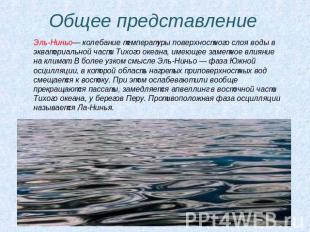
General idea El Niño is a fluctuation in the temperature of the surface layer of water in the equatorial Pacific Ocean, which has a noticeable effect on the climate. In a narrower sense, El Niño is a phase of the Southern Oscillation in which an area of heated surface water moves eastward. At the same time, trade winds weaken or stop altogether, and upwelling slows down in the eastern part of the Pacific Ocean, off the coast of Peru. The opposite phase of the oscillation is called La Niña.
Slide no. 3

Slide description:
First signs of El Niño Increase in air pressure over Indian Ocean, Indonesia and Australia. A drop in pressure over Tahiti, over the central and eastern parts of the Pacific Ocean. Weakening trade winds in the South Pacific until they stop and the wind direction changes to the west. Warm air mass in Peru, rains in the Peruvian deserts. This is also the influence of El Nino
Slide no. 4
Slide description:
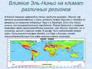
El Niño influence on the climate of different regions. In South America, the El Niño effect is most pronounced. This phenomenon typically causes warm and very humid summer periods (December to February) along the northern coast of Peru and Ecuador. When El Niño is strong, it causes severe flooding. Southern Brazil and northern Argentina also experience wetter than normal periods, but mainly in the spring and early summer. Central Chile experiences mild winters with plenty of rain, while Peru and Bolivia occasionally experience unusual winter snowfalls for the region.
Slide no. 5

Slide description:
Losses and losses More than 15 years ago, when El Niño first showed its character, meteorologists had not yet connected the events of those years: droughts in India, fires in South Africa and hurricanes that swept through Hawaii and Tahiti. Later, when the reasons for these disturbances in nature became clear, the losses brought by the willfulness of the elements were calculated. But it turned out that this is not all. Let's say rains and floods are direct consequences of a natural disaster. But after them came secondary ones - for example, mosquitoes multiplied in new swamps and brought an epidemic of malaria to Colombia, Peru, India, and Sri Lanka. Human bites on the rise in Montana poisonous snakes. They approached settlements, chasing their prey - mice, and they left their settled places due to lack of water, came closer to people and to water.
Slide no. 6

Slide description:
From myths to reality Meteorologists' predictions have been confirmed: catastrophic events associated with the El Niño current are hitting the earth one after another. Of course, it is very sad that all this is happening now. But still, it should be noted that for the first time humanity is meeting a global natural disaster knowing its causes and progress further development. The El Niño phenomenon is already quite well studied. Science has solved the mystery that plagued Peruvian fishermen. They did not understand why sometimes during the Christmas period the ocean becomes warmer and the shoals of sardines off the coast of Peru disappear. Because the arrival of warm water coincided with Christmas, the current was called El Niño, which means “baby boy” in Spanish. Fishermen, of course, are interested in the immediate reason for the departure of the sardines...
Slide no. 7

Slide description:
The fish leave... ...The fact is that sardines feed on phytoplankton. And algae need sunlight and nutrients - primarily nitrogen and phosphorus. They are present in ocean water, and their supply in the upper layer is constantly replenished by vertical currents going from the bottom to the surface. But when the El Niño current turns back towards South America, its warm waters “lock” the exit of deep waters. Biogenic elements do not rise to the surface, and algae reproduction stops. The fish leave these places - they do not have enough food.
Slide no. 8

Slide description:
Magellan's mistake The first European to swim across largest ocean planet, was Magellan. He called him "The Quiet One". As it soon became clear, Magellan was mistaken. It is in this ocean that most typhoons are born, and it produces three-quarters of the planet's clouds. Now we have also learned that the El Niño current emerging in the Pacific Ocean sometimes causes many different troubles and disasters on the planet...
Slide no. 9

Slide description:
El Niño is an elongated tongue of highly heated water. It is equal in area to the United States. Heated water evaporates more intensely and “pumps” the atmosphere with energy faster. El Niño supplies it with 450 million megawatts, which is equivalent to the power of 300,000 large nuclear power plants. It is clear that this energy, according to the law of conservation of energy, does not disappear. And now in Indonesia, disaster broke out in full force. First, there was a raging drought on the island of Sumatra, then the dried-out forests began to burn. In the impenetrable smoke that enveloped the entire island, the plane crashed upon landing, and a tanker and a cargo ship collided at sea. The smoke reached Singapore and Malaysia...
Slide no. 10

Slide description:
Years in which El Niño was recorded 1864, 1871, 1877-1878, 1884, 1891, 1899, 1911-1912, 1925-1926, 1939-1941, 1957-1958, 1965-1966, 1972, 1976, 198 2-1983 , 1986-1987, 1992-1993, 1997-1998. , in 1790-1793, 1828, 1876-1878, 1891, 1925-1926, 1982-1983 and 1997-1998, powerful phases of El Niño were recorded, while, for example, in 1991-1992, 1993, 1994 this phenomenon often repeating, it was weakly expressed. El Niño 1997-1998 was so strong that it attracted the attention of the world community and the press.
Fires and floods, droughts and hurricanes - all hit our Earth at the end of the last century. Fires turned the forests of Indonesia to ashes, then raged across the vast expanses of Australia. Showers have become frequent over the Chilean Atacama Desert, which is particularly dry. Torrential rains and floods did not spare South America. The total damage from the willfulness of the disaster amounted to about $50 billion. Meteorologists believe the cause of all these disasters is the phenomenon.
El Niño means "baby" in Spanish. This is the name given to the abnormal warming of the surface waters of the Pacific Ocean off the coast of Ecuador and Peru, which occurs every few years. This affectionate name only reflects the fact that the onset of El Niño most often occurs around the Christmas holidays, and fishermen on the west coast of South America associated it with the name of Jesus in infancy.
In normal years, along the entire Pacific coast of South America, due to the coastal upwelling of cold deep waters caused by the cold surface Peruvian Current, ocean surface temperatures fluctuate within a narrow seasonal range of 15°C to 19°C. During the El Niño period, ocean surface temperatures in the coastal zone increase by 6-10°C. As geological and paleoclimatic studies have shown, the phenomenon mentioned has existed for at least 100 thousand years. Fluctuations in the temperature of the surface layer of the ocean from extremely warm to neutral or cold occur with periods of 2 to 10 years. Currently, the term "El Niño" is used to refer to situations where abnormally warm surface waters occupy not only the coastal region near South America, but also most of the tropical Pacific Ocean up to the 180th meridian.
There is a constant warm current originating from the coast of Peru and extending to the archipelago lying southeast of the Asian continent. It is an elongated tongue of heated water, with an area equal to the territory of the United States. The heated water intensively evaporates and “pumps” the atmosphere with energy. Clouds form over the warming ocean. Typically, trade winds (constantly blowing easterly winds in the tropical zone) drive a layer of this warm water from the American coast towards Asia. Around Indonesia, the current stops and monsoon rains begin to fall over southern Asia.
During El Niño near the equator, this current warms up more than usual, so the trade winds weaken or do not blow at all. The heated water spreads to the sides and goes back to the American coast. An anomalous convection zone appears. Rain and hurricanes hit Central and South America. The La Niño phenomenon, the opposite of El Niño, manifests itself as a decrease in surface water temperature below the climate norm in the eastern tropical zone of the Pacific Ocean. Unusually cold weather sets in in the eastern Pacific Ocean during this period. During the formation of La Niño, trade winds (easterly) winds from the west coast of the Americas increase significantly. Winds shift the zone of warm water and the “tongue” of cold water stretches for 5000 km, exactly in the place (Ecuador - Samoa Islands) where during El Niño there should be a belt of warm waters. During this period, heavy monsoon rains are observed in Indochina, India and Australia. The countries of the Caribbean and the United States are suffering from droughts and tornadoes. La Niño, like La Niño, most often occurs from December to March. The difference is that El Niño occurs on average once every three to four years, while La Niño occurs once every six to seven years. Both events bring with them an increased number of hurricanes, but La Niño has three to four times as many hurricanes as El Niño.
According to observations, the reliability of the onset of El Niño or La Niño can be determined if:
1. Near the equator, in the eastern Pacific Ocean, a patch of warmer than normal water (El Niño) and colder water (La Niño) forms.
2. The atmospheric pressure trend between the port of Darwin (Australia) and the island of Tahiti is compared. During an El Niño, pressure will be high in Tahiti and low in Darwin. During La Niño it is the other way around.
Research over the past few decades has established that El Niño means more than just coordinated fluctuations in surface pressure and ocean water temperature. El Niño and La Niño are the most pronounced manifestations of interannual climate variability on a global scale. These phenomena represent large-scale changes in ocean temperatures, precipitation, atmospheric circulation, and vertical air movements over the tropical Pacific Ocean.
Abnormal weather conditions on the globe during El Niño years
In the tropics, there is an increase in precipitation over areas east of the central Pacific Ocean and a decrease from normal over northern Australia, Indonesia and the Philippines. In December-February, precipitation above normal is observed along the coast of Ecuador, in northwestern Peru, over southern Brazil, central Argentina and over the equatorial, eastern part of Africa, during June-August in the western United States and over central Chile.
El Niño events are also responsible for large-scale air temperature anomalies around the world. During these years there are outstanding temperature rises. Warmer than normal conditions in December-February were over southeast Asia, over Primorye, Japan, the Sea of Japan, over southeast Africa and Brazil, and southeast Australia. Warmer than normal temperatures occur in June-August along the western coast of South America and over southeastern Brazil. Colder winters (December-February) occur along the southwest coast of the United States.
Abnormal weather conditions on the globe during La Niño years
During La Niño periods, precipitation increases over the western equatorial Pacific, Indonesia and the Philippines, and is almost completely absent over the eastern part. More precipitation falls in December-February over northern South America and over South Africa, and in June-August over southeastern Australia. Drier than normal conditions occur over the coast of Ecuador, over northwestern Peru and equatorial eastern Africa during December-February, and over southern Brazil and central Argentina during June-August. There are large-scale aberrations across the world, with the largest number of areas experiencing abnormally cool conditions. Cold winters in Japan and the Maritimes, over southern Alaska and western, central Canada. Cool summer seasons over southeast Africa, India and southeast Asia. Warmer winters over the southwestern United States.
Some aspects of teleconnection
Despite the fact that the main events associated with El Niño occur in the tropical zone, they are closely related to processes occurring in other regions of the globe. This can be seen in long-distance communications across territory and time - teleconnections. During El Niño years, energy transfer into the troposphere of tropical and temperate latitudes increases. This is manifested in an increase in thermal contrasts between tropical and polar latitudes, and intensification of cyclonic and anticyclonic activity in temperate latitudes. The DVNIIGMI carried out calculations of the frequency of cyclones and anticyclones in the northern part of the Pacific Ocean from 120° east. up to 120° W It turned out that cyclones in the band 40°-60° N. and anticyclones in the band 25°-40° N. is formed in subsequent winters after El Niño more than in previous ones, i.e. processes in the winter months after El Niño are characterized by greater activity than before this period.
During El Niño years:
- the Honolulu and Asian anticyclones are weakened;
- the summer depression over southern Eurasia is filled, which is the main reason for the weakening of the monsoon over India;
- The summer depression over the Amur basin is more developed than usual, as well as the winter Aleutian and Icelandic depressions.
On the territory of Russia during El Niño years, areas of significant air temperature anomalies are identified. In spring, the temperature field is characterized by negative anomalies, that is, spring in El Niño years is usually cold in most of Russia. In summer, a center of negative anomalies remains over the Far East and Eastern Siberia, and centers of positive air temperature anomalies appear over Western Siberia and the European part of Russia. In the autumn months, no significant air temperature anomalies were identified over the territory of Russia. It should only be noted that in the European part of the country the temperature background is slightly lower than usual. El Niño years experience warm winters over most of the area. The focus of negative anomalies can be traced only over the northeast of Eurasia.
We are currently in a period of weakening of the cycle - a period of average ocean surface temperature distribution. (El Niño and La Niño represent opposite extremes of ocean water pressure and temperature cycles.)
Over the past few years, great strides have been made in the comprehensive study of the El Niño phenomenon. Scientists believe that the key issues in this problem are the oscillations of the atmosphere-ocean-Earth system. In this case, atmospheric fluctuations are the so-called Southern Oscillation (coordinated fluctuations in surface pressure in the subtropical anticyclone in the southeast Pacific Ocean and in a trough stretching from northern Australia to Indonesia), ocean fluctuations - the El Niño and La Niño phenomena and fluctuations Earth - movement of geographic poles. Also of great importance when studying the El Niño phenomenon is the study of the impact of external cosmic factors on the Earth's atmosphere.
After a period of neutrality in the El Niño-La Niña cycle observed in mid-2011, tropical zone The Pacific Ocean began to cool in August, and a weak to moderate La Niña has been observed from October until now.
"Forecasts made on the basis mathematical models, and their expert interpretation suggests that La Niña is close to maximum strength, and will likely begin to slowly weaken in the coming months. However, existing methods do not allow predicting the situation beyond May, so it is unclear what situation will develop in the Pacific Ocean - whether it will be El Niño, La Niña or a neutral situation,” the report says.
Scientists note that La Niña 2011-2012 was significantly weaker than in 2010-2011. Models predict that temperatures in the Pacific Ocean will approach neutral levels between March and May 2012.
La Niña 2010 was accompanied by a decrease in cloud cover and increased trade winds. The decrease in pressure led to heavy rain in Australia, Indonesia and Southeast Asia. In addition, according to meteorologists, it is La Niña that is responsible for heavy rains in southern and drought in eastern equatorial Africa, as well as for the drought situation in the central regions of southwest Asia and South America.
El Niño (Spanish El Niño - Baby, Boy) or Southern Oscillation (English El Niño/La Niña - Southern Oscillation, ENSO) is a fluctuation in the temperature of the surface layer of water in the equatorial part of the Pacific Ocean, which has a noticeable effect on the climate. In a narrower sense, El Niño is a phase of the Southern Oscillation in which an area of heated surface water moves eastward. At the same time, trade winds weaken or stop altogether, and upwelling slows down in the eastern part of the Pacific Ocean, off the coast of Peru. The opposite phase of oscillation is called La Niña (Spanish: La Niña - Baby, Girl). The characteristic oscillation time is from 3 to 8 years, but the strength and duration of El Niño in reality varies greatly. Thus, in 1790-1793, 1828, 1876-1878, 1891, 1925-1926, 1982-1983 and 1997-1998, powerful phases of El Niño were recorded, while, for example, in 1991-1992, 1993, 1994 this phenomenon , often repeating, was weakly expressed. El Niño 1997-1998 was so strong that it attracted the attention of the world community and the press. At the same time, theories about the connection between the Southern Oscillation and global changes climate. Since the early 1980s, El Niño also occurred in 1986-1987 and 2002-2003.
Normal conditions along the western coast of Peru are determined by the cold Peruvian Current, which carries water from the south. Where the current turns to the west, along the equator, cold and plankton-rich waters rise from deep depressions, which contributes to the active development of life in the ocean. The cold current itself determines the aridity of the climate in this part of Peru, forming deserts. Trade winds drive the heated surface layer of water into the western zone of the tropical Pacific Ocean, where the so-called tropical warm pool (TTB) is formed. In it, the water is heated to depths of 100-200 m. The Walker atmospheric circulation, manifested in the form of trade winds, coupled with low pressure over the Indonesian region, leads to the fact that in this place the level of the Pacific Ocean is 60 cm higher than in its eastern part . And the water temperature here reaches 29 - 30 °C versus 22 - 24 °C off the coast of Peru. However, everything changes with the onset of El Niño. The trade winds are weakening, the TTB is spreading, and water temperatures are rising across a vast area of the Pacific Ocean. In the region of Peru, the cold current is replaced by a warm current moving from the west to the coast of Peru. water mass, upwelling weakens, fish die without food, and westerly winds They bring humid air masses and rainfall to the deserts, even causing floods. The onset of El Niño reduces the activity of Atlantic tropical cyclones.
The first mention of the term "El Niño" dates back to 1892, when Captain Camilo Carrilo reported at the Congress of the Geographical Society in Lima that Peruvian sailors called the warm northerly current "El Niño" because it was most noticeable around Christmas. In 1893, Charles Todd suggested that droughts in India and Australia were occurring at the same time. Norman Lockyer also pointed out the same thing in 1904. The connection between the warm northerly current off the coast of Peru and floods in that country was reported in 1895 by Peset and Eguiguren. The phenomena of the Southern Oscillation were first described in 1923 by Gilbert Thomas Walker. He introduced the terms Southern Oscillation, El Niño and La Niña, and examined the zonal convection circulation in the atmosphere in the equatorial zone of the Pacific Ocean, which now received his name. For a long time Almost no attention was paid to the phenomenon, considering it regional. Only towards the end of the 20th century. The connection between El Niño and the planet’s climate has been clarified.


QUANTITATIVE DESCRIPTION
Currently, for a quantitative description of the phenomena, El Niño and La Niña are defined as temperature anomalies of the surface layer of the equatorial part of the Pacific Ocean lasting at least 5 months, expressed in a deviation of water temperature by 0.5 °C higher (El Niño) or lower (La Niña) side.
First signs of El Niño:
Increase in air pressure over the Indian Ocean, Indonesia and Australia.
A drop in pressure over Tahiti, over the central and eastern parts of the Pacific Ocean.
Weakening of the trade winds in the South Pacific until they cease and the wind direction changes to the westerly.
Warm air mass in Peru, rain in the Peruvian deserts.
In itself, an increase in water temperature off the coast of Peru by 0.5 °C is considered only a condition for the occurrence of El Niño. Typically, such an anomaly can exist for several weeks and then disappear safely. And only a five-month anomaly, classified as an El Niño phenomenon, can cause significant damage to the region’s economy due to a drop in fish catches.
The Southern Oscillation Index (SOI) is also used to describe El Niño. It is calculated as the difference in pressure over Tahiti and over Darwin (Australia). Negative values index indicates the El Niño phase, and positive ones indicate La Niña.
INFLUENCE OF EL NINO ON THE CLIMATE OF DIFFERENT REGIONS
In South America, the El Niño effect is most pronounced. This phenomenon typically causes warm and very humid summer periods (December to February) along the northern coast of Peru and Ecuador. When El Niño is strong, it causes severe flooding. This, for example, happened in January 2011. Southern Brazil and northern Argentina also experience wetter than usual periods, but mainly in the spring and early summer. Central Chile experiences mild winters with plenty of rain, while Peru and Bolivia occasionally experience unusual winter snowfalls for the region. Drier and warm weather observed in the Amazon basin, Colombia and Central America. Humidity is falling in Indonesia, increasing the likelihood of forest fires. This also applies to the Philippines and northern Australia. From June to August, dry weather occurs in Queensland, Victoria, New South Wales and eastern Tasmania. In Antarctica, the western Antarctic Peninsula, Ross Land, Bellingshausen and Amundsen seas are covered with large amounts of snow and ice. At the same time, the pressure increases and becomes warmer. IN North America Winters are generally getting warmer in the Midwest and Canada. Central and southern California, northwestern Mexico and the southeastern United States are becoming wetter, while the Pacific Northwest states are becoming drier. During La Niña, on the other hand, the Midwest becomes drier. El Niño also leads to a decrease in Atlantic hurricane activity. Eastern Africa, including Kenya, Tanzania and the White Nile Basin, experiences long rainy seasons from March to May. Droughts plague southern and central Africa from December to February, mainly Zambia, Zimbabwe, Mozambique and Botswana.
An effect similar to El Niño is sometimes observed in Atlantic Ocean, where the water along the equatorial coast of Africa becomes warmer and the water off the coast of Brazil becomes colder. Moreover, there is a connection between this circulation and El Niño.
INFLUENCE OF EL NINO ON HEALTH AND SOCIETY
El Niño causes extreme weather conditions associated with cycles in the incidence of epidemic diseases. El Niño is associated with an increased risk of mosquito-borne diseases: malaria, dengue fever and Rift Valley fever. Malaria cycles are associated with El Niño in India, Venezuela and Colombia. There is an association with outbreaks of Australian encephalitis (Murray Valley Encephalitis - MVE) occurring in south-eastern Australia following heavy rainfall and flooding caused by La Niña. A striking example is a severe outbreak of Rift Valley fever that occurred due to El Niño following extreme rainfall events in northeastern Kenya and southern Somalia in 1997-98.
It is also believed that El Niño may be associated with the cyclical nature of wars and the emergence of civil conflicts in countries whose climate is influenced by El Niño. A study of data from 1950 to 2004 found that El Niño was associated with 21% of all civil conflicts during that period. At the same time, the risk of civil war in El Niño years is twice as high as in La Niña years. It is likely that the connection between climate and military action is mediated by crop failures, which often occur in hot years.

The climate phenomenon La Niña, associated with a drop in water temperatures in the equatorial Pacific Ocean and affecting weather patterns across almost the entire globe, has disappeared and is not likely to return until the end of 2012, the World Meteorological Organization (WMO) said.
The La Nina phenomenon (La Nina, “the girl” in Spanish) is characterized by an anomalous decrease in surface water temperature in the central and eastern part of the tropical Pacific Ocean. This process is the opposite of El Niño (El Nino, “the boy”), which, on the contrary, is associated with warming in the same zone. These states replace each other with a frequency of about a year.

Following a period of neutrality in the El Niño-La Niña cycle observed in mid-2011, the tropical Pacific began to cool in August, with weak to moderate La Niña observed from October to date. By early April, La Niña had completely disappeared, and neutral conditions are still observed in the equatorial Pacific, experts write.
“(Analysis of modeling results) suggests that La Niña is unlikely to return this year, while the probabilities of remaining neutral and El Niño occurring in the second half of the year are approximately equal,” the WMO said.
Both El Niño and La Niña influence circulation patterns of ocean and atmospheric currents, which in turn influence weather and climate throughout to the globe, causing droughts in some regions, hurricanes and heavy rains in others.

The La Niña climate phenomenon that occurred in 2011 was so strong that it ultimately caused global sea levels to drop by as much as 5mm. With the advent of La Niña, there was a shift in Pacific surface temperatures and changes in precipitation patterns around the world, as terrestrial moisture began to leave the ocean and be directed to land in the form of rain in Australia, northern South America, and Southeast Asia .
The alternating dominance of the warm oceanic phase of the Southern Oscillation, El Niño, and the cold phase, La Niña, can change global sea levels so dramatically, but satellite data inexorably indicates that global levels have The waters still rise to a height of about 3 mm.
As soon as El Niño arrives, the rise in water levels begins to occur faster, but with a change in phases almost every five years, a diametrically opposite phenomenon is observed. The strength of the effect of a particular phase also depends on other factors and clearly reflects the general climate change towards its harshness. Many scientists around the world are studying both phases of the southern oscillation, as they contain many clues to what is happening on Earth and what awaits it.
A moderate to strong La Niña atmospheric phenomenon will continue in the tropical Pacific until April 2011. This is according to an El Niño/La Niña advisory issued on Monday by the World Meteorological Organization.
As the document highlights, all model-based forecasts predict a continuation or possible intensification of the La Niña phenomenon over the next 4-6 months, ITAR-TASS reports.
La Niña, which this year formed in June-July, replacing the El Niño phenomenon that ended in April, is characterized by unusual low temperatures waters in the central and eastern equatorial Pacific Ocean. It disrupts normal routines. tropical precipitation and atmospheric circulation. El Niño is exactly the opposite phenomenon, which is characterized by unusual high temperatures waters in the Pacific Ocean.
The effects of these phenomena can be felt in many parts of the planet, expressed in floods, storms, droughts, increases or, conversely, decreases in temperatures. Typically, La Niña results in heavy winter rainfall in the eastern equatorial Pacific, Indonesia, and the Philippines, and severe droughts in Ecuador, northwestern Peru, and eastern equatorial Africa.
In addition, the phenomenon contributes to a decrease in global temperatures, and this is most noticeable from December to February in northeast Africa, Japan, southern Alaska, central and western parts Canada, southeast Brazil.

The World Meteorological Organization (WMO) announced today in Geneva that in August this year In the equator region of the Pacific Ocean, the La Niña climate phenomenon has again been observed, which may increase in intensity and continue until the end of this year or the beginning of next year.
The latest WMO report on El Niño and La Niña phenomena states that the current La Niña event will peak later this year, but the intensity will be less than what it was in the second half of 2010. Due to its uncertainty, WMO invites countries in the Pacific region to closely monitor its development and promptly report on possible droughts and floods due to it.
The La Niña phenomenon refers to the phenomenon of an anomalous long-term large-scale cooling of water in the eastern and central parts of the Pacific Ocean near the equator, which gives rise to a global climate anomaly. The previous La Niña event led to spring drought along the western Pacific coast, including China.