What mountains are in the Caucasus. The Caucasus is the highest mountains in Russia. The Greater Caucasus Mountains are located between the Black and Caspian Seas, from the Taman to the Absheron Peninsula. From
The vast majority of the peaks included in the list of the highest mountains in Russia on the map belong to one mountain system - the Greater Caucasus. This huge mountain range is located between the Black and Caspian Seas. Three Kamchatka hills - Klyuchevskaya, Kamen and Ploskaya Blizhnaya (13th, 18th and 70th places) and two peaks are barely catching up with the southerners Altai mountains— Belukha and Tavan-Bogdo-Uul (19th and 67th place).

To prevent Russian climbers from getting bored with the monotony, the Mountaineering Federation decided to include in the conditions for receiving the most honorable mountaineering title the conquest of not only the eight highest mountains on the list, but also the assault on Belukha and Klyuchevskaya Sopka.

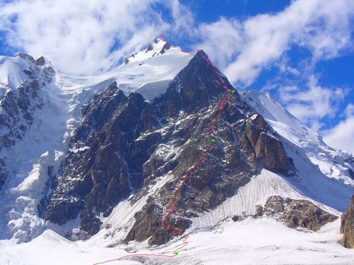
Shota Rustaveli Peak is one of the peaks that make up the so-called Bezengi Wall - a giant mountain range stretching for 13 km. In addition to the Shota Rustaveli peak, the wall is formed by Dzhangitau (fifth place in the ranking), Katyntau (ninth) and Shkhara (sixth).
9. Katyn-Tau – 4970 m

The Kabardino-Balkarians have a sad legend associated with the name of this mountain. Mountain peak Tetnuld (“white”), one of the most beautiful, invariably admirable tourists with his whiteness, decided to leave his old wife, Katyn (“wife”), for the sake of the young one, Dzhanga (“new”, “young”). Perhaps Tetnuld was a climber - the height of Katyn does not reach 5 km, but Dzhangy, or Dzhangitau, ranks fifth in the list of the highest mountains in Russia.
8. Mizhirgi – 5025 m

The list of Russian “five thousand meters” begins with Mizhirga - the highest and most dangerous mountains in Russia, which every climber dreams of climbing. Mizhirgi, despite the modest eighth place in height, the mountain is very capricious and surpasses higher peaks in terms of difficulty.
7. Kazbek – 5034 m

This is one of the most beautiful peaks of the Greater Caucasus Range. Her image appears on many covers of travel magazines, photographs, postcards and stamps. A lonely white peak of a regular conical shape (Kazbek was once a volcano) stands out sharply against the background of green foothills. Unfortunately, due to the difficult geopolitical situation, ascents to Kazbek are no longer as frequent as they once were.
6. Shkhara – 5068 m

One of the most beloved peaks by climbers, and the highest mountain in the central part of the Caucasus range. You can climb it via a wide variety of routes, and several peaks will allow you to appreciate the beauty of the surrounding places from new points of view.
According to the results of recent measurements, Shkhara can move from sixth place to third - according to the latest data, its height is 5193.2 m. However, there is no doubt about which is the highest mountain in Russia - first place is ahead of all the others with a margin of almost half a kilometer.
5. Dzhangitau – 5085 m
Like Mizhirgi, Dzhangitau is considered one of the most difficult and dangerous peaks. Just three years ago, an experienced climber fell from its slopes (with fatal results), and a couple of years before that, a climbing group had to be rescued by helicopter.
4. Pushkin Peak – 5100 m
Most often they prefer to climb Pushkin Peak from the south side. However, experienced rock climbers prefer the northern side - in addition to a slightly more difficult route, you can admire the enchanting beauty of the surrounding nature.
3. Koshtantau – 5152 m

Koshtantau opens the top three among the highest mountains in Russia. Sometimes she is merciful to climbers and gives them beautiful weather, making the ascent easy and enjoyable. However, this rarely happens; Most often, the capricious beauty prefers to dress up in an icy robe, which makes the ascent much more difficult.
The conquest of Costantau began with a tragedy - two English climbers and their Swiss guides died while trying to climb it. Since then, several routes have been laid up the mountain, but they all have increased difficulty - from 4B to 6A (for comparison: the lowest category is 1B, the highest is 6B, and category 6A is in second place, up to 6B).
2. Dykhtau – 5204 m
The poetic genius of the Balkar people decided to rest on the name Dykhtau. Translated from this language, the name simply means “steep mountain.” It's almost like a nickname.
The mountain looks harsh - the granite-gneiss rocks that make up Dykhtau are dark in color. And in contrast to the white snow and clouds (located at a lower altitude than the peak), they look especially gloomy.
The difficulty of climbing the mountain corresponds to its seriousness appearance— there are more than ten routes to the double peaks of Dykhtau, but even the simplest of them belongs to category 4A, above average.
1. The highest mountain in Russia – Elbrus, 5642 m
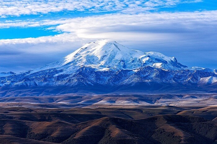
On the border between the republics of Kabardino-Balkaria and Karachay-Cherkessia is the Side Range of the Caucasus Mountains, where Elbrus, the highest mountain in Russia, is located. Elbrus has two peaks - western and eastern; the difference between them is 21 m.

This is not an easy mountain; she is a legacy of those times when young Caucasus Mountains were still fire-breathing. Elbrus is a huge volcano, fortunately, extinct a long time ago. Over the past tens of thousands of years, Elbrus has been covered with a shell of ice of enormous thickness - in some places it reaches 250 m, which is equal to the height of an eighty-story building.

Despite the terrifying height (Elbrus is considered the most high mountain not only in Russia, but also in Europe, and is also among the top ten), the mountain’s character is not evil and the path to the top has long been found. The first ascent of Elbrus took place in the first third of the 19th century. Since then, whoever has been there! People climbed not only on foot, but also on horses, motorcycles and cars. They carried ATVs and even 75-kilogram barbells. And since the early 1990s, regular competitions have been taking place in high-speed climbing of the snow giant. From the foot to the top of Elbrus the journey takes exactly 3 hours 28 minutes 41 seconds.

List of 80 highest mountain peaks in Russia
The table shows mountain peaks with a height of at least 4000 meters and located on the territory of the Russian Federation.
| Place | Vertex | Height, m | The subject of the Russian Federation | Mountain system |
|---|---|---|---|---|
| 1 | 5642 | Kabardino-Balkaria and Karachay-Cherkessia | Greater Caucasus | |
| 2 | 5204 | Kabardino-Balkaria | Greater Caucasus | |
| 3 | 5152 | Kabardino-Balkaria | Greater Caucasus | |
| 4 | 5100 | Kabardino-Balkaria | Greater Caucasus | |
| 5 | 5085 | Kabardino-Balkaria | Greater Caucasus | |
| 6 | 5068 | Kabardino-Balkaria (Russia), Svaneti (Georgia) | Greater Caucasus | |
| 7 | 5034 | North Ossetia, Georgia | Greater Caucasus | |
| 8 | 5025 | Kabardino-Balkaria | Greater Caucasus | |
| 9 | 4970 | Kabardino-Balkaria | Greater Caucasus | |
| 10 | 4860 | Kabardino-Balkaria, Georgia | Greater Caucasus | |
| 11 | Gestola | 4860 | Kabardino-Balkaria | Greater Caucasus |
| 12 | Jimara | 4780 | North Ossetia | Greater Caucasus |
| 13 | Klyuchevskaya Sopka | 4750 | Kamchatka Krai | East Ridge |
| 14 | Wilpata | 4646 | North Ossetia | Greater Caucasus |
| 15 | Sauhokh | 4636 | North Ossetia | Greater Caucasus |
| 16 | Kukurtli-Kolbashi | 4624 | Karachay-Cherkessia | Greater Caucasus |
| 17 | Maylihoh | 4598 | North Ossetia | Greater Caucasus |
| 18 | Stone | 4575 | Kamchatka Krai | East Ridge |
| 19 | Belukha | 4509 | Altai | Altai Mountains |
| 20 | Sallynngantau | 4507 | Kabardino-Balkaria | Greater Caucasus |
| 21 | Tebulosmta | 4492 | Chechnya, Georgia | Greater Caucasus |
| 22 | Sugan | 4489 | North Ossetia, Kabardino-Balkaria | Greater Caucasus |
| 23 | Bazarduzu | 4466 | Dagestan | Greater Caucasus |
| 24 | Chanchakhi | 4461 | North Ossetia | Greater Caucasus |
| 25 | Donguzorun-Cheget-Karabashi | 4454 | Kabardino-Balkaria | Greater Caucasus |
| 26 | Shan | 4452 | Ingushetia, Georgia | Greater Caucasus |
| 27 | Warmth | 4431 | North Ossetia | Greater Caucasus |
| 28 | Chatyntau | 4411 | Karachay-Cherkessia, Georgia | Greater Caucasus |
| 29 | Adai-Khokh | 4408 | North Ossetia | Greater Caucasus |
| 30 | Songuti | 4405 | North Ossetia | Greater Caucasus |
| 31 | Tyutyubashi | 4404 | Kabardino-Balkaria | Greater Caucasus |
| 32 | Vologata | 4396 | North Ossetia | Greater Caucasus |
| 33 | Karaug | 4364 | North Ossetia, Georgia | Greater Caucasus |
| 34 | Adyrsubashi | 4349 | ||
| 35 | Laboda | 4313 | North Ossetia, Georgia | Greater Caucasus |
| 36 | Bachakhi | 4291 | ||
| 37 | Diklosmta | 4285 | Greater Caucasus | |
| 38 | Caucasus Peak | 4280 | Greater Caucasus | |
| 39 | Jorashti | 4278 | ||
| 40 | Bzhedukh | 4271 | ||
| 41 | Comito | 4261 | Chechnya | Greater Caucasus |
| 42 | Sullukolbashi | 4251 | ||
| 43 | Kayaartybashi | 4250 | ||
| 44 | Bashiltau | 4248 | ||
| 45 | Zeygalankhoh | 4244 | North Ossetia | Greater Caucasus |
| 46 | Zaromag | 4203 | North Ossetia | Greater Caucasus |
| 47 | Donchentykhoh | 4192 | North Ossetia | Greater Caucasus |
| 48 | Kalota | 4182 | North Ossetia | Greater Caucasus |
| 49 | Denunciation | 4179 | Chechnya, Georgia | Greater Caucasus |
| 50 | Addala-Schuchgelmeer | 4151 | Dagestan | Greater Caucasus |
| 51 | Chkalov Peak (Anchobala-anda) | 4150 | Dagestan | Greater Caucasus |
| 52 | Pukhgarty-Kom | 4149 | ||
| 53 | Syrkhibarzond | 4148 | North Ossetia | Greater Caucasus |
| 54 | Shalbuzdag | 4142 | Dagestan | Greater Caucasus |
| 55 | Tseyakhoh | 4140 | North Ossetia | Greater Caucasus |
| 56 | Fitnargin | 4134 | Kabardino-Balkaria | Greater Caucasus |
| 57 | Dyultydag | 4127 | Dagestan | Greater Caucasus |
| 58 | Tsmiakomhokh | 4117 | North Ossetia | Greater Caucasus |
| 59 | Barrels | 4116 | Dagestan | Greater Caucasus |
| 60 | Musostau | 4110 | Kabardino-Balkaria | Greater Caucasus |
| 61 | Baidukov Peak (Kasaraku-meer) | 4104 | Dagestan | Greater Caucasus |
| 62 | Bishnei Jenolshob | 4104 | Dagestan | Greater Caucasus |
| 63 | Belyakov Peak (Belengi) | 4100 | Dagestan | Greater Caucasus |
| 64 | Chimismeer | 4099 | Dagestan | Greater Caucasus |
| 65 | Chachkhokh | 4098 | North Ossetia, Georgia | Greater Caucasus |
| 66 | Tsunklyata | 4084 | Dagestan | Greater Caucasus |
| 67 | Tavan-Bogdo-Ula | 4082 | Altai | Altai Mountains |
| 68 | Maistismta | 4081 | Chechnya, Georgia | Greater Caucasus |
| 69 | Charundag | 4080 | Dagestan, Azerbaijan | Greater Caucasus |
| 70 | Flat Middle | 4057 | Kamchatka Krai | East Ridge |
| 71 | Taklik | 4049 | Dagestan | Greater Caucasus |
| 72 | Dombay-Ulgen | 4046 | Karachay-Cherkessia, Republic of Abkhazia | Greater Caucasus |
| 73 | Gockley | 4046 | Dagestan | Greater Caucasus |
| 74 | Kurmutau | 4045 | Kabardino-Balkaria | Greater Caucasus |
| 75 | Archon | 4040 | North Ossetia | Greater Caucasus |
| 76 | Izhenameer | 4025 | Dagestan | Greater Caucasus |
| 77 | Dougie | 4020 | Dagestan, Azerbaijan | Greater Caucasus |
| 78 | Deavgay | 4016 | Dagestan | Greater Caucasus |
| 79 | Kezgenbashi | 4013 | Kabardino-Balkaria | Greater Caucasus |
| 80 | Balial | 4007 | Dagestan | Greater Caucasus |
There is a beautiful mountain system on our planet. It is located on, or to be more precise, between two seas - the Caspian and Black. It bears the proud name - the Caucasus Mountains. Has coordinates: 42°30′ northern latitude and 45°00′ east longitude. The length of the mountain system is more than one thousand kilometers. Territorially it belongs to six countries: Russia and the states of the Caucasus region: Georgia, Armenia, Azerbaijan, etc.
It is still not clearly stated which part of the continent the Caucasus Mountains belong to. Elbrus and Mont Blanc are fighting for the title. The latter is located in the Alps. Geographical position The plan is easy to describe. And this article will help with this.
Borders
During the times of Ancient Greece, it was the Caucasus and the Bosphorus that separated the 2 continents. But the world map was constantly changing, peoples migrated. In the Middle Ages, the Don River was considered the border. Much later, in the 17th century, a Swedish geographer led it through the Urals, down the river. Embe to the Caspian Sea. His idea was supported by scientists of the time and the Russian Tsar. According to this definition, mountains belong to Asia. On the other hand, in Great Encyclopedia Laroussa marks the border running south of Kazbek and Elbrus. Thus, both mountains are in Europe.
It is somewhat difficult to describe the geographical position of the Caucasus Mountains as accurately as possible. Opinions regarding territorial affiliation changed solely according to political reasons. Europe was singled out as a special part of the world, linking this with the level of development of civilization. The border between the continents gradually moved east. She became a moving line.
Some scientists, noting differences in geological structure massif, they propose to draw the border along the main ridge of the Greater Caucasus. And this is not surprising. mountains allows it. Its northern slope will belong to Europe, and its southern slope will belong to Asia. This issue is being actively discussed by scientists from all six states. Geographers of Azerbaijan and Armenia believe that the Caucasus belongs to Asia, and Georgian scientists believe that it belongs to Europe. Many well-known authoritative people believe that the entire massif belongs to Asia, so Elbrus will not be considered the most for a long time high point Europe.

System composition
This massif consists of 2 mountain systems: the Lesser and Greater Caucasus. Often the latter is presented as a single ridge, but this is not so. And if you study the geographical position of the Caucasus Mountains on the map, you will notice that it is not one of those. The Greater Caucasus stretches for more than a kilometer from Anapa and the Taman Peninsula almost all the way to Baku. Conventionally, it consists of the following parts: Western, Eastern and Central Caucasus. The first zone extends from the Black Sea to Elbrus, the middle one - from the highest peak to Kazbek, the last - from Kazbek to the Caspian Sea.
The western chains originate from the Taman Peninsula. And at first they look more like hills. However, the further east you go, the higher they become. Their peaks are covered with snow and glaciers. The ranges of Dagestan are located in the east of the Greater Caucasus. These are complex systems with river valleys forming canyons. About 1.5 thousand sq. km of the Greater Caucasus is covered with glaciers. Most of they account for central District. The Lesser Caucasus includes nine ranges: Adzhar-Imereti, Karabakh, Bazum and others. The highest of them, located in the middle and eastern parts, are Murov-Dag, Pambaksky, etc.

Climate
Analyzing the geographical position of the Caucasus Mountains, we see that they are located on the border of two climatic zones- subtropical and temperate. Transcaucasia belongs to the subtropics. The rest of the territory belongs to the temperate climate zone. The North Caucasus is a warm region. Summer there lasts almost 5 months, and winter never drops below -6 °C. It is short-lived - 2-3 months. In high mountain areas the climate is different. There it is influenced by the Atlantic and Mediterranean, so the weather is wetter.
Due to the complex terrain in the Caucasus, there are many zones that differ from each other. This climate allows the cultivation of citrus fruits, tea, cotton and other exotic crops that suit the temperate nature weather conditions. The geographical location of the Caucasus Mountains largely influences the formation of the temperature regime in nearby areas.

Himalayas and Caucasus Mountains
Often at school, students are asked to compare the geographical position of the Himalayas and Iz, the similarity is only in one thing: both systems are located in Eurasia. But they have many differences:
- The Caucasus Mountains are located in the Himalayas, but they belong only to Asia.
- The average height of the Caucasus Mountains is 4 thousand m, the Himalayas - 5 thousand m.
- Also, these mountain systems are located in different climatic zones. The Himalayas are mostly in the subequatorial, less in the tropics, and the Caucasus - in the subtropical and temperate.
As you can see, these two systems are not identical. The geographical position of the Caucasus Mountains and the Himalayas is similar in some respects, but not in others. But both systems are quite large, beautiful, and amazing.
State budgetary educational institution secondary general education high school No. 509 Moskovsky district
city of St. Petersburg
ABSTRACT
in the discipline "Geography"
on the topic of: « Caucasus Mountains».
Completed by: students of grade 8 “A”
Gaisyonok Yulia
Akhmedova Rukiyat
Head: geography teacher
Kovaleva Natalya Nikolaevna
St. Petersburg 2012
1. Introduction. ………………………………… ………………………...........3
2. Main part
2.1 Legend about the origin of the Caucasus Mountains………………………...4
2.2Physico-geographical location……………………………..5
2.3Climate…………………………………………………………………………………7
2.4 Rivers and lakes………………………………………………………...8
2.5 Fauna ………………………………………………………..9
2.6Flora…………………………………………………......11
3.Conclusion………………………………………………………..12
4. References…………..…………………………………….…..13
5..Appendix 1………………………………………………………14
6.Appendix 2……………………………………………………….16
1. Introduction
Since ancient times our Russian Parnassus
Drawn to unfamiliar countries
And most of all, only you, Caucasus,
It rang like a mysterious fog.
S.A. Yesenin
This is an amazing land, one of the most interesting regions globe. Combining unique landscapes and becoming home to hundreds of nationalities, it is truly a unique region of the world. The North Caucasus is my homeland , which I love.
The pride of the Caucasus is its mountains! Without mountains, the Caucasus is not the Caucasus. The mountains are unique, majestic and inaccessible. The Caucasus is amazingly beautiful. He's so different. You can look at the mountains for hours.
The Caucasus Mountains are the great divide between Europe and Asia. The Caucasus is a narrow strip of land between the Black and Caspian seas. It amazes with the incredible diversity of climate, flora and fauna.
Green hills and alpine meadows of the Caucasus, salt deserts, miniature sand dunes give way to high mountains. Caucasian landscapes are not inferior in beauty to any region on the planet.
The Greater Caucasus mountain range is home to many pastures, forests, and amazing natural wonders. More than 2 thousand glaciers descend through narrow gorges. A chain of large mountains stretches from northwest to southeast for almost one and a half thousand kilometers. The main peaks exceed 5 thousand meters and significantly influence the weather in the regions.
The clouds that form over the Black Sea rain, hitting the mountain peaks of the Caucasus. On one side of the ridge there is a harsh landscape, and on the other there is lush vegetation. Here you can find more than 6 and a half thousand plant species, a quarter of which cannot be found anywhere else in the world.
The purpose of our essay is to study natural features Caucasus mountains.
The material can be used in geography lessons when studying the topic “North Caucasus”.
2. Base part
2.1 Legend about the origin of the Caucasus Mountains
A long time ago, when the earth was still very young, in place modern territory A huge plain stretched across the Caucasus. The huge Nart heroes lived here in peace and love. They were kind and prudent, they greeted day and night with joy, they knew neither evil, nor envy, nor deceit. The ruler of this people was the gray-haired giant Elbrus, and he had a beautiful son Beshtau, and his son had a charming bride, the beautiful Mashuki. But they had an evil envious person - Korshun. And he decided to harm the sledges. He prepared a terrible potion in which he mixed the teeth of a wolf, the tongue of a boar and the eyes of a snake. At a big celebration, he added a potion to all the Narts' drinks. And having drunk it, they acquired the greed of a boar, the anger of a wolf and the cunning of a snake. And from that time on the happy and carefree life of the Narts ended. The father decided to take his young bride away from his son and, sending him on a hunt, wanted to forcefully marry Mashuki. But Mashuki resisted Elbrus. And in a fierce battle she lost her wedding ring. He saw Beshtau’s ring and hurried to help the bride. And a terrible life-and-death battle ensued, and half of the Narts fought on the side of Elbrus, and the other half on the side of Beshtau. And the battle lasted for several days and nights, and all the sledges died. Elbrus chopped his son into five parts, and the son, delivering the final blow, dismembered his father’s gray head into two halves. Mashuki came out onto the battlefield after the battle and did not see a single living soul. She approached her lover and plunged a dagger into her heart. Thus the life of a great and old people stopped.
And in this place the Caucasian mountains now rise: the helmet from the head of Beshtau - Mount Zheleznaya, the ring of Mashuki - Mount Koltso, five peaks - Mount Beshtau, nearby - Mount Mashuk and far, far from the others - the gray-haired or simply snow-covered handsome Elbrus. [2]
2.2Physico-geographical location
The Caucasus Mountains form a natural border between Europe and Asia, located on the isthmus between the Caspian and Black Seas. The Caucasus is separated from the East European Plain by the Kuma-Manych depression. The territory of the Caucasus can be divided into several parts: Ciscaucasia, Greater Caucasus and Transcaucasia. In the territory Russian Federation only Ciscaucasia and Northern part Greater Caucasus. The last two parts together are called the North Caucasus. However, for Russia this part of the territory is the southernmost. Here, along the ridge of the Main Ridge, passes state border Russian Federation, behind which lie Georgia and Azerbaijan.
The North Caucasus Mountains are relatively young. Their relief was created by different tectonic structures. These mountains were formed when deep trough zones were filled with sedimentary and volcanic rocks, which later underwent folding. Tectonic processes here were accompanied by significant bends, stretches, ruptures and fractures of the earth's layers. As a result, it poured onto the surface a large number of magma (this led to the formation of significant ore deposits).
The Greater Caucasus is often presented as a single ridge. In fact, this is a whole system of various ridges, which can be divided into several parts. The Western Caucasus is located from Black Sea coast to Mount Elbrus, then (from Elbrus to Kazbek) the Central Caucasus follows, and east of Kazbek to the Caspian Sea - the Eastern Caucasus. In addition, in the longitudinal direction two ridges can be distinguished: Vodorazdelny (sometimes called the main one) and Bokovaya. On the northern slope of the Caucasus there are the Skalisty and Pastbishchny ridges, as well as the Black Mountains. They were formed as a result of interlayering layers composed of sedimentary rocks of different hardness. One slope of the ridge here is gentle, while the other ends quite abruptly. As you move away from the axial zone, the height of the mountain ranges decreases.
The chain of the Western Caucasus begins at the Taman Peninsula. At the very beginning, it’s more likely not even mountains, but hills. They begin to rise to the east. The highest parts of the North Caucasus are covered with snow caps and glaciers. The highest peaks of the western Caucasus are Mount Fisht (2870 meters) and Oshten (2810 meters). The highest part of the Greater Caucasus is the Central Caucasus. Even some passes at this point reach an altitude of 3000 meters, and the lowest of them (Krestovy) lies at an altitude of 2380 meters. The highest peaks of the Caucasus are also located here. For example, the height of Mount Kazbek is 5033 meters, and the double-headed extinct volcano Elbrus is the highest peak in Russia. The relief here is highly dissected: sharp ridges, steep slopes and rocky peaks predominate.
The eastern part of the Greater Caucasus consists mainly of numerous ridges of Dagestan (in translation the name of this region means “ Mountain country"). There are complex branching ridges with steep slopes and deep canyon-like river valleys. However, the height of the peaks here is less than in the central part of the mountain system, but they still exceed a height of 4 thousand. meters. The rise of the Caucasus Mountains continues in our time. Quite frequent earthquakes in this region of Russia are associated with this. To the north of the Central Caucasus, where the magma rising through cracks did not spill out to the surface, low, so-called island mountains formed. The largest of them are Beshtau (1400 meters) and Mashuk (993 meters). At their base there are numerous springs of mineral waters.
The so-called Ciscaucasia is occupied by the Kuban and Terek-Kuma lowlands. They are separated from each other by the Stavropol Upland, whose height is 700-800 meters.
Fig.1 Dagestan. Red Mountain.
2.3Climate
The climate in this area is quite favorable. Enough high mountains serve as a good barrier to cold air penetrating here. The proximity of the long cooling sea also has an effect. The Greater Caucasus is the border between two climatic poles - subtropical and temperate. On Russian territory the climate is still moderate, but the above factors contribute to high temperatures.
As a result, winters in the Ciscaucasia are quite warm (the average temperature in January is about -5 ° C) .This is facilitated by warm temperatures coming from the Atlantic Ocean air masses. On the Black Sea coast, the temperature rarely drops below zero (the average temperature in January is 3 ° C). In mountainous areas the temperature is naturally lower. So, the average temperature on the plain in summer is about 25 ° C, and in the upper reaches of the mountains - 0 ° C.
Precipitation in this area mainly falls due to cyclones arriving from the west, as a result of which its amount gradually decreases to the east. Most precipitation falls on the southwestern slopes of the Greater Caucasus. Their number on the Kuban Plain is approximately 7 times lower.
Glaciation has developed in the mountains of the North Caucasus, the area of which ranks first among all regions of Russia. The rivers flowing here are fed by water formed by the melting of glaciers. The largest Caucasian rivers are the Kuban and Terek, as well as their numerous tributaries. Mountain rivers, as usual, are fleeting, and in their lower reaches there are wetlands overgrown with reeds and reeds.
The most dangerous natural phenomena hazards that occur in these places are landslides, rockfalls and earthquakes.
2.4 Rivers and lakes
The rivers of the Caucasus belong to the basin of the Caspian (Kura with Araks, Sulak, Terek, Kuma), Black (Rioni, Inguri, etc.) and Azov (Kuban) seas. Flow distribution and river regime depend mainly on climatic conditions and relief. The Greater Caucasus is characterized by rivers with long (about 6 months) flood in the warm part of the year; their diet involves eternal snow and ice and late melting in the highlands seasonal snow. The regime of rivers starting in the highest ridges and massifs of the Transcaucasian Highlands (Aragats, Zangezur ridge, Murovdag) and in those areas of the southern slope of the Greater Caucasus where there are no glaciers is close to this type. The remaining rivers of the Transcaucasian Highlands are characterized by spring floods. On the rivers of the southern slope of the Greater Caucasus, along with spring floods, summer floods are typical. The rivers of Ciscaucasia, with the exception of those flowing from the Greater Caucasus, have spring floods and winter freeze-up, become very shallow in the summer, and sometimes dry up. The Stavropol region is artificially watered from the river. Kuban. For rivers of the Caucasus starting in areas without sustainable snow cover, characterized by floods from heavy rains and rapid melting of snow. An additional source of their nutrition is groundwater. Floods occur throughout the year (the Black Sea coast south of Sochi, the Colchis lowland, etc.), during the warm season (in the leading ridges of the northern slope of the Greater Caucasus, in the Terek basin) and in the cold half of the year (the western tip of the Greater Caucasus and the northern part of the Black Sea coast) . Many rivers in the Eastern and parts of the Central Caucasus are characterized by mudflows. The advanced limestone ranges of the Greater Caucasus have karst rivers, which in some places disappear underground and reappear on the surface. Their regime, like the rivers of the volcanic region of the Armenian Highlands, is regulated due to their large participation in nutrition groundwater. Large rivers receiving tributaries from different regions have a combined regime. Most of the large rivers of the Caucasus in the upper reaches are mountainous in nature and flow in trough valleys and gorges, while in the lower reaches they flow more calmly in wide valleys.
The lower reaches of the Kura, Kuban and Rioni are navigable. The waters of many rivers are used to irrigate the arid regions of the Ciscaucasia, the Kura Depression and the Middle Araks Basin. Many hydroelectric power stations have been built on the rivers of the Caucasus (Mingachevirskaya and Zemo-Avchalskaya on the Kura, Khramskaya, Rionskaya, a number of hydroelectric power stations on the rivers of the Greater Caucasus).
Of the lakes in the Caucasus, the largest is Sevan. There are many tar lakes in the highland region of the Greater Caucasus; There are also dammed, karst and other lakes. On the coasts of the seas there are estuary lakes. Most lakes are fresh, but in the arid regions of the eastern Caucasus they are salty.
2.5Fauna
Animal world The Caucasus is very diverse, which is due to significant spatial variability within its borders environmental conditions and the history of the formation of the faunal complex. There is a significant group of endemics here: Caucasian and Dagestan aurochs (stone goats), Caucasian hamster, Promethean mouse, Caucasian black grouse, Caucasian snowcock, etc. The degree of endemism is especially high in the upper parts of the mountains. Ancient representatives live in the forests deciduous forests: bison, red deer, wild boar, pine marten. The fauna of Ciscaucasia developed mainly in pre-Quaternary times.
The steppes of Western and Middle Ciscaucasia are inhabited by the same animals as the steppes of the Russian Plain. Small ground squirrels are common here, big jerboa, hamster, mole mole, brown hare, steppe ferret, in some places the ferret has been preserved, the number of foxes and wolves is large. Animals of semi-deserts and deserts live in the Terek-Kuma Lowland Central Asia and Kazakhstan: corsac fox, ground hare, hairy jerboa, long-eared hedgehog, combed and midday gerbils, etc. There is a steppe antelope - saiga. There are also endemics here: the Nogai jerboa, the Cis-Caucasian gerbil, and the small vole.
Reptiles are abundant in the Ciscaucasia ( steppe viper, boa constrictor, snakes, green and steppe lizards, etc.) Typical birds include the steppe lark, quail, eagles, harrier, kite, kestrel; there are bustards, demoiselle cranes, and little bustards.
In the reed thickets of the Terek and Sulak deltas live jungle cat(Fig.2), jackals, wild boars. In the deltas of these rivers and the Kuban there are many waterfowl and marsh birds.
 Fig.2 Jungle cat
The Greater Caucasus is inhabited mainly by forest and alpine animals. In the broad-leaved forests there are deer, Siberian roe deer, wild boars, badgers, Caucasian squirrels, dormouse, and many wood mice. Stone marten and wildcat live in many areas.
The species composition of birds is very rich. The most numerous are jays, finches, nuthatches, owls, etc. In winter, squirrels migrate into the dark coniferous forests. The pine marten is associated with coniferous forests. Birds, rodents and shrews feed on fir and spruce seeds. In the Colchis forests of the southwestern slope there are Persian squirrel, European roe deer, small badger, and jackal.
Dark coniferous forests and high mountain meadows are characterized by seasonal migrations of many animals. Deer and wild boars live in subalpine meadows in summer, but in winter, when the depth of snow in the forest is half that in the meadows, they migrate to coniferous forests. Turs and chamois graze in the high-mountain meadows in the summer, and spend the winter on the rocky slopes of the forest belt. The leopard lives in mountain forests (Fig. 3), making a den in rock crevices, but it hunts chamois and aurochs in high-mountain meadows. The Caucasian grouse spends a significant part of its time in rhododendron thickets.
 Fig.3 Leopard
Alpine meadows are habitats of the Caucasian snowcock, Promethean mouse, common, gray and bush voles. Among the birds that live here are: chough, horned lark, snow finch (Fig. 3).

Fig.3 Reel
2.6
 Vegetable world
Vegetation cover The Caucasus is also very diverse. Participated in its formation floral elements European forests and vegetation of the Eurasian highlands, Eastern European steppes and Western Asian deserts, as well as complex plant communities of the Mediterranean. The Greater Caucasus is associated with significant regional endemism and the distinctive nature of plant groups. There are about 550 endemic species within its borders. The highest percentage of endemics is among plants in high mountains and rocky habitats. Among the plant groups, the most distinctive are the vegetation of the mountain xerophytes of Dagestan and the relict Colchian plants that enter Russia on their northwestern edge. broadleaf forests.
Western and Central Ciscaucasia in the recent past was covered with steppe vegetation. Now it has survived only in fragments, mainly on slopes inconvenient for plowing.
The steppes of the plains and foothills are a direct continuation of the steppes of the south of the Russian Plain. Forb-fescue-feather grass steppes predominated. On the eastern slope of the Stavropol Upland they were replaced by tussock-grass (fescue-feather grass and fescue) steppes. Closer to the foothills, on the Kuban, Kabardian, Ossetian and other sloping plains, in the elevated southwestern part of the Stavropol Upland and in the Mineralovodchesky region, mixed-grass meadow steppes with areas of forests of oak, ash, and hornbeam (forest-steppe) were widespread. Highland steppes are confined to the dry slopes of the mountains, more diverse in species composition than the steppes of the plains. Grass-wormwood semi-deserts are widespread in the Eastern Ciscaucasia. Solyanka vegetation is common on saline soils. The western and southern outskirts of the Terek-Kuma Plain are occupied by dry wormwood-cereal steppes. In the dry mountainous regions of the Greater Caucasus, upland xerophytic vegetation is widespread, represented by groups such as frigana and shiblyak.
In the Greater Caucasus Mountains, the largest areas are occupied by forests. The lower part of the forest belt is represented by forests with a predominance of oak or beech. Dark coniferous forests are common in the upper part. In the southern regions of the Black Sea coast of the Caucasus, there are depleted relict Colchis broad-leaved forests. Above the forests in the mountains, subalpine and alpine meadows are common.
3. Conclusion.
So leave unnecessary disputes -
I have already proven everything to myself:
The only things better than mountains are mountains,
Which no one has ever been to!
The nature of the Caucasus is rich and varied, and the beauty of its landscapes is unique. Bare rocks, eternal snow and glaciers. Highlands, dense coniferous and lush deciduous forests covering the mountains, open steppe and semi-desert plains with dry, cracked soil from the sun's heat, abundantly saturated with moisture, subtropical forests and plantations - all this is located next to each other, creating striking contrasts.
The Caucasus Mountains are one of the parts southern borders our country. There is a wide variety of natural areas due to altitudinal zone, special microclimates are formed, which is why they occur in nature interesting views flora and fauna.
Historically, this territory was home to a large number of peoples and their national color arouses the interest of many tourists.
List of used literature:
1.Caucasus. http://sir35.narod.ru/Caucas/1_080817.htm
2.Legend about the origin of the Caucasus Mountains www. http://sasw.chat.ru/rasskazi2.htm
3.Regional reviews of nature in Russia http://www.ecosystema.ru/08nature/world/geoussr/3-5-4.htm#68jiv
4.North Caucasus http://geography.kz/slovar/severnyj-kavkaz/
Annex 1
Rivers of the Caucasus

Rice. 1 Kuma River

Rice. 2 Rioni River

Rice. 3 Terek River

Fig.4 Kura River
Appendix 2


It is divided into two mountain systems: the Greater Caucasus and the Lesser Caucasus. The Caucasus is often divided into the North Caucasus and Transcaucasia, the border between which is drawn along the Main, or Watershed, ridge of the Greater Caucasus, which occupies central position in the mountain system. The Greater Caucasus extends more than 1,100 km from northwest to southeast, from the Anapa region and the Taman Peninsula to the Absheron Peninsula on the Caspian coast, near Baku. The Greater Caucasus reaches its maximum width in the area of the Elbrus meridian (up to 180 km). In the axial part there is the Main Caucasian (or Watershed) ridge, to the north of which a number of parallel ridges (mountain ranges), including a monoclinal (cuesta) character, extend (see Greater Caucasus). The southern slope of the Greater Caucasus mostly consists of en echelon ridges adjacent to the Main Caucasus Range. Traditionally, the Greater Caucasus is divided into 3 parts: Western Caucasus (from the Black Sea to Elbrus), Central Caucasus (from Elbrus to Kazbek) and Eastern Caucasus (from Kazbek to the Caspian Sea).
The most famous peaks - Mount Elbrus (5642 m) and Mount Kazbek (5033 m) are covered with eternal snow and glaciers. The Greater Caucasus is a region with extensive modern glaciation. The total number of glaciers is about 2,050, and their area is approximately 1,400 km2. More than half of the glaciation in the Greater Caucasus is concentrated in the Central Caucasus (50% of the number and 70% of the area of glaciation). Large centers of glaciation are Mount Elbrus and the Bezengi Wall (with the Bezengi glacier, 17 km). From the northern foot of the Greater Caucasus to the Kuma-Manych depression, the Ciscaucasia stretches with vast plains and hills. To the south of the Greater Caucasus are the Colchis and Kura-Araks lowlands, the Inner Kartli Plain and the Alazan-Avtoran Valley [Kura Depression, within which the Alazan-Avtoran Valley and the Kura-Araks Lowland are located]. In the southeastern part of the Caucasus are the Talysh Mountains (up to 2477 m high) with the adjacent Lenkoran Lowland. In the middle and west of the southern part of the Caucasus is the Transcaucasian Highlands, consisting of the ridges of the Lesser Caucasus and the Armenian Highlands (Aragats, 4090 m). The Lesser Caucasus is connected to the Greater Caucasus by the Likhsky ridge, in the west it is separated from it by the Colchis Lowland, in the east by the Kura Depression. Length - about 600 km, height - up to 3724 m. Mountains near Sochi - Achishkho, Aibga, Chigush (Chugush, 3238 m), Pseashkho and others (Krasnaya Polyana resort area) - will host participants in the 2014 Winter Olympic Games.


Caucasus Mountains– the great divide between Europe and Asia. The Caucasus is a narrow strip of land between the Black and Caspian seas. It amazes with the incredible diversity of climate, flora and fauna.
The pride of the Caucasus is its mountains! Without mountains, the Caucasus is not the Caucasus. The mountains are unique, majestic and inaccessible. The Caucasus is amazingly beautiful. He's so different. You can look at the mountains for hours.
The Greater Caucasus mountain range is home to many pastures, forests, and amazing natural wonders. More than 2 thousand glaciers descend through narrow gorges. A chain of large mountains stretches from northwest to southeast for almost one and a half thousand kilometers. The main peaks exceed 5 thousand meters and significantly influence the weather in the regions. The clouds that form over the Black Sea rain, hitting the mountain peaks of the Caucasus. On one side of the ridge there is a harsh landscape, and on the other there is lush vegetation. Here you can find more than 6 and a half thousand plant species, a quarter of which cannot be found anywhere else in the world.
There are many legends about the origin of the Caucasus Mountains:
A long time ago, when the earth was still very young, a huge plain stretched on the site of the modern territory of the Caucasus. The huge Nart heroes lived here in peace and love. They were kind and prudent, they greeted day and night with joy, they knew neither evil, nor envy, nor deceit. The ruler of this people was the gray-haired giant Elbrus, and he had a beautiful son Beshtau, and his son had a charming bride, the beautiful Mashuki. But they had an evil envious person - Korshun. And he decided to harm the sledges. He prepared a terrible potion in which he mixed the teeth of a wolf, the tongue of a boar and the eyes of a snake. At a big celebration, he added a potion to all the Narts' drinks. And having drunk it, they acquired the greed of a boar, the anger of a wolf and the cunning of a snake. And from that time on the happy and carefree life of the Narts ended. The father decided to take his young bride away from his son and, sending him on a hunt, wanted to forcefully marry Mashuki. But Mashuki resisted Elbrus. And in a fierce battle she lost her wedding ring. He saw Beshtau’s ring and hurried to help the bride. And a terrible life-and-death battle ensued, and half of the Narts fought on the side of Elbrus, and the other half on the side of Beshtau. And the battle lasted for several days and nights, and all the sledges died. Elbrus chopped his son into five parts, and the son, delivering the final blow, dismembered his father’s gray head into two halves. Mashuki came out onto the battlefield after the battle and did not see a single living soul. She approached her lover and plunged a dagger into her heart. Thus the life of a great and old people stopped.
And in this place the Caucasian mountains now rise: the helmet from the head of Beshtau - Mount Zheleznaya, the ring of Mashuki - Mount Koltso, five peaks - Mount Beshtau, nearby - Mount Mashuk and far, far from the others - the gray-haired or simply snow-covered handsome Elbrus.
The Caucasus Mountains are the result of the convergence of two plates
Let's look at one of the narrowest places of this grandiose mountain belt. At its northern outskirts, in the Ciscaucasia, there are flat areas that belong to a strong plate called the Scythian. Further to the south there are sublatitudinal (that is, stretching approximately from west to east) mountains of the Greater Caucasus up to 5 km high, narrow depressions of Transcaucasia - the Rioni and Kura lowlands - and also sublatitudinal, but convex to the north mountain ranges Lesser Caucasus in Georgia, Armenia, Eastern Turkey and Western Iran (up to 5 km in height).
To the south are the plains of Northern Arabia, which, like the plains of the Ciscaucasia, belong to the very strong, monolithic Arabian lithospheric plate.
Therefore, the Scythian and Arabian plates- these are like two parts of a giant vice that are slowly approaching, crushing everything that is between them. It is curious that directly opposite the northern, relatively narrow end of the Arabian Plate, in Eastern Turkey and Western Iran, there are the highest mountains compared to the mountains located to the west and east. They rise precisely in the place where the Arabian Plate, like a kind of hard wedge, most strongly compressed the pliable sediments.