Who discovered the southern sea. Southern or Antarctic Ocean
The youngest ocean on the planet is the South or Antarctic. It is located in the Southern Hemisphere, has points of contact with other oceans, excluding northern ocean. The waters of the Southern Ocean wash Antarctica. The International Geographical Organization identified it in 2000, uniting the waters of the southern regions of the Indian, Pacific and Atlantic Oceans. This ocean has conditional boundaries, since there are no continents and islands in the northern part of its water area.
Discovery history
South ocean became an object of interest of people for a very long time. They tried to explore it back in the 18th century, but at that time the ice shell was an insurmountable obstacle for travelers. It appeared on the map even earlier, in 1650. In the 19th century, whalers from England and Norway managed to visit polar Antarctica. In the 20th century, the Southern Ocean was a whaling area and a site for scientific research.
The existence of the Southern Ocean is now a proven fact, but this decision hydrological organization is not legalized. Thus, legally there is no such area on the planet. At the same time, the Southern Ocean is marked on the world map. southern border its water area is Antarctica, the northern boundary is considered to be 60 degrees south latitude.
Geographic details
The ocean occupies more than 20 million square meters. km. The South Sandwich Trench is the deepest place in the ocean, where the maximum elevation reaches 8428 m. A map of the Southern Ocean shows that it is formed by the following seas: Commonwealth, Mawson, Ross, Durvel, Somov, Skosh, Lazarev, Cosmonauts, Riiser-Larsen Amundsen, Weddell, Davies and Bellingshausen. There are many islands of different sizes in the water area. Almost all of them are of volcanic origin. The largest islands include South Shetland, South Orkney, Kerguelen.
Climatic features
The coast of the Southern Ocean is an area dominated by harsh elements. Above the water conditions of the maritime climate prevail, and on the coast there is an Antarctic climate. All year round It's cold, windy and overcast here. Snow falls in any season.
Closer to the Arctic Circle, the most powerful winds on the planet are formed. Storms are formed due to the huge temperature difference between the waters of the ocean and the air. In winter, the air reaches 60-65 degrees below zero. The atmosphere above the water area is characterized by ecological cleanliness.
Weather due to a number of reasons: the proximity of Antarctica, permanent ice cover, lack of warm sea currents. A zone of high pressure constantly forms over land. At the same time, an area is forming around Antarctica. reduced pressure Or the Antarctic depression. Features of the water area a large number of icebergs, which are formed as a result of breaking off parts of glaciers under the influence of tsunamis, swells and waves. There are more than 200,000 icebergs annually in the Southern Ocean.
Representatives of the older generation in geography lessons at school studied 4 oceans: the Pacific, Atlantic, Indian and Arctic. However, not so long ago, part of the educational community identified the fifth ocean - the South. The International Hydrographic Association has agreed to allocate this ocean since 2000, but so far this decision has not been recognized by everyone.
What is the Southern Ocean? Who opened it and under what circumstances? Where is he located? What shores does it wash and what currents circulate in it? The answers to these and many other questions are waiting for you in the article.
History of Fifth Ocean Exploration
It is in the 21st century that there are no unexplored places left on the world map for a person. Technological progress has made it possible not only to see previously inaccessible territories on a satellite image, but also to get there relatively comfortably.
In the period of modern history, neither space satellites nor powerful icebreakers capable of breaking through the layer permafrost or internal combustion engines. Man had only his own physical strength and flexibility of mind at his disposal. It is not surprising that the first mention of the Southern Ocean is theoretical.
The first mention of the ocean
Back in the 17th century, in 1650, the Dutch explorer-geographer Verenius announced the existence of a continent in the south, as yet unexplored, pole of the Earth, washed by the waters of the ocean. The idea was originally expressed in the form of a theory, since humanity was unable to unambiguously confirm or refute it.
"Random" discoveries
Like many geographical discoveries, the first "swims" towards the South Pole occurred by chance. Thus, Dirk Geeritz's ship was caught in a storm and strayed off course, sailing past 64 degrees south latitude and stumbling into the South Orkney Islands. South Georgia, Bouvet Island, and Kargelan Island were explored in a similar way.
First expeditions to the South Pole
In the 18th century, active exploration of this region was carried out by maritime powers. Until that time, a purposeful study of the pole was not carried out.
One of the first serious expeditions to the southern part of the globe, historians call the expedition of the Englishman Cook, who passed the Arctic Circle at 37 degrees east longitude. Buried in impenetrable ice fields, having spent significant forces to overcome them, Cook had to deploy his ships. In the future, he wrote a description of the Southern Ocean so colorfully that the next daredevil went to storm the South Pole only at the beginning of the 19th century.
Bellingshausen expedition
In the early 1830s, the Russian explorer Bellingshausen circumnavigated the South Pole for the first time in history. At the same time, the navigator discovered the island of Peter I and Alexander I Land. The fact that he traveled on light maneuverable ships that were not at all designed to deal with ice gives special weight to the traveler's merit.
Expedition of Dumont-Derville
The campaign of the French in 1837 was crowned with the discovery of Louis-Philippe Land. The expedition also discovered Adélie Land and the Clari Coast. The expedition was complicated by the fact that the Dumont-Derville ships were "captured" by the ice, from which they had to be rescued with the help of ropes and human strength.
American expeditions
A significant contribution to the study of the Southern Ocean was made by the then "young" United States of America. During the expedition of 1839, a group of ships led by Villis tried to pass from the Archipelago of Tierra del Fuego to the south, but ran into ice barriers and turned around.
In 1840, an expedition led by Wilkes discovered part of the territory of East Antarctica, which later became known as Wilkes Land.
Where is the Southern Ocean located?
Geographers call the southern part of the World Ocean, consisting of the most southern parts Indian, Pacific, Atlantic. The waters of the Southern Ocean wash Antarctica on all sides. The fifth ocean does not have such clear island boundaries as the other four.
To date, it is customary to limit the boundaries of the Southern Ocean to the 60th parallel of south latitude - an imaginary line that envelops the southern hemisphere of the Earth.
The problem of determining the actual boundaries is quite relevant today. The researchers tried to designate the boundaries of the fifth ocean using the currents of the Southern Ocean. This attempt was unsuccessful, as the currents gradually change their trajectory. It also turned out to be problematic to establish the island boundaries of the "new" ocean. Thus, the unequivocal answer to the question of where the Southern Ocean is located is: beyond the 60th parallel of south latitude.
Some interesting facts
The most deep point fifth ocean - almost 8300 meters (South Sandwich Trench). Average depth- 3300 meters. The length of the ocean coast reaches 18 thousand kilometers.
The length of the Southern Ocean from north to south is determined very conditionally, since there are no reference points from which to count. Until now, geographers do not have a common opinion about the boundaries of the ocean.

What seas does the fifth ocean consist of?
The oceans are the largest hydrographic features in modern geography. Each consists of several seas adjacent to land or expressed using the relief of the Earth, which is under water.
Consider the ocean. To date, geographers identify 20 seas that are part of the "new" ocean. Five of them were discovered by Russian and Soviet researchers.
| sea name | |
| Sea of Lazarev | From 0 to 15 degrees east longitude |
| Sea of King Haakon VII | 20 to 67 degrees south latitude |
| Riiser-Larsen Sea | From 14th to 34th degrees of east longitude |
| Weddell Sea | 10 to 60 degrees west longitude, 78 to 60 degrees south latitude |
| Sea of Cosmonauts | Longitude 34 to 45 East |
| sea scotia | Longitude 30 to 50 East, Latitude 55 to 60 South |
| Commonwealth Sea | Longitude 70 to 87 East |
| Bellingshausen Sea | Longitude 72 to 100 degrees west |
| Davis Sea | Longitude 87 to 98 East |
| Amundsen Sea | Longitude 100 to 123 West |
| Mawson Sea | From 98th to 113th degrees of east longitude |
| Ross Sea | Longitude 170 East to Longitude 158 West |
| Durville Sea | Longitude 136 to 148 East |
| Sea of Somov | Longitude 148 to 170 East |
It should be noted that geographers rarely single out the Sea of King Haakon VII because of the adjacent territories with the Lazarev Sea. However, the Norwegian side, which opened it, insists on separating the Sea of King Haakon VII and does not recognize the borders of the Lazarev Sea.
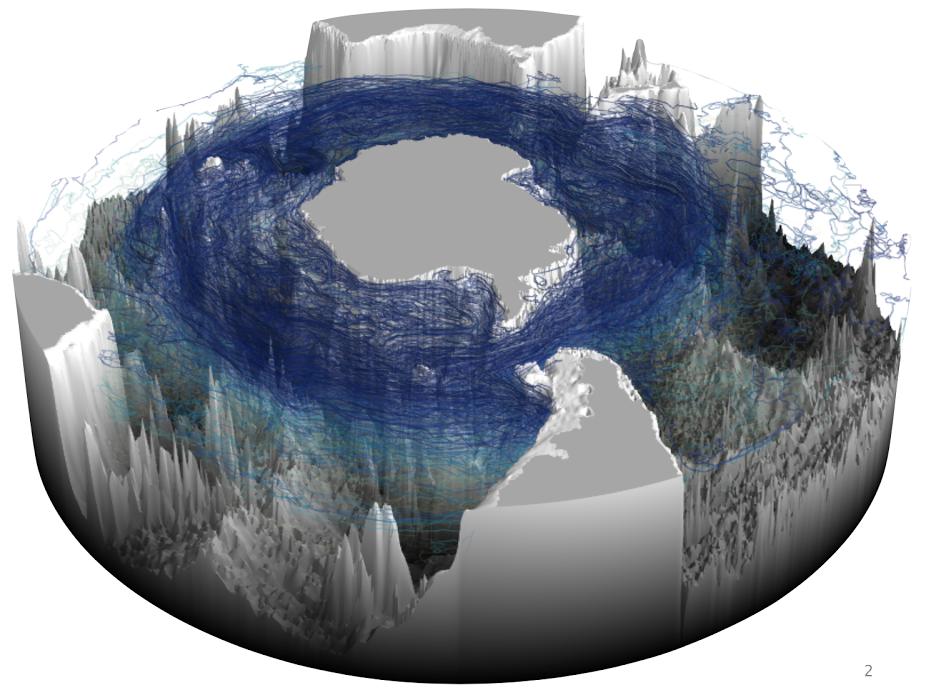
Currents of the Southern Ocean
The main current characteristic of the ocean is the Antarctic Current - the most powerful flow of water in the oceans. Geographers call it Circular because it flows around the mainland - Antarctica. This is the only current that crosses absolutely all the meridians of the globe. Another, more romantic name is the current of the West Winds. It carries its waters between the subtropical zone and the Antarctic zone. If expressed in degrees, then it flows within the 34-50th degrees of south latitude.
Speaking of the course of the West Winds, it is impossible not to note that interesting fact that it is divided almost along its entire length into two symmetrical streams located from the northern and southern edges of the current. Enough is fixed in these streams high speed- up to 42 centimeters per second. Between them, the current is weaker, moderate. Thanks to this phenomenon, enclosing Antarctica in a continuous ring, the Antarctic waters cannot leave their circulation. This conditional band is called the Antarctic Convergence.
In addition, there is another zone of water circulation in the ocean. It is located at 62-64 degrees south latitude. Here, the speed of the currents is noticeably weaker than in the Antarctic Convergence, and is up to 6 centimeters per second. The currents of this area are mainly directed to the east.
Currents near Antarctica make it possible to talk about the circulation of water around the mainland in the opposite direction - to the west. However, this theory has not been proven to date. main reason this is served by periodic changes in currents that occur quite often.
An interesting feature of the water circulation in the fifth ocean, which distinguishes it from other hydrographic objects of this category, is the depth of the water circulation. We are talking about the fact that the current in the Southern Ocean moves water masses not only on the surface, but also to the very bottom. This phenomenon is explained by the presence of special gradient currents, exciting and deep waters. In addition, the density and uniformity of water in the "new" ocean is higher than in others.

Temperature regime of the ocean
The temperature range on the mainland and in the ocean surrounding it is very wide. The highest temperature recorded in Antarctica was 6.5 degrees Celsius. The lowest temperature is minus 88.2 degrees.
As for the average ocean temperature, it ranges from minus 2 degrees to 10 degrees Celsius.
Most low temperatures cover Antarctica in August, and the highest - in January.
Interestingly, during the day the temperature in Antarctica is lower than at night. This phenomenon is still unresolved.
The climate of the Southern Ocean is clearly characterized by the level of glaciation of the mainland. Scientists have found that the glaciation of the mainland is slowly, but beginning to decrease. This means that the increase average temperature air in Antarctica and the fifth ocean. True, in this case we are talking about the so-called global warming, which covers not only the South Pole, but the entire Earth. The main proof of this theory is the parallel decrease in glaciation at the North Pole.

icebergs
gradual melting Antarctic ice leads to the appearance of icebergs - huge pieces of ice that break off the mainland and set sail on the oceans. The largest of them can measure hundreds of meters and cause great trouble to ships that meet on their way. The "lifespan" of such icebergs drifting in the ocean can be up to 16 years. This fact significantly increases the risk of damage to the ship when sailing in these latitudes.
Some experiencing countries are trying to use giant icebergs for its mining. To do this, icebergs are caught and towed to specially equipped mining sites. fresh water.

Ocean dwellers
Despite the difficult climatic conditions, the area of the ocean is quite densely populated by fauna.
by the most prominent representatives animal world of Antarctica and the Southern Ocean are penguins. These flightless seabirds feed in waters teeming with plankton and small fish.

Of the other birds, petrels and skuas are the most common.
The Southern Ocean is a habitat for many species of whales. The humpback whale lives here blue whale and other types. Seals are also common at the South Pole.
If you are asked how many oceans there are on the planet, I think you are somewhat perplexed, unless of course you were good at school with geography, answer four (Pacific, Arctic, Atlantic, Indian) and you will be ... wrong, because since 2000 there were five of them. The fifth was the Southern Ocean (or the Antarctic Ocean).
Southern Ocean (or Antarctic Ocean)- the fourth largest ocean of the Earth, surrounding Antarctica.
This ocean was first identified in 1650 by the Dutch geographer B. Varenius, and until the 1st quarter of the 20th century, the name "Southern Ocean" was placed on maps and atlases, while in many countries it included the territory of Antarctica, since the icy continent was considered to the area of the ocean and its boundary, the latitude of the Antarctic Circle was adopted.
From the 2nd quarter of the 20th century, the boundary of the Southern Ocean began to be drawn from 35 ° S. (on the basis of water and atmosphere circulation) up to 60°S. (according to the nature of the bottom topography). In the Soviet Atlas of the Antarctic (Vol. 2, 1969), the boundary of the Southern Ocean is the northern boundary of the Antarctic Convergence Zone, located near 55°S.
In the spring of 2000, the international hydrographic organization decided to declare the body of water north of the coast of Antarctica to 60 ° south latitude as a separate ocean - the South. The decision is based on the latest oceanographic data indicating the uniqueness of the waters surrounding Antarctica. In the Russian tradition, the Southern Ocean is a conventional concept. Its approximate boundary is considered to be the Antarctic Convergence Zone (the northern boundary of the Antarctic surface waters). In other countries, the border is also blurred - the latitude is south of Cape Horn, the border floating ice, Antarctic Convention area.

The area of \u200b\u200bthe ocean is 86 million km 2, the average depth is 3500 m, the maximum is (South Sandwich Trench) 8428 m. 13 seas stand out off the coast of Antarctica: Weddell, Scotia, Bellingshausen, Ross, as well as Amundsen, Davis, Lazarev, Riiser -Larsen, Cosmonauts, Commonwealth, Mawson, D'Urville, Somov. The most important islands of the southern ocean: Falkland (Malvinas), Kerguelen, South. George, South. Shetland, South. Orkney, South. Sandwich. The Antarctic shelf is submerged to a depth of 500 m.
Intensive cyclonic activity is developed over the water area of the Southern Ocean. Most cyclones move from west to east. Air temperature in January, off the coast of Antarctica, it does not exceed 0°C (-6°C in the Weddell and Ross Seas), at 50°S. in the Indian and Atlantic sectors it rises to 7°C, and to 12°C in the Pacific Ocean. In winter, the contrasts are even greater: in the coastal zone, the average temperature drops to -20°С (in the Weddell and Ross seas to -30°С), and at 50°S. is 2-3°C in the Atlantic and Indian sectors and 6-7°C in the Pacific.
The main feature of the Southern Ocean- current westerly winds, which spreads throughout the water column and transfers them to eastbound. South of this current, the Western Coastal Current is formed. Cold and dense water masses from the shores of Antarctica flow down the ocean floor far to the north.
The ice cover of the Southern Ocean is more developed in Western hemisphere and varies greatly by season: in September-October, its area is 18-19 million km 2, and in January-February - only 2-3 million km 2.
Average width of the drifting ice belt in November at 30° W. d. is 2000 km, at 170 ° W. d. - 1500 km, at 90-150 ° E. d. - 250-550 km.
Icebergs are constantly breaking off from the Antarctic Ice Sheet. At the same time, there are more than 200 thousand icebergs in the Southern Ocean, their average length is 500 m, but there are giants up to 180 km long and several tens of kilometers wide. Icebergs are brought to the north and can be found even at 35-40°S. They exist in the ocean for an average of 6 years, but in some cases their age can exceed 12-15 years.
Despite the harsh climate, the Southern Ocean is rich in life. There are huge masses of phyto- and zooplankton, krill, sponges and echinoderms are abundant, several families of fish, especially notothenia. Of the birds, petrels, skuas, and penguins are numerous. There are many whales in the ocean (blue whale, fin whale, sei whale, humpback whale, etc.) and seals (Weddell seal, crabeater seal, leopard seal, fur seal). Whaling is prohibited, but a lot of krill and fish are caught.
Oceanologist of the Department of Marine Forecasts
Kitchenko N.V.
In particular, it is signed in the 3rd edition of the fundamental Atlas of the world and in other atlases published already in the 21st century.
Encyclopedic YouTube
-
1 / 5
14 seas stand out off the coast of Antarctica: Weddell, Scotia, Bellingshausen, Ross, Amundsen, Davis, Lazarev, Riiser-Larsen, King Haakon VII, Cosmonauts, Commonwealth, Mawson, D'Urville, Somov. The most important islands of the Southern Ocean: Kerguelen, South Shetland, South Orkney. The Antarctic shelf is submerged to a depth of 500 meters.
All the seas washing Antarctica, except for the Scotia and Weddell Seas, are marginal. In the tradition accepted in most countries, they divide its coast into sectors as follows:
Seas of the Southern Ocean
Name Sector In whose honor is it named . Sea Lazareva 0-14° in. d. Sea Riser-Larsen 14-34° in. d. Sea Cosmonauts 34-45° in. d. Sea Commonwealth 70-87° in. d. International cooperation in Antarctica
Sea Davis 87-98° in. d. Sea Mawson 98-113° in. d. Sea Durville 136-148° in. d. Sea Somova 148-170° in. d. Sea Rossa 170° in. - 158°W d. Sea Amundsen 100-123°W d. Sea Bellingshausen 70-100°W d. Sea Scotia 30-50°W 55-60°S sh. Sea Weddell 10-60°W d., 78-60°S sh. Sea King Hawkon VII 20° in. 67°S sh. . Southern Ocean in cartography
The Southern Ocean was first identified in 1650 by the Dutch geographer Bernhard Varenius and included as yet undiscovered by Europeans " southern mainland”, and all areas above the Antarctic Circle.
Currently, the ocean itself continues to be considered water mass, which is mostly surrounded by land. In 2000, the International Hydrographic Organization adopted a division into five oceans, but this decision was never ratified. The current definition of oceans from 1953 does not include the Southern Ocean.
In the Soviet tradition (1969), the approximate boundary of the conditional "Southern Ocean" was considered the zone of the Antarctic convergence (the northern boundary of the Antarctic surface waters), near 55 ° south latitude. In other countries, the border is also blurred - the latitude south of Cape Horn, the border of floating ice, the Antarctic Convention zone (the area south of 60 parallel south latitude). The Australian Government considers the "Southern Ocean" to be the waters immediately south of the Australian continent.
in atlases and geographic Maps the name "Southern Ocean" was included until the first quarter of the 20th century. In Soviet times, this term was not used [ ], however, since the end of the 20th century, he began to sign on maps published by Roskartografiya.
History of Southern Ocean exploration
XVI-XIX centuries
The first ship to cross the border of the Southern Ocean belonged to the Dutch; it was commanded by Dirk Geeritz, who sailed in the squadron of Jacob Magyu. In 1559, in the Strait of Magellan, Geeritz's ship, after a storm, lost sight of the squadron and went south. Having descended to 64 ° south latitude, it saw high ground- possibly the South Orkney Islands. In 1671, Anthony de la Rocher discovered South Georgia; in 1739 the island of Bouvet was discovered; in 1772 French Marine officer Kerguelen discovered an island in the Indian Ocean named after him.
Almost simultaneously with the voyage of Kerguelen from England, he set off on his first trip to Southern Hemisphere James Cook, and already in January 1773, his ships Adventure and Resolution crossed the Antarctic Circle at the meridian 37 ° 33 "E. After a hard struggle with ice, he reached 67 ° 15" south latitude, where he was forced to turn north. In December of the same year, Cook again went to the Southern Ocean, on December 8 he crossed the Antarctic Circle at 150 ° 6 "West longitude and at the parallel of 67 ° 5" S. latitude was covered with ice, freed from which, went further south and, in late January 1774, reached 71°15" south latitude, 109°14" west longitude, southwest of Tierra del Fuego. Here an impenetrable wall of ice prevented him from going further. On his second voyage in the Southern Ocean, Cook crossed the Antarctic Circle twice. During both voyages, he became convinced that the abundance of ice mountains indicates the existence of a significant Antarctic continent. The difficulties of polar navigation were described by him in such a way that only whalers continued to visit these latitudes and the southern polar scientific expeditions ceased for a long time.
In 1819, the Russian navigator Bellingshausen, commanding the warships Vostok and Mirny, visited South Georgia and tried to penetrate deep into the Southern Ocean; for the first time, in January 1820, almost on the Greenwich meridian, he reached 69 ° 21 "south latitude; then, having gone beyond the limits of the southern polar circle, Bellingshausen passed along it to the east to 19 ° east longitude, where he crossed it again and reached in February again almost the same latitude (69°6"). Further east, it rose only to 62 ° parallel and continued its journey along the margin of the floating ice, then, on the meridian of the Balleny Islands, it reached 64 ° 55 ", in December 1820, at 161 ° west longitude, passed the Antarctic Circle and reached 67 ° 15 "south latitude, and in January 1821, between the meridians 99 ° and 92 ° west longitude, reached 69 ° 53" south latitude; then, almost on the meridian 81 °, opened in 68 ° 40 "south latitude, a high coast islands Peter I, and going even to the east, inside the southern polar circle - the coast of the Earth Alexander I. Thus, Bellingshausen was the first to make a full voyage around the South Arctic continent, discovered by him, almost all the time between latitudes 60 ° - 70 °, on small sailing ships.
At the end of 1837, a French expedition, under the command of Dumont-Durville, consisting of two steam ships - the Astrolabe (L'Astrolabe) and the Zele (La Zélée), set off to explore Oceania, to verify information Veddel and others. In January 1838, Dumont-D'Urville took the path of Weddel, but ice blocked his path at the parallel of 63 ° south latitude. South of the South Shetland Islands, he saw a high coast called Louis Philippe Land; later it turned out that this land is an island, the western shores of which are called Trinity Land and Palmer Land. After wintering in Tasmania, on the way to the south, Dumont-D'Urville met the first ice and after a difficult navigation between them, on January 9, 1840, in latitudes 66 ° - 67 °, almost on the Arctic Circle, and 141 ° E. D. saw a high mountainous coast. Dumont-Durville traced this land, called the Land of Adélie, along the Arctic Circle to the meridian of 134 ° east longitude On January 17, at 65 ° south latitude and 131 ° east longitude, another coast was discovered, called the Clary Coast.
An American expedition, consisting of three ships: "Vincennes", "Peacock" and "Porpoise", under the command of Lieutenant Willis, set out from the Tierra del Fuego archipelago in February 1839 in order to try to pass the Weddel route to the south, but she was met with the same insurmountable obstacles , like Dumont-Durville, and she was forced to return without any special results to Chile (on the meridian of 103 ° west longitude, she reached almost 70 ° south latitude and then, as if, she saw the earth). In January 1840, the American explorer Charles Wilkes went almost due south along longitude 160° east. Already at the parallel of 64 ° 11 "S, the ice blocked his further path. Turning to the west and reaching the meridian 153 ° 6" East longitude, at 66 ° South latitude, he saw a mountain 120 km away, which was named by Ringold Knoll. Ross, who visited these places a little later, disputed Wilkes' discovery, but without foundation. The honor of discovering various parts of the Earth Wilks actually belongs to each of the three navigators - Wilkes, Dumont-Durville and Ross - separately. During January and February 1840, Wilkes traveled a considerable distance along the margins of the Antarctic continent and reached the meridian 96° East. For all the time of the voyage, he did not manage to land on the shore anywhere.
A third English expedition, under the command of James Clark Ross, on the steam ships Erebus and Terror (Erebus was Crozier in command), was equipped to explore the south polar countries in general. In August 1840, Ross was in Tasmania, where he learned that Dumont-D'Urville had just discovered the coast of Adélie's Land; this prompted him to begin his explorations further east, on the meridian of the Balleny Islands. In December 1840, the expedition crossed the Antarctic Circle on the meridian 169 ° 40 "E. and soon began to fight the ice. After 10 days, the ice strip was passed, and on December 31 (old style) they saw the high coast of the Earth Victoria, one of the highest mountain peaks which Ross named after the initiator of the expedition - Sabina, and the entire chain of mountains with a height of 2000 - 3000 m - the Admiralty ridge. All the valleys of this chain were littered with snow and huge glaciers descending to the sea. Behind Cape Adar, the coast turned south, remaining mountainous and impregnable Ross landed on one of the Possession Islands, at 71 ° 56 "south latitude and 171 ° 7" east longitude, completely devoid of vegetation and inhabited by a mass of penguins that covered its shores with a thick layer of guano. Continuing his navigation further south, Ross discovered the Kuhlman Islands and Franklin (the latter - at 76 ° 8 "south latitude) and saw the coast directly to the south and high mountain(Erebus volcano) with a height of 3794 meters, and a little to the east another volcano was seen, already extinct, called Terror, 3230 meters high. The further way to the south was blocked by the coast, turning to the east and bordered by a continuous vertical ice wall, up to 60 meters high above the water, which, according to Ross, descends to a depth of about 300 meters. This ice barrier was distinguished by the absence of any significant depressions, bays or capes; its nearly level, vertical wall stretched for a vast distance. Beyond the ice shore to the south were the peaks of a high mountain range, which went deep into the southern polar continent; it is named after Parry. Ross passed from Victoria Land to the east for about 840 km, and throughout this length the character of the ice coast remained unchanged. Finally, the late season forced Ross to return to Tasmania. On this voyage, he reached 78 ° 4 "south latitude, between meridians 173 ° -174 ° west longitude. On the second voyage, his ships on December 20, 1841, again crossed the Antarctic Circle and went south. At the beginning of February 1842, on meridian 165 ° west, they reached over high seas and headed straight south, approaching the icy shore a little more to the east than in 1841. At 161°27" west longitude they reached 78°9" south latitude, that is, they approached south pole closer than anyone so far. Further navigation to the east was blocked solid ice(pak), and the expedition turned to the north. In December 1842, Ross made a third attempt to penetrate south; this time he chose the path of Weddel and headed for the Land of Louis-Philippe. Going east, Ross, on the meridian of 8° West, crossed the Arctic Circle and on February 21 reached 71°30" South, at 14°51 West.
Almost 30 years later, an expedition on the Challenger corvette visited, among other things, the southern polar countries. Having visited Kerguelen Island, the Challenger headed south and reached 65° 42 "S. should have been at a distance of only 30 kilometers, it was not visible.
Climate and weather
Sea temperatures vary from approximately −2 to 10 °C. The cyclonic movement of storms is eastward around the continent and often becomes intense due to the temperature contrast between ice and open ocean. The ocean region from 40 degrees south latitude to the Antarctic Circle has the strongest average winds on Earth. In winter, the ocean freezes to 65 degrees south latitude in the Pacific sector and 55 degrees south latitude in the Atlantic sector, dropping surface temperatures well below 0 °C; at some coastal points permanent strong winds leave the coastline ice-free during the winter.
Icebergs can be found at any time of the year throughout the Southern Ocean. Some of them are capable of reaching several hundred meters; smaller icebergs, iceberg fragments and sea ice (typically 0.5 to 1 meter) also pose problems for ships. The icebergs encountered are 6-15 years old, which implies the simultaneous existence of more than 200,000 icebergs in the waters of the ocean, ranging in length from 500 meters to 180 km and a width of up to several tens of kilometers.
Sailors of latitudes from 40 to 70 degrees south latitude, from the era of sailing ships, are known as the "Roaring forties", "Furious fifties" and "Shrill sixties" due to bad weather, stormy winds and big waves, formed due to the movement of air masses, which, flowing around Earth, do not encounter obstacles in the form of any noticeable land masses. Floating ice, especially between May and October, makes this area even more dangerous, and the remoteness of the region from the inhabited areas of the Earth makes search and rescue operations ineffective.
A life
Despite the harsh climate, the Southern Ocean is teeming with life.
Due to the subpolar location of the Southern Ocean, there is a sharp seasonal dynamics of the most important condition for photosynthesis - solar radiation. Under such conditions, a large amplitude is observed throughout the year. quantitative changes
General information. The ring of ocean waters surrounding Antarctica combines characteristics a separate ocean and well-defined natural features of the Atlantic, Pacific and Indian oceans.
Difficult in this situation is the question of boundaries. In the south it is bounded by the coast of the southern polar continent. This ocean has no western and eastern borders. According to modern scientifically based ideas, the northern boundary is considered to be the northern periphery of the Antarctic Convergence Line (a band of convergence of relatively warm and cold surface waters) approximately 40-50 ° S. sh., which is close to the northern boundary of the Antarctic Circumpolar Current.
The main feature of this conditional geographical boundary of the Southern Ocean is its certain changes in time and space due to interannual and interseasonal fluctuations in the position of the Antarctic convergence lines.
Within the designated boundaries, the area of the Southern Ocean is 86 million km2 (according to some sources, this is a moot point), the average depth is 3503 m, the greatest depth is 8264 m (South Sandwich Trench, Meteor). Within the Southern Ocean are scattered many islands of various sizes, most of which originate with a complex mountainous terrain. The seas are located on the southern periphery of the ocean. The Scotia Sea is located apart. In the south, the seas are limited by the coast of Antarctica, and in the north they are open to the ocean.
Relief ocean floor . Based contemporary research geographical science, the mainland and its surrounding waters lie mainly on the continental-but-oceanic Antarctic. Some sections of the bottom of the northern limits of the Southern Ocean are located on other plates adjacent to the Pacific-South American, the Scotia Sea, etc. It is precisely with this that the features and topography of the bottom of the Southern Ocean are connected. all the main geomorphological forms are clearly expressed on the bottom, the shelf zone is characterized by an insignificant width (150 km on average). Only in the Ross Seas and its width reaches 1000-1100 km. The average depth of the shelf zone reaches 200 m.
The continental slope near Antarctica, especially its East End, dissected by steps and cut through by an abundance of underwater canyons. In the near-Antarctic part, the continental slope is steep near the Pacific coast and relatively gentle and slightly dissected near the Antarctic coast.
The ocean floor is characterized by a number of underwater ridges, small uplifts and basins. The largest ridges are the West Indian and Central Indian, within which rift valleys are clearly visible. They are essentially the southern spurs of the mid-ocean ridges.
Within the Southern Ocean are the Australo-Antarctic, South Pacific and partially East Pacific Rise. In the region of 60 ° S. sh. large basins of the ocean are located: African-Antarctic (6787 m), Australo-Antarctic (6098 m) and Bellingshausen (5399 m).
In the general circulation of ocean waters, their vertical movement occupies an important place. Between the East and West currents, due to their divergence (divergence), there is an upwelling of deep waters enriched with nutrients.
Over the continental slope within the Weddell Sea in winter, cooled and saline surface waters, as heavier ones, sink into the deep layers. As a result of this phenomenon, relatively cold and salty bottom waters are formed. They spread east around Antarctica and north into the Atlantic, and where they mix with their waters.
Wind waves develop in the ice-free spaces of the Southern Ocean. It is strongest in winter between 40 and 60°S. sh. Here, waves about 2 m high prevail, and during a storm they reach a height of 8-9 m. Near Kerguelen Island (sector of the Indian Ocean), the highest waves were recorded - up to 35 m. to the southwest. In summer, the strength of the waves weakens, the height of the waves decreases. Region 40-60°S sh. commonly referred to as the "Roaring Forties" and "Furious Fifties".
Tides in the Southern Ocean are noted everywhere, their largest values (about 8 m) are observed in southern shores. In other areas, the value is 2-2.5 m.
Ice is one of the most characteristic features nature of the Southern Ocean. They exist all year round. During the maximum development (September-October), ice covers an area of 18-19 million km2, and in summer time(January-February) - only 2-3 million km2.
Here there are sea ice (fast ice and drifting), shelf and. Drifting ice is located to the north of fast ice. The patterns and direction of their movement are determined by winds and currents.
Between the fast ice edge and drifting ice there are fast ice polynyas - large spaces clean water. The presence of shelf ice is associated with the coastal strip of the shelf. This ice is of sedimentary origin, its continental edge is a continuation of the land cover. It lies completely on the ground. The average height of the ice shelf is 430 m, and above sea level it rises by 10, and sometimes by 50 m.
The presence of icebergs is the most significant feature of the Southern Ocean. They are formed as a result of breaking off coastal parts of continental and shelf ice under the action of waves, swell and. According to available data, over 200,000 icebergs are found in the waters of the Southern Ocean every year. Their average length is about 500 m, and the height is 50 m above sea level. Individual icebergs are up to 5 km long. Most icebergs melt within 3-5 years. The largest number icebergs are found at a distance of 100-150 km from the coast. At a distance of up to 700 km, they are quite rare. Under the influence of wind and current, icebergs drift in the coastal zone of Antarctica. During the drift, over time, they collapse, acquire bizarre shapes.
organic life in the ocean. The presence of the Antarctic Circumpolar Current in the ocean determines the composition and distribution of organic life. Huge masses of ice limit life in the ocean, but nevertheless, the Antarctic seas can compete with many tropical regions of the World Ocean in terms of the abundance and diversity of living organisms. The long existence of flora and fauna in a little changing environment (at least 5 million years) has led to the fact that organisms have adapted to harsh conditions habitat. Diatoms remain viable up to a temperature of -20 °C. Fish have developed adaptations for life in supercooled water, and the inhabitants of the lower surface of fast ice use ice as a shelter, where rich pastures of ice algae - regrowths are formed.
The subpolar position of the Southern Ocean is associated with a sharp seasonal dynamics of the main condition for photosynthesis -. Under such conditions, during the year there is a large amplitude of quantitative changes in phytoplankton and a shift in the flowering zone from the north, where spring begins earlier, to the south, where it is late. In low latitudes, two flowering peaks have time to develop, and in high latitudes only one. AT surface waters pronounced biological latitudinal zonality. The inhabitants of the bottom do not have such zonality, since in their development important role plays the bottom topography and barriers that prevent the exchange of flora and fauna. In the Southern Ocean, phytoplankton is dominated by diatoms (about 180 species).
Blue-green algae make up a small number. In quantitative terms, diatoms also predominate, especially in high latitudes, where they are almost 100%. During the period of maximum bloom, the number of diatoms reaches its largest accumulation.
There is a clear relationship between the distribution of algae and the vertical stability of waters. In summer, a significant amount of algae is in the surface 25-meter layer.
In the direction from south to north, the composition of phytoplankton changes: high-latitude cold-water species gradually fall out of the flora, being replaced by warm-water species.
Zooplankton in the waters of the Southern Ocean is represented by copepods (about 120 species), amphipods (about 80 species), and others; chaetognaths, polychaetes, ostracods, appendicularians, and mollusks are less important. In quantitative terms, copepods are in the first place, accounting for almost 75% of the zooplankton biomass of the Pacific and Indian sectors of the ocean. There are few copepods in the ocean sector, since euphausiids (krill) are widespread.
The Southern Ocean, especially for its Antarctic regions, is characterized by a massive accumulation of krill (Antarctic crustaceans). The biomass of krill in these areas reaches 2200 million tons, which makes it possible to catch up to 50-70 million tons of krill annually. Here, krill is the main food of baleen whales, seals, fish, cephalopods, penguins and tube-nosed birds. The crustaceans feed on phytoplankton.
The number of zooplankton during the year has two peaks. The first is associated with the rise of overwintered species and is observed in surface waters. The second peak is characterized by an abundance of zooplankton throughout the thickness and is due to the appearance of a new generation. Both peaks appear as two latitudinal bands of zooplankton concentration. This is the period of zooplankton bloom in summer, when most of zooplankton passes into the upper layers and moves to the north, where a noticeable accumulation occurs in the Antarctic Convergence Zone.
In winter, condensation is observed in the area of divergence, where individuals from the deep one gather. In winter, the maximum species abundance was recorded at depths of 250-1000 m.
The question of the vertical distribution of zooplankton is complicated by the ability of many organisms to make regular (daily, seasonal) migrations from one zone to another.
Phytobenthos and zoobenthos in the waters of the Southern Ocean are striking in their richness and diversity. The number of phytobenthos decreases from South America to Antarctica. If 300 species are known in Kerguelen, 138 species are known, then off the coast of Antarctica there are from 20 to 40 species. Mainly dominated different kinds red algae. Brown algae reach gigantic sizes (marcocystis - 80, and sometimes 90 m in length) with a limited biomass.
Of the representatives of the zoobenthos, filter feeders predominate, mainly sponges (300 species), polychaetes (300), bryozoans (320), brachiopods (15), molluscs (300), echinoderms (320 species).
The biomass of zoobenthos in coastal areas averages up to 0.5 kg/m2, and in some places reaches 3 kg/m2 at depths of 20-50 m in the surface zone there are no permanent inhabitants. The fauna is unevenly distributed along the coast. The decrease in biomass begins at a depth of 500 m. It should be noted that if in other areas of the World Ocean the lower boundary of the sublittoral zone is at a depth of 200 m, then near Antarctica, sublittoral animals live at depths of 500-700 m. The greatest species diversity is characteristic to a depth of 200-300 m , fish - at depths of 200-500 m.
In the Antarctic region of the Southern Ocean, the fauna is rich, unique and includes many endemics. For fauna, gigantism is inherent in many representatives (for example, among sponges).
Near the island of Kerguelen, the fauna is 5 times poorer than the continental regions. There are about 100 species of fish in the Southern Ocean. Among them, only 12 benthic, belonging to the nototenaceae family, having commercial value. In the Antarctic sector, white-blooded pikes, grenadiers, gray and marbled notothenia, southern blue whiting are widely represented. In the Indian sector of the ocean, the number commercial fish small. The striped white-blooded pike (icefish), gray and marbled notothenia live here. In the Pacific sector, the largest in terms of area, there are blue whiting and New Zealand macro runes.
Mammals. The total number of whales in the Southern Ocean is estimated at over 500,000 heads. From pinnipeds there are crabeater seal, sea leopard, southern sea Elephant, Ross seal, Weddell seal and a number of others. Antarctic seals account for up to 56% of the world's pinniped population.
Avifauna. It is represented by 44 species of birds with a total number of 200 million individuals. Among them, 7 species of penguins account for 90% of the total biomass.